
The England Coast Path (ECP) covered a great deal of the south coast of England when I did these walks, but not all of it, so I used other trails and local footpaths as well. For instance, the ECP was not complete along parts of the Hampshire and West Sussex coast so I chose to follow The Solent Way, part of The Shipwright's Way and some local footpaths.
On this page:
Walking the coastal paths of south east England.
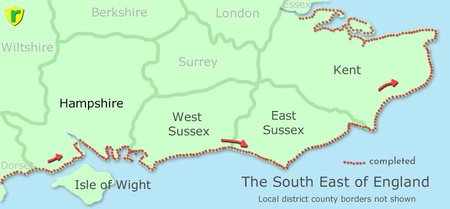
Completed
The Solent Way to Emsworth Hampshire
Emsworth Hampshire to West Wittering West Sussex
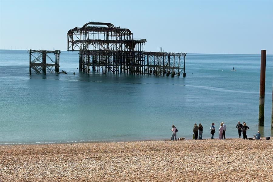
The England Coast Path West Sussex
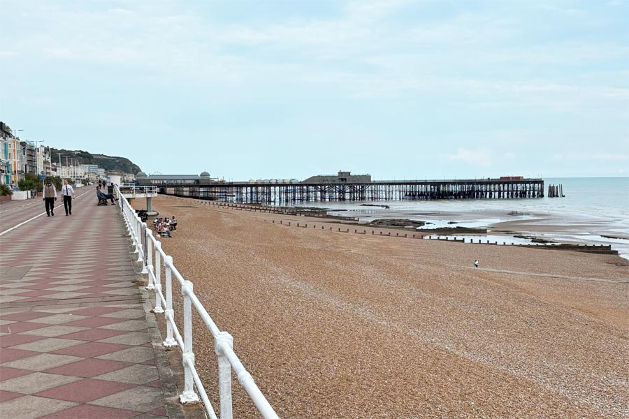
The England Coast Path East Sussex
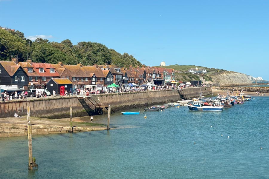
The England Coast Path and Saxon Shore Way Kent
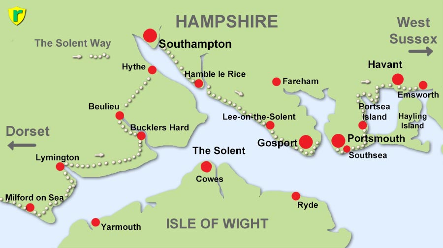
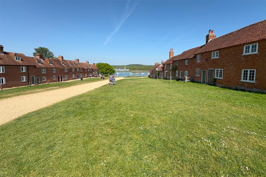
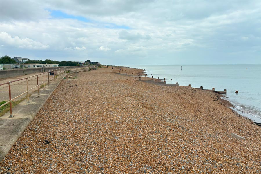
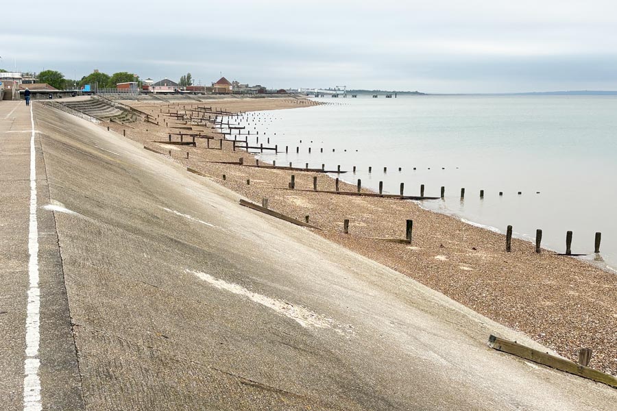
Highcliffe, Barton on Sea, Milford on Sea, Lymington, Bucklers Hard, Beaulieu, Hythe, Southampton, Netley, Hamble le Rice, Warsash, Hill Head, Lee-on-the-Solent, Gosport, Portsmouth, Portsea Island, Havant and Emsworth.

I used a Fujifilm X-E3, a small mirrorless digital camera, fitted with a Fuji 27mm f2.8 pancake lens. I found this camera to be a perfect size and weight for any traveling, not just hiking, as it could slipped be into almost any pocket. I also took a Fuji 18mm f2 for when a wide-angle shot was required.
The weather for the week ahead seemed to be good so I decided to go the next day. I didn't book any accommodation as I had decided to take my campervan instead. It was an experiment to see if I could walk for a day and then return to the camper by bus or train, then move it to my finishing point, ready for the next day without any problems. I did a quick on-line check of the bus services along my intended route and it seemed possible.
Day 1: From Highcliff to Milford on Sea
 |
 |
| Beyond Highcliffe | Approaching Milford on Sea |
 |
 |
| Milford on Sea | Hurst Castle |
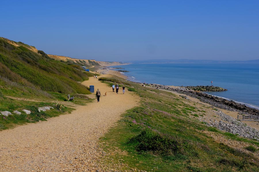
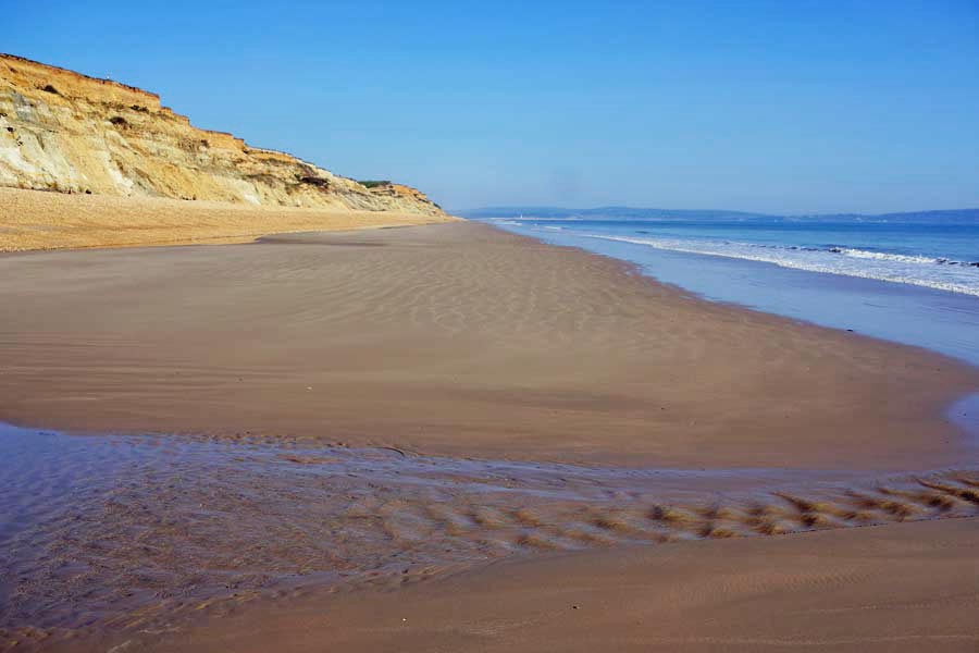
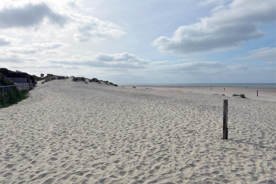
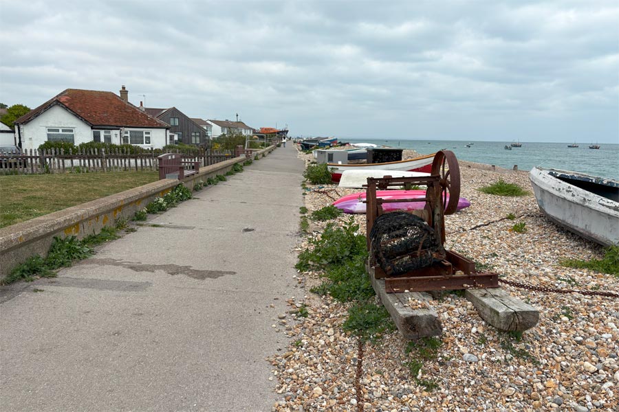
I drove the campervan to Highcliffe in Dorset, which was at the end of my previous Dorset coast walk and parked in a quiet residential road. I started walking in the afternoon and soon I was at the Dorset Hampshire border at Chewton Bunny. My OS map showed a meandering inland footpath from Chewton Bunny to Barton on Sea but I decided to walk along the beach past Barton on Sea before returning to the path to Milford on Sea, which was where the Solent Way began. It was hot so at the far end of the Milford front I stopped for a beer at a smart bar restaurant overlooking the sea. Then, as I walked out along the shoreline towards Hurst Castle, I noticed a suitably remote parking spot on a road at the very edge of the mud flats where there was already about a dozen campervans and motorhomes camped. I did a little more walking and stopped at Keyhaven where I had a beer in The Gun Inn. I decided not to walk the 2 miles to the bus stop as I was keen to get the campervan parked up for the night, so I took a taxi back then drove it to the 'casual camper park' at Milford on Sea. I dropped off to sleep that night listening to the sound of the sea.
End of day 1: About 6 miles walked that afternoon.
Day 2: Milford on Sea to Beulieu
 |
 |
| Lymington | Bucklers Hard |
Next day was an early start. I walked through Keyhaven again and continued alongside the water's edge all the way to Lymington. There was a cloudless sky and the sun was hot but a luckily a cool breeze was blowing. At Lymington I had a light breakfast at a cafe overlooking the waterfront. My left big toe was feeling sore. On investigation I found that the insole of my left boot had worn into a hole and my toe was rubbing on the edges of the hole and had produced a large blister. After stopping off at Mountain Warehouse to buy some replacement size 11 insoles, I dealt with the blister, applied a Compeed plaster to the raw skin and walked out of town. The walk was through fields for nearly 4 miles and then along hot country roads for just over 4 miles to reach Bucklers Hard on the Beaulieu River.
The two rows of houses that lead down to the river at Buckler's Hard are very photogenic. I lunched then rested in the sun on the large area of grass near the river where I fell asleep for a while. Later, as I walked on it became very hot as there was now very little breeze. At Beaulieu I missed the bus by minutes due to my resting for too long at Bucklers Hard. Unfortunately, although it was only mid afternoon it was the last bus of the day! So I had no option but to take a taxi back to the campervan at Milford on Sea. There was no phone signal in Beaulieu but the very nice receptionist at the Montague Arms Hotel ordered one for me. She must have noticed that I was very hot, probably red-faced and dripping on the floor, so she said that I could wait in the reception are for my taxi. Back at the campervan I decided to stay for another night at the Milford on Sea 'casual camper park' before driving to Beaulieu early the next day to continue the walk to Hythe, where I would take the ferry across to Southampton.
Several times over the past few years I have found myself on a long walk during very hot weather. In 2022 I walked from Poole to Lyme Regis in a mini heatwave and in 2023 I walked from Lyme Regis to Plymouth, part of which was during a heatwave. Then in 2024. I walked The Tamara Way from Plymouth to the North Devon / North Cornwall Atlantic Coast during a very hot spell. These walks totalled 290 miles and took 24 days during which I was mostly in shorts and tee shirt and not once did I need my waterproofs. It seems that I was yet again walking in another hot spell. (These walks are not included in this website.)
End of day 2: About 18 miles walked today.
Because I had decided to do this walk at very short notice I didn't do much research before I left home, so when I checked for the ferry times on-line that evening for the next day's walking I was surprised to find that the Hythe ferry was no longer running. In fact it had stopped running in August 2024! I decided not to do the walk from Beulieu to Hythe, but to drive straight to where the ferry would have taken me to in Southampton. As it was mostly a roadside walk to Hythe and not a coastal walk I wasn't worried about missing it out. I intended to return later anyway to walk from Beulieu to Hythe via Calshot when there is a coast path from Beulieu to Calshot. The England Coast Path route there has yet to be secured.
Day 3: Southampton to Portsmouth.
 |
 |
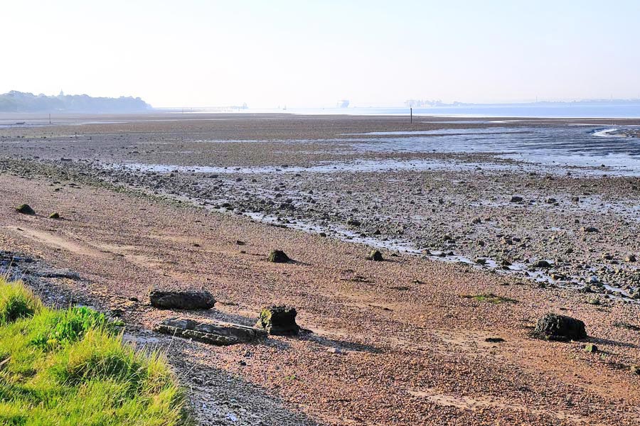
I woke early and drove straight to Southampton and was parked in a long stay vehicle park near the start of Southampton Water by 7am (£6 for 24 hours). I'm not sure what I was expecting to find in such a built-up area but I was pleasantly surprised to find myself walking along a wonderfully quiet path southwards along the edge of Southampton Water with no intruding buildings or noisy roadways. It was cool and slightly misty and there was plenty to see even though the tide was out.
 |
 |
 |
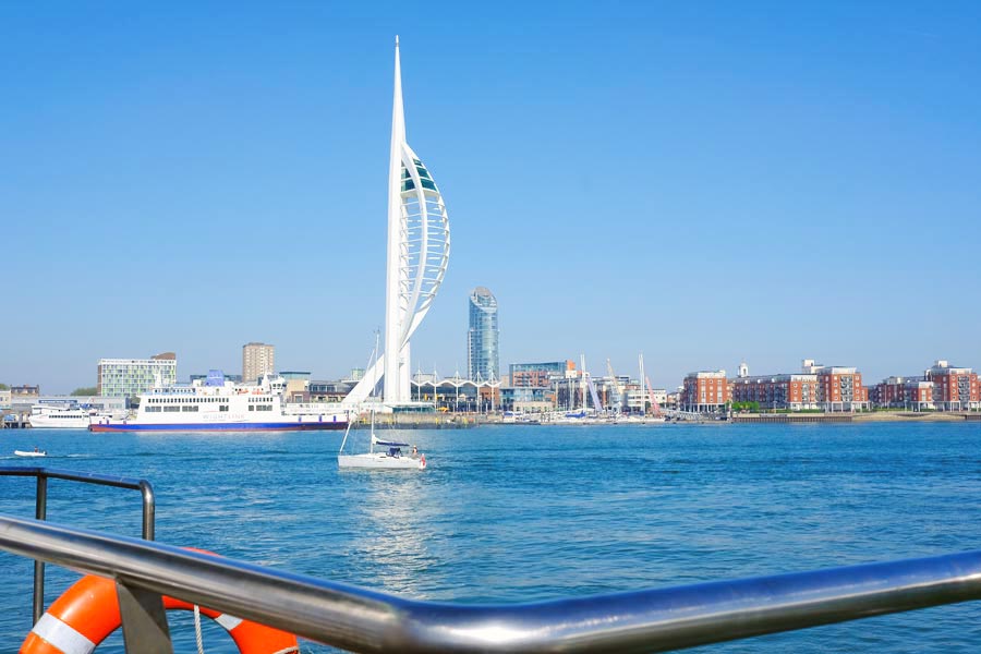 |
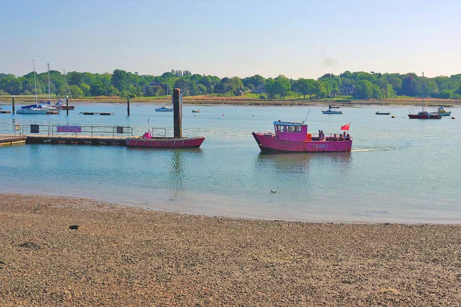
At Hamble le Rice I just missed the little ferry boat that crosses the River Hamble to Warsash. I thought that I had plenty of time to get a coffee and a pastry at the nearby cafe before it returned. I was about to take a sip of my coffee when I looked out of the window at the cafe an saw that the ferry was already on its way back. I couldn't drink my coffee quickly because it was too hot so I hurried, with coffee in one hand and a pastry in the other, back to the ferry, which had already arrived. I drank a little coffee during the very short journey and didn't have time to eat much of my pastry. I finished my snack ashore. There was then a 1 mile walk along the other side of the River Hamble back to Southampton Water. It was still a quiet path, much of it along the shore line before routing along the road at Hillhead for a short time, then passing along the long promenade of Lee-on-the-Solent. I have never seen so many benches in one line before! The path then stays close to the shore at Gosport until it reaches the ferry to cross the mouth of Portsmouth Harbour to the Spinnaker Tower.
There I had a meal and then needed two buses and a taxi to get back to where I had parked the campervan that morning. I slept at the vehicle park. The nearby flyover was noisy but that didn't bother me. It had been a good day's walking.
End of Day 3:About 20 miles walked today. Another very hot day.
Day 4: Portsmouth to Emsworth
 |
 |
| Southsea Castle | South Parade Pier |
 |
 |
| Langstone Harbour |
 |
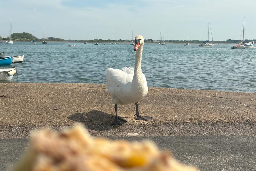 |
| The Mill Pond Emsworth | Swan eyeing up my pasty |
Another early start. Using the Apple Maps app I had chosen a quiet spot a short walk from the coast in Eastney, Portsmouth, to park for the day but from there I had several miles westwards to walk to where I had ended my walk the previous day which had been at the Spinaker Tower. There I turned back eastwards and walked along the promenade, passing Southsea Castle and the South Parade Pier. I stopped at a small kiosk on the promenade for a coffee and an omelette bap which I ate sat on a bench in the warm sun. Nothing else was open yet. Unlike the previous mornings it was already very warm.
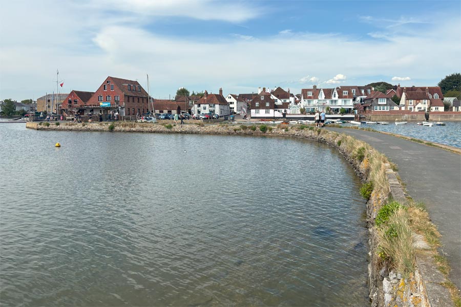
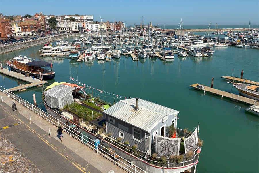
Back at Eastney the path turned inland through the streets for a short while before reaching the shoreline of Langstone harbour. From then on it was a pleasant walk along the waterfront, passing the remains of a large structure partially buried out in the mud. This was the remains of a Mulberry temporary portable harbour as developed during the Second World War for offloading cargo onto beaches in France during the Allied invasion of Normandy in June 1944. The pleasant walk continued until I neared the very noisy A27. Shortly after, the path continued around the perimeter of Farlington Marches for 2 miles before retuning close to the A27 again. I lost my way slightly here and found myself heading into the centre of Havant so I decided to do some food shopping before returning to the path. I had a pint in the The Parchment Makers then continued out of town, back to the coast and on to Emsworth, where I walked around the perimeter of the Mill Pond, a feature of the town. There I stopped, very hot, to rest and eat my recently purchased pasty. As I arrived in the Centre of Emsworth I spotted a number 700 bus already at the bus stop. I knew that this express service would take me back to Portsmouth Bus Station near where I had started earlier that day, so I ran to catch it. I did not explore Emsworth as had been there before. Back at the bus station I was able to catch a local bus part-way back to where the campervan was parked.
End of day 4: About 18 miles walked today. It turned out to be the hottest day of the year so far.
That's the end of my walk along the coast of Hampshire on the Solent Way. About 60 miles walked in four days.
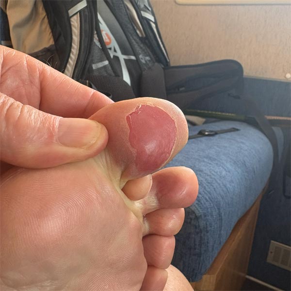
Before I drove home I decided to check on my blister as it had recently started to hurt again. When removing my sock, the Compeed plaster on my toe came with it and with it a lot of soft, loose skin. The result was a very large sore area. I found that the universal insoles, marked with trimming lines and for use up to size 12, that I had bought at Mountain Warehouse in Lymington on the first day of my walk were 10mm too short for my size 11 boots (even though I had not trimmed them) and so both of my big toes had been rubbing on the front edge of the insoles. This edge had caused the Compeed plaster on my left toe to be peeled away from the blister bit by bit as I walked, causing the sticky side to fold over and glue itself firmly to my thick walking sock.
back to the start of Hampshire
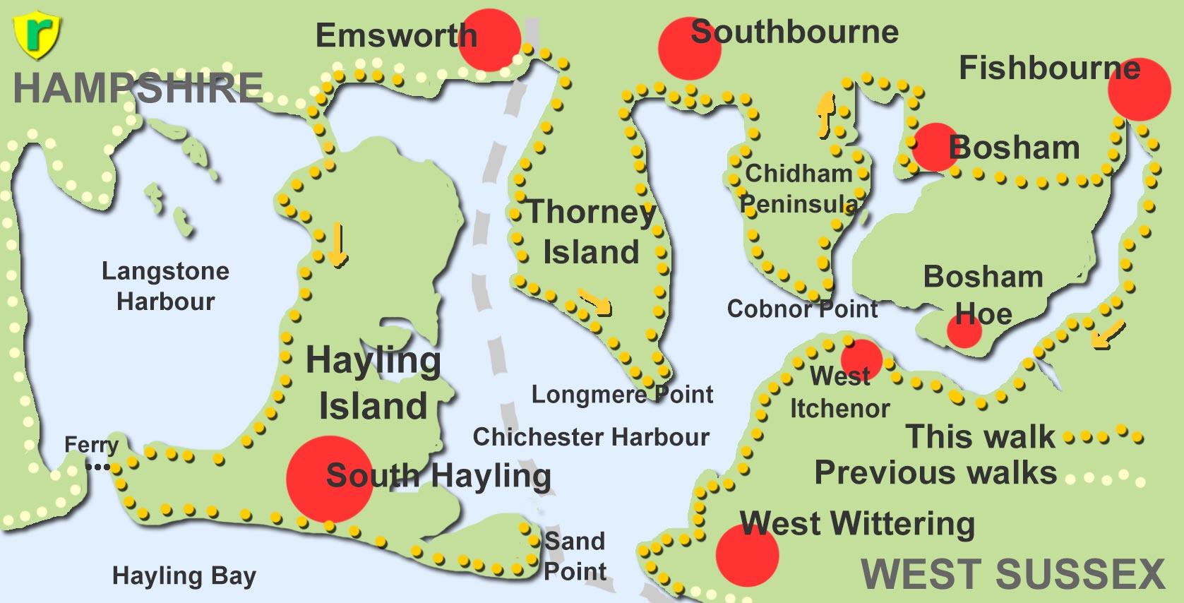
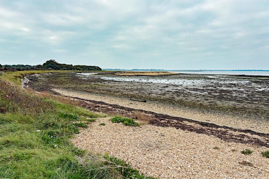
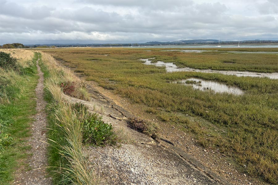
Emsworth, Warblington, Langstone, Hayling Island (Ferry Point and Sand Point), Langstone, Emsworth, Thorney Island (Longmere Point), Southbourne, Chidham Peninsula, Bosham, Fishbourne, West Ichenor, West Wittering beach.
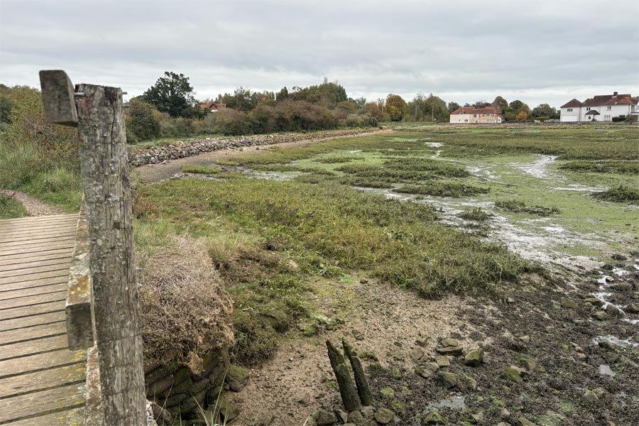
While walking the south coast from Dorset to Kent I left out a section from Emsworth in Hampshire to West Wittering in West Sussex. See map above. I returned later to walk this missing link. I have added it at this point to keep my walk a continuous narrative and in geographic order.
The Shipwright's Way and local footpath on Hayling Island. The Sussex Border Path on Thorney Island. Local footpaths on the Chidham Peninsula. Local footpaths and The Lipchis Way to West Wittering.
For photography I took my new Fujifilm X-E5 and Fuji 16-50mm lens. This lens was larger than I would usually want to take on a multi-day ramble but I wanted to try it out.
Day 1: From Emsworth to Sand Point, Hayling Island.
 |
 |
| The foreshore to Langstone | Langstone Harbour |
By the time I arrived at the start of this walk it was already nearly 11 am. I had started out early from home but due to traffic, and annoyingly, two roads near Chichester with the same name. One being about 8 miles from where I wanted to be. Of course I chose the wrong one on my sat nav, so I had an extra 16 mile drive through more traffic. I parked my campervan in a quiet spot in Warblington and walked to the St Thomas a Becket Church, which I had passed through on my earlier walk along the Solent Way to Emsworth. Then I followed the foreshore path to Langstone where the Solent Way intersects with the Shipwright's Way, and I crossed the Langstone Bridge on to Hayling Island. I turned right at the end of the bridge and continued along The Shipwright's Way.
The Shipwright's Way is a 50-mile long distance path from Alice Holt Forest to Portsmouth. I chose to use part of this route to take me from Langstone Village along the western edge of Haling Island to where there is a ferry across the Langstone Channel to Portsea Island to the west. From the ferry point I would then be turning east. I had walked close to the Portsea Island ferry point on a previous walk on the other side of the channel. The channel leads to Langstone Harbour.
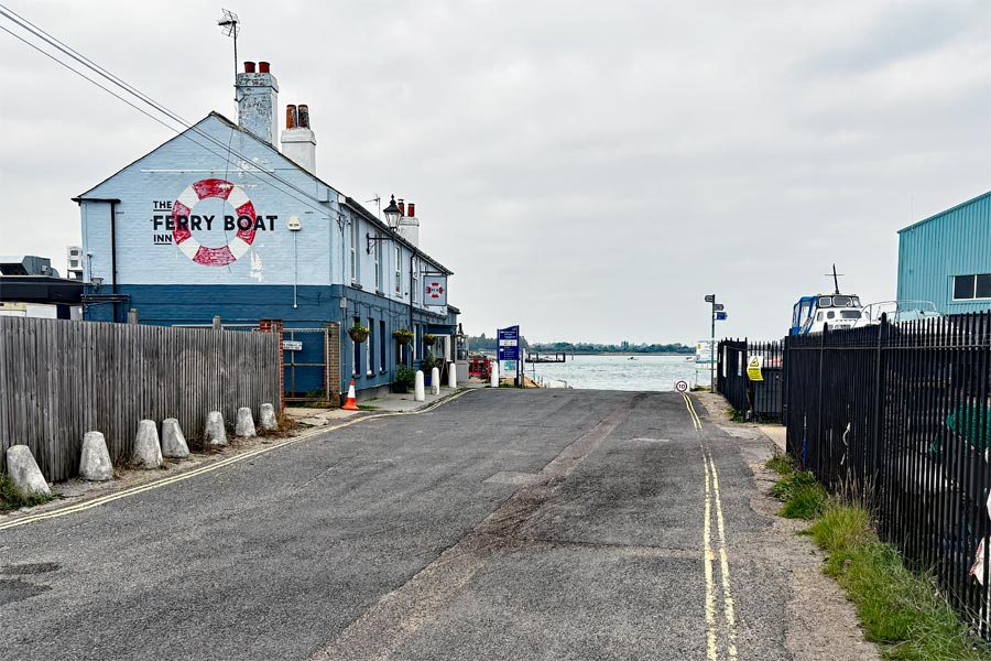
The tide was out so there were a lot of exposed mud flats and flocks of waders at the distant water's edge. After about 4 miles of pleasant easy walking on good paths the path came into West Town. From there the main route, as marked on the Shipwright's Way map that I had downloaded, follows the road west to the ferry, which is the way I went. But I found that the last part of that route had a poor footpath and then no proper footpath at all for some of the way, so some walking in the road was required. I stopped at The Ferry Boat Inn for lunch. There was a cold wind blowing so it was too chilly to sit outside.
I tend to get very warm when I walk, so on a normal day prefer a pub or a cafe with outdoor seating. As soon as I enter, my temperature starts to rise, so I quickly order what I want and take it outside. Or I might have to stand outside for a few minutes until I have cooled down a little. I normally walk in shorts and a light top, all polycotton. If I stop on the trail for more than a few minutes and start to cool down I put my light fleece on. It's not a good idea to let muscles get too cold.
 |
 |
| The Ferry point | South Hayling beach |
 |
 |
| Sand Point | Langstone foreshore late afternoon |
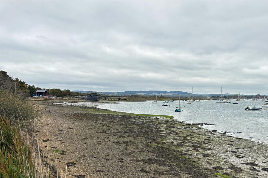
By the mid afternoon the sun was shining and it became a little warmer. I walked eastwards along part of the Shipwright's Way and then continued along the length of the South Hayling beach, passing around Sandy Point and the lifeboat station to arrive at Black Point. From that point are no public footpaths heading northwards along the eastern side of the island so I could walk no further. I was then looking across the channel that leads to Chichester Harbour. I returned on a number 30 bus to the Langstone Bridge and the mainland. The tide was now high and the sun was setting. I walked back along the now wet foreshore sparkling in the early evening sun, to my campervan at Warblington and moved it to the campsite at Southbourne where I had booked a pitch for the next two days of walking.
End of day 1: About 12 miles walked today.
Day 2: From Emsworth to Southbourne via Thorney Island and the Chidham Peninsula
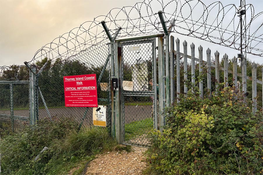
I took an early bus from the campsite back to Emsworth. I intended to follow the footpath around Thorney Island, which is actually a peninsula. I was intrigued about this walk as the majority of Thorney Island is MOD property and access is only allowed along the perimeter path.
 |
 |
| Emsworth | The marina |
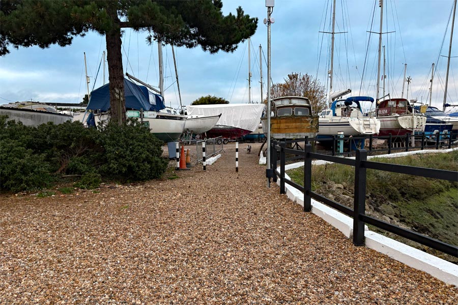
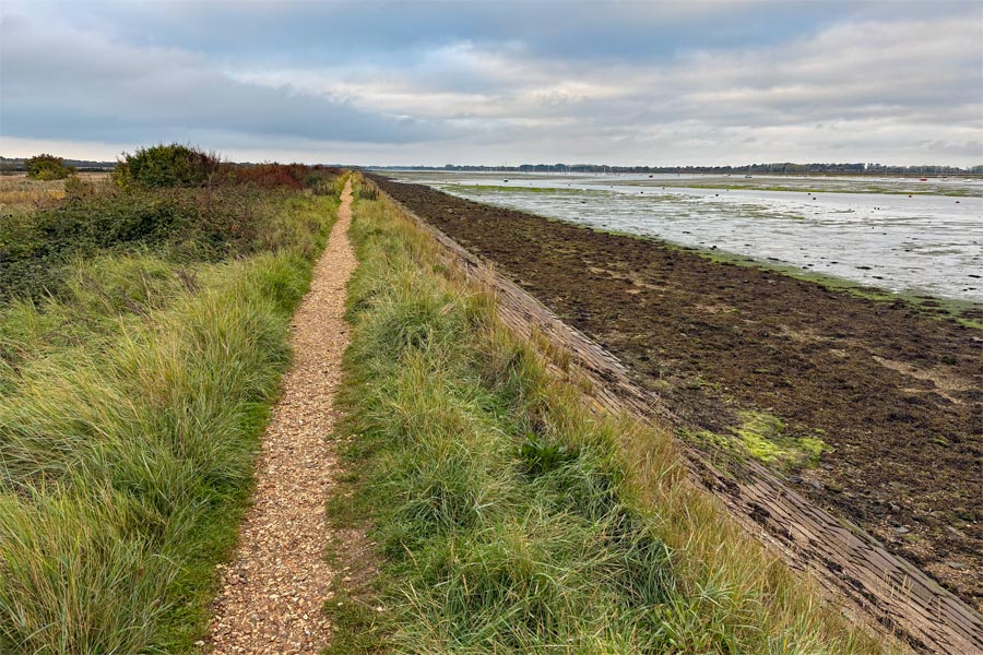
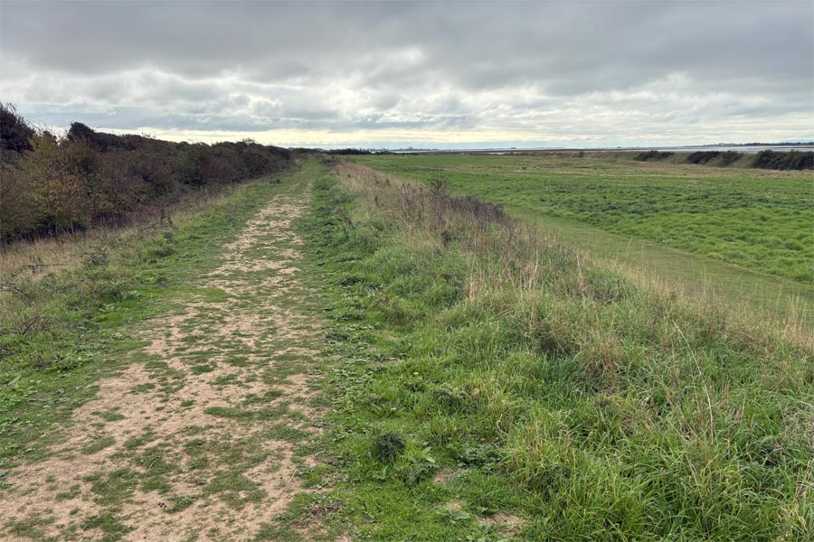
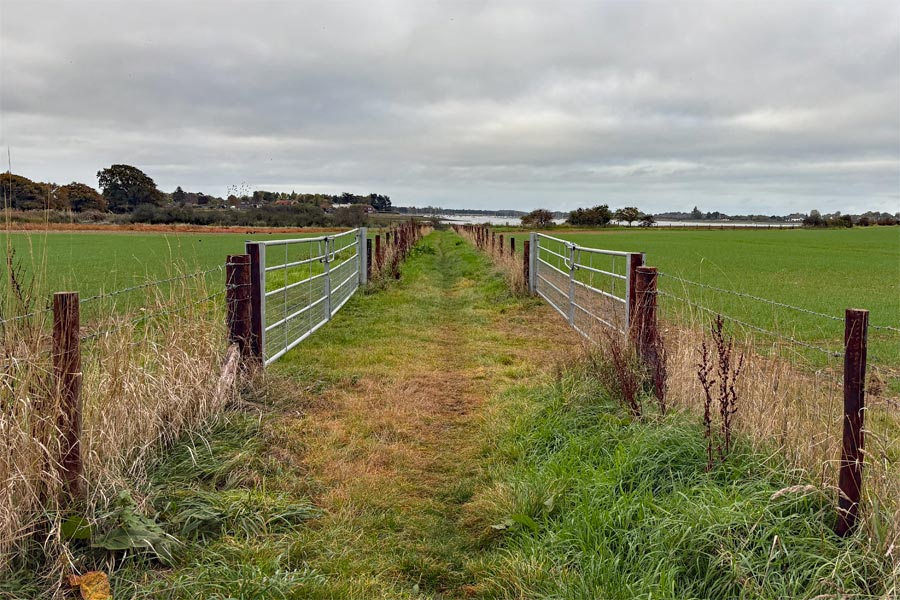
For the walk around the island I was using part of the Sussex Border Path as the island was not on the England coast Path. Heading south from Emsworth the path first threaded its way through the marina between the rows of laid-up boats. It was sign-posted but I found myself following several dog walkers ahead of me. The weather was promising with patches of blue sky appearing. It wasn't very long before the dog walkers veered off to the left their regular poop loop, leaving me to continue along the water's edge. Once again the tide was out so there were mud flats stretching away to my right. The path had good views of the Emsworth Channel as it was along the top of the sea defences. After about a mile I came to the Great Deep, a large channel that completely bisects the promontory, crossed only by the seawall. I assume that there was opening or a sluice below to allow the tide to flow through. After crossing the channel I came to a barbed-wire topped fence and a gate. There was a warning sign stating that there were no facilities of any kind ahead and that walkers requesting to continue must keep to the path around the edge of the island. I pressed the intercom button and made my request to the guard room, somewhere on the island. There were no buildings nearby. I was warned to keep to the path, and then I heard the gate unlock.
 |
 |
| Emsworth Channel | MOD Gate |
 |
 |
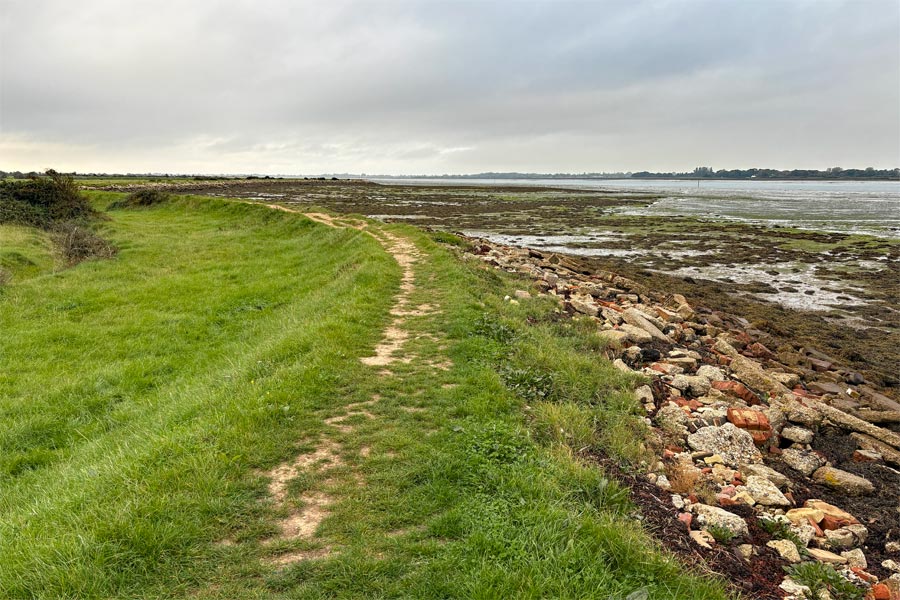
The path remained along the top of the sea defences bank. Inland there was a ditch and a fence and beyond that there were fields with cows grazing. After just over a mile the path arrived at Walker Point. Less than a mile further on the bank became impassible due to dense bushes and the path was sign-posted slightly inland. I came to a path with high hedges on both sides where there were two soldiers and an impressive military vehicle parked touching both hedges. I thought that I had taken a wrong turn. When I enquired, I told that I was on course and to just squeeze past the monster. After a while the track became an open pathway again. At Pilsey Sand there was a white sandy beach which I started to walk on but a sign warned that the beach was restricted for bird protection purposes. I took the path that turned away from the beach and arrived at Longmere Point where, shortly afterwards, the path turned northwards along the Thorney channel.
 |
 |
| Pilsey Sand | Heading north |
On the eastern side of the peninsula the shore was very marshy with many muddy pools and channels. The path ran between hedges for a short while then opened out with views across the Thorney Channel. After about a mile the path passed West Thorney and its church. Then after another mile arrived at the MOD fence again and another gate. I pressed the intercom button to request to exit. A voice said "it's open". I pulled the gate open and crossed the Great Deep once again. The path continued along the sea wall and at Thornham Marina I bought a coffee and a very nice bacon bap which I ate, out of the wind, in one of the little wooden open-fronted huts that were provided for diners. I had made some cheese rolls for my lunch but I couldn't resist a bacon bap. I then walked to the inland end of the Thorny Channel which then became the Prinstead Channel and the Nutbourne Channel.
The Chidham Peninsula.
 |
 |
| Embankment walking south | Foreshore path walking south |
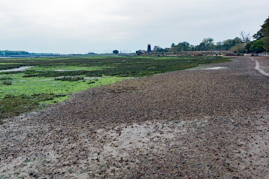
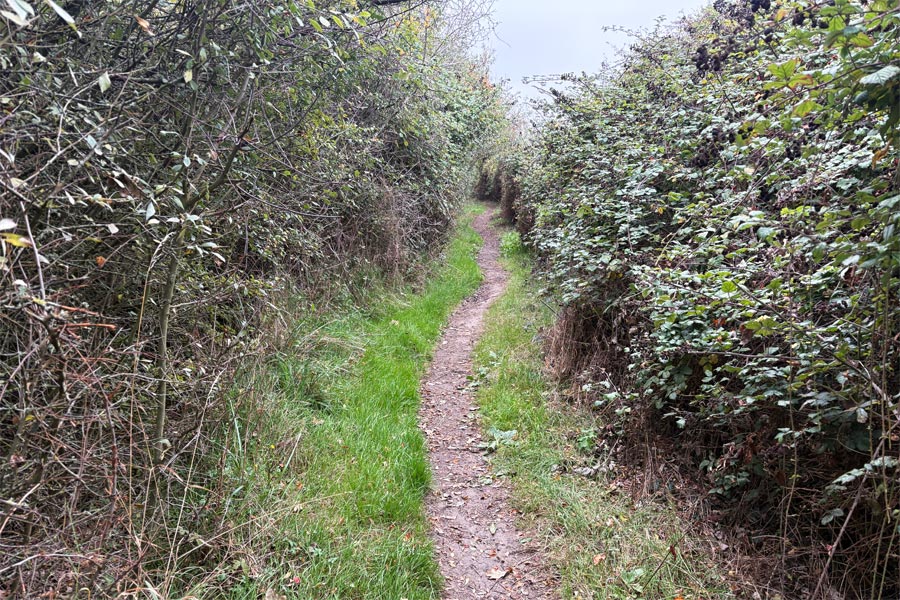
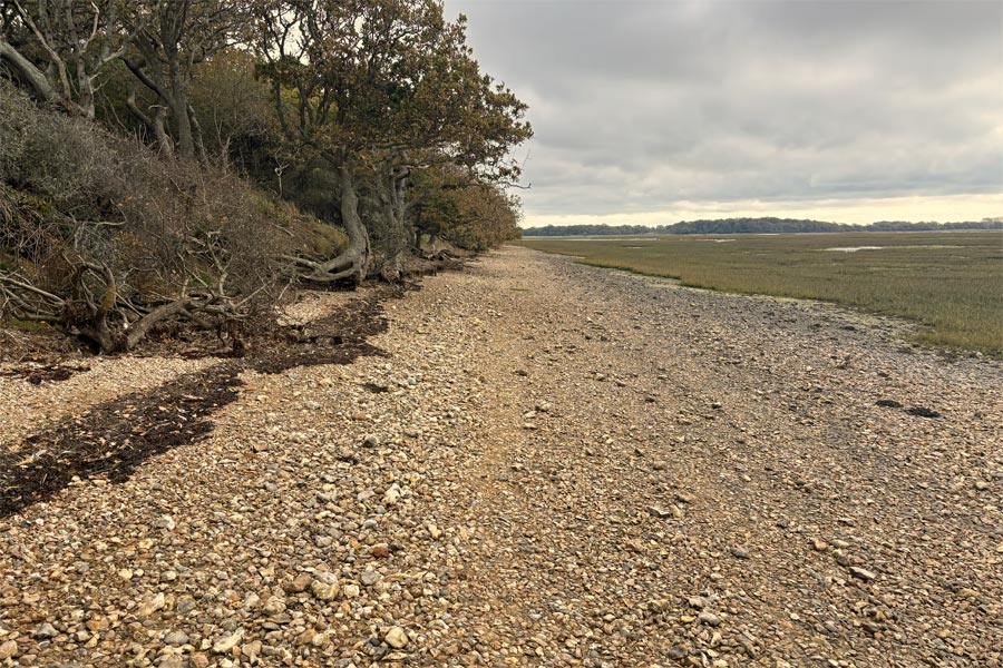
After walking from Prinstead to Nutbourne and around the inland end of the two channels I continued south again and out onto the Chidham Peninsula. There were plenty more mud flats here but the tide was then on the way in. Continuing south at Chidham point the path left the shore and followed an embankment created slightly inland for flood management purposes but it returned to the shoreline later. Here the path ran along the foreshore and can be flooded at high tide. I had checked the tide times and had plenty of time to get round. At the end of the peninsula, Cobnor Point, the footpath turned north onto a raised bank with the foreshore being on both side of it. The path then threaded slightly inland through an activity centre and a youth sailing centre before returning to the shoreline just after a sailing jetty. After another 3 miles walking north I reached the inland end of the Bosham Channel, which is very close to the A259, along which I then walked back to my campsite at Southbourne.
 |
 |
| Heading north | North end of the Bosham Channel |
End of day 2: About 14 miles walked today.
Day 3: Bosham Channel to West Wittering
 |
 |
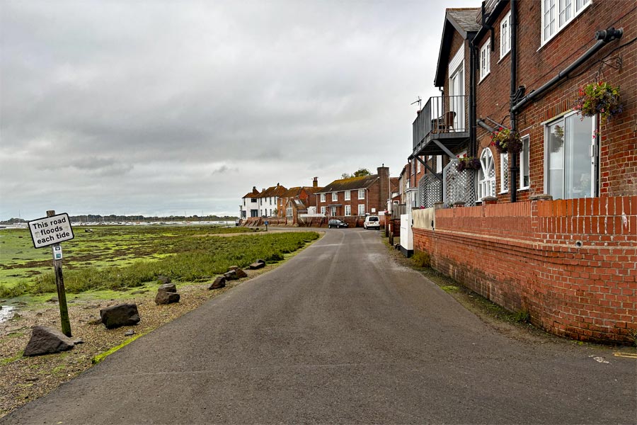
I returned by bus to the point on the A259 that I had reached the day before and walked the short distance to the start of the footpath to Bosham. Once again the morning was bright but cloudy and the tide was out. Along the banks of the Bosham channel there were several interesting and abandoned quays and slipways. At the centre of Bosham, the houses along the waterfront were on a raised bank above the road which had a warning notice about the road becoming submerged during some high tides. Here I stopped at the Shoreside Cafe for a coffee and to check my onward route.
I wanted to walk along the channel to West Ichenor which would require crossing the Chichester Channel. I had made several attempts to contact the advertised ferry and water taxi service at West Ichenor by email and telephone before and during walk but my messages were never replied to. I checked my emails and tried phoning once more but got no answer. So I was not able to continue the walk to Ichenor the way I wanted to go. I had an alternative route although it was several miles longer and inland. For this I walked due east along public footpaths through farmland to the banks of the next channel, the Fishbourne channel where I then walked to its northern end to cross at the bridge there.
 |
 |
| Bosham | Fishbourne Channel |
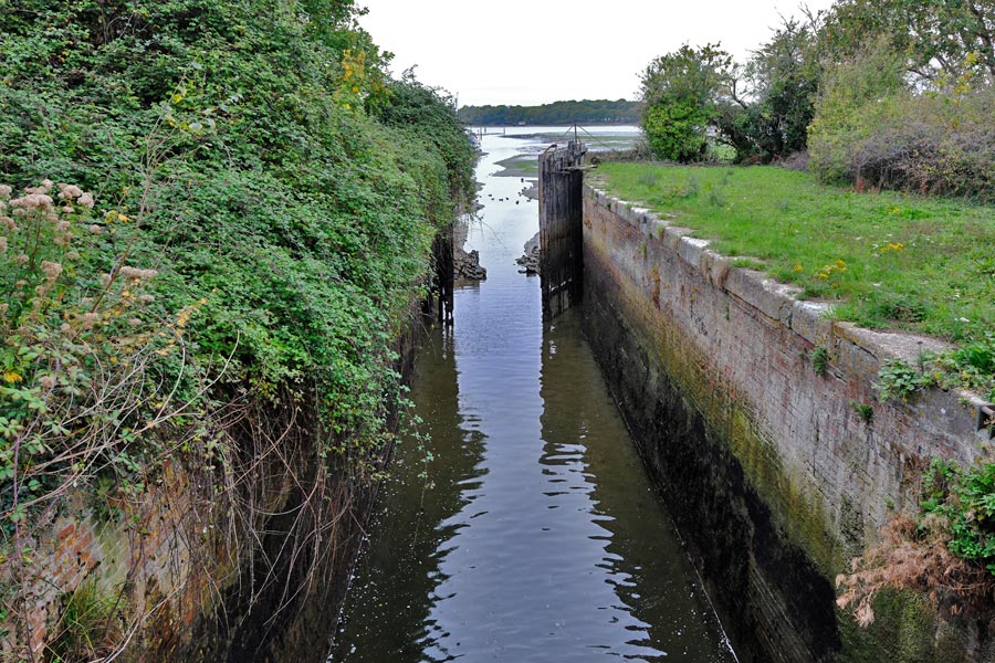
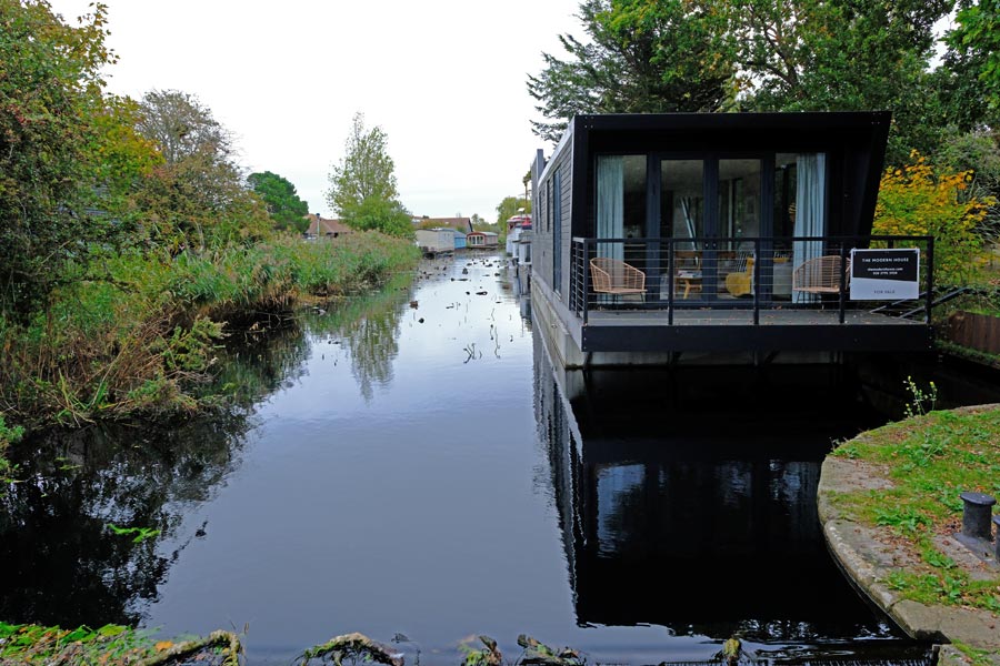
I turned south to walk along the banks of the Fishboune Channel, across the slipway and the disused lock gates at Salterns Lock at the Chichester Ship Canal entrance, where there are houseboats moored. The footpath then passes the marina and shipyard, all very interesting.
 |
 |
| The foreshore Fishbourne Channel | Chichester Ship Canal entrance |
 |
 |
| Chichester Ship Canal | Approaching West Ichenor |
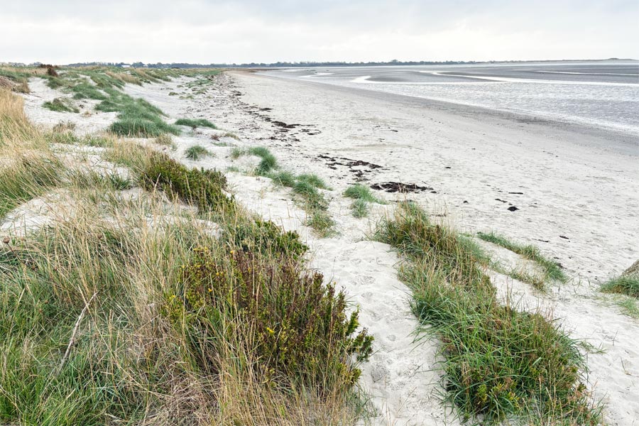
At West Ichenor, where my ferry/water taxi ride would have taken me, the Fishbourne and Bosham Channels become the Chichester Channel, I stopped at the Ship Inn for a pint and a snack before continuing on for about 4 miles to West Wittering beach, which was where I had started my West Sussex coastal walk earlier in the year. I walked along the wide sandy beach a short way and then walked back into the town to catch a number 52 or 53 bus to Chichester then a number 700 bus back to my campsite. It had been a pleasant three day walk. It was cloudy but bright for most of the walk, with glimpses of sun now and then, with mostly just a light wind but no rain.
 |
 |
| Sea defences after West Ichenor | West Wittering Beach |
End of day 3: About 13 miles walked today.
About 39 miles walked in two and a half days.
back to the start of Hampshire
West Wittering, East Wittering, Selsey, Bognor Regis, Littlehampton, Goring-by-Sea, Worthing, Shoreham-by-Sea, Southwick, Portslade-by-Sea, Hove and Brighton.
There was another good week of weather forecasted so I decided to use it to walk the West Sussex coastline. Using my campervan instead of booking accommodation worked out very well on my previous walk so I decided to do the same from now on.
For this walk I decided to leave my camera at home and just take my iPhone. I had just bought an iPhone 16 and was quite impressed with it's small small range of camera controls. I like to travel light and liked the idea of taking something that small. I knew that if I took my Fuji X-E5 I would keep using it so I forced myself to leave it at home.
Day 1: West Wittering to Pagham Harbour.
 |
 |
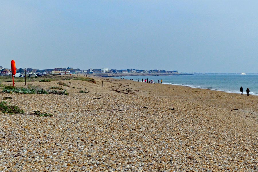
Arriving at about 9am, I parked the campervan in the all-day car park behind West Wittering beach. (Gates locked at 8pm.) The beach is wide and sandy with large pebbles higher up. The tide was going out so I walked on the firm wet sand. It was sunny with a few clouds but there was a cold north-easterly wind. At East Wittering, 10am, I found the Drifters cafe just opening so I sat outside and had a very nice scrambled eggs on toast. I continued on the footpath above the beach which later made a 4 mile detour inland around the Medmerry Nature Reserve before returning to the coast just before Selsey. I didn't see many of the birds featured on the reserve's information board but I did hear some very strange noises from within the reeds.
 |
 |
| Selsey Bill | Selsey front |
I'm not sure what I was expecting to see at Selsey Bill but I was disappointed. I was hoping for at least a cafe or somewhere that I could stop for a coffee and a snack, but there were just ugly broken concrete slabs and groynes, and with no beach access the path detoured inland around the house that was built there. I then walked northwards along the waterfront, looking for somewhere to stop for lunch but I didn't find anywhere, then suddenly I found myself walking away from Selsey. I didn't realise that there were no facilities along the waterfront here. I didn't have time to walk into the town centre so I walked on. The sun had disappeared by then and I was now walking directly into a cold north-easterly wind. I put on my fleece and hat. I continued on until I reached the start of Pagham Harbour, then caught buses back to West Wittering. (Number 51 to Chichester then number 52 or 53 to the Witterings. I found a campsite on-line at Sidlesham and drove straight there. It was only a mile from where I finished walking that day.
End of day 1: About 14 miles walked today
Day 2: Pagham Harbour to Littlehampton
 |
 |
| Pagham Harbour low tide | Bognor Regis |
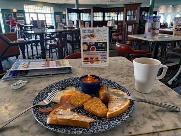
It was a clear sunny sky and a light north-easterly wind as I walked from the campsite to Pagham Harbour and began to walk its perimeter. But by the time I reached the start of the beach at Bognor Regis it became quite windy. My map showed the path to be above the beach but I preferred to walk on the firm damp sand near the waters edge. Arriving at the centre of Bognor at about 9:30am I stopped for a Wetherspoon breakfast at The Hatter's Inn.
 |
 |
| Erosion between Bognor and Littlehampton | View from the footbridge to Littlehampton |
Leaving Bognor behind the path became pebble-strewn and more difficult to walk on for a time, then there was a lot of bank erosion for a few miles. Turning inland to walk along the bank of the River Arun the path was scruffy and hap-hazard until reaching the footbridge to Littlehampton. Then on the other there was a smart, wide, new-looking walkway taking me back to the beach. From here I returned to my campsite by bus. Number 700 to Chichester then number 51 to Sidlesham. On-line I found a campsite at Littlehampton and booked a pitch for two nights.
End of day 2: About 14.5 miles walked today
Day 3: Littlehampton to Worthing
 |
 |
| Rustington beach | Worthing Pier |
I drove from the campsite at Sidleston to Littlehampton where I parked on a road where there were other motor-homes and commercial vehicles parked as I was not able to book into the Littlehampton campsite until the afternoon. I had noted this road the previous day as being a likely spot to park, even overnight if I hadn't found a suitable campsite. Leaving Littlehampton, some of the path was on shingle and pebbles so I walked on the firm sand near the waterline. After a couple of miles the path improved, some of which was on grass, and the last section was the promenade at Worthing. It was a very pleasant walk, especially along the beach. As the morning wore on it began to get hot. I went to The Three Fishes for a late breakfast. It was a Saturday and the town was very Busy. I only had about 12 miles to go to get to my final destination tomorrow, Brighton, so I decided to return to Littlehampton on the number 701 bus, where I booked into my campsite and spent the rest of the day relaxing.
End of day 3: Only about 8.5 miles walked today. Lazy.
Day 4: Worthing to Brighton
 |
 |
| Shoreham-by-Sea footbridge | View from the footbridge |
 |
 |
| West Pier Brighton | Brighton Pier |
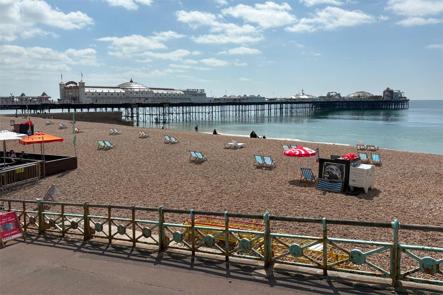
My last walking day was again bright and sunny. I started early and returned to Worthing by bus. At Shoreham-by-Sea the path crosses the River Adur via a footbridge. At Southwick I missed the path and ended up walking on a narrow pavement along the scruffy and busy A259 for a time until correcting my mistake by crossing to the seaward side of the harbour at Portslade-by-Sea onto a more pleasant stretch of walkway. The final part of the walk was on the wide promenade at Brighton, which was very busy. I nipped into town to get a late breakfast at The Bright Helm.
End of day 4: About 12 miles walked today.
That's the end of my walk along the coast of West Sussex. About 50 miles walked in three and a half days.
It was an easy walk, not as peaceful as countryside walking and there was plenty of walking on pavements and promenades, the advantage being that it was not necessary to keep looking down as is often necessary when walking on uneven country tracks or rough ground. But it was pleasant and interesting. I avoided the pebbly sections on beaches by walking on the firm, damp sand near the water's edge when I could. In fact I chose to walk there often, even when I did not need to.
back to the start of West Sussex
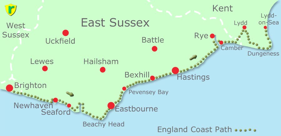
Brighton, Rottingdean, Newhaven, Seaford, Seven Sisters, Beachy Head, Eastbourne, Pevensey Bay, Bexhill-on-Sea, Hastings, Rye Harbour and Camber.

After the last trip I found that the picture quality and extra photographic controls on it were good enough for me to take it instead of my usual camera. However, I still wanted to take camera as well. So I decided to throw my old and very battered Fuji X-E1 into my rucksack for when I wanted to relax and handle a camera shaped camera.
The colour photos on this walk were taken on an iPhone16. The black and white photos were taken on a Fuji X-E1 with 23mm f2.8 lens.
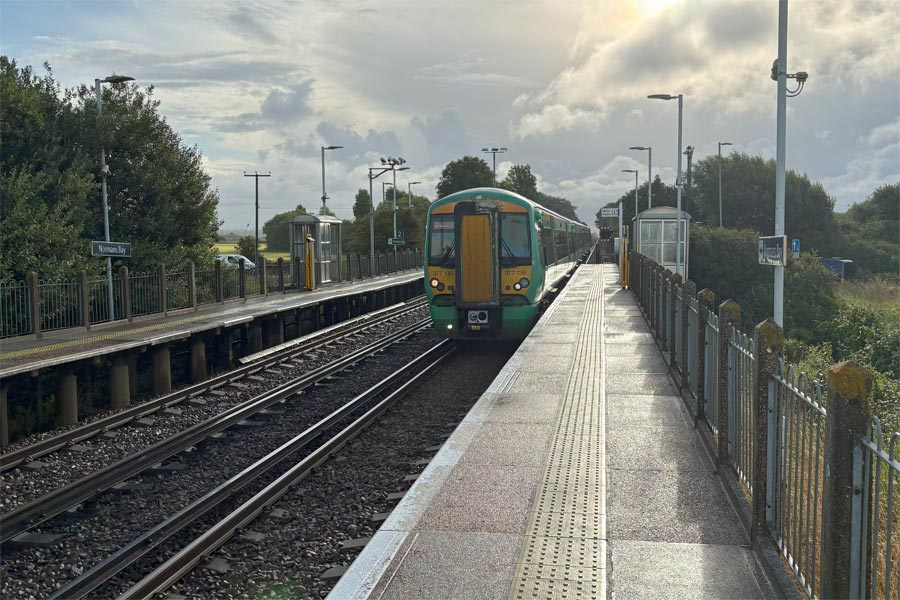 |
I based my campervan at a campsite that my wife and I had been to before at Normans Bay (Normans' Bay on the OS maps), near Pevensey Bay. Because there is a tiny railway station about half a mile away I would be able to take a train to the start of this walk at Brighton, then travel from and to Eastbourne, Bexhill, Hastings and Rye. Much quicker and much more comfortable that buses. I used an app to buy my rail tickets in advance each day.
Day 1: Brighton to Seaford.
 |
 |
| Brighton Pier | The cliffs at Peacehaven |
 |
 |
| The Bridge at Newhaven | Between Newhaven and Seaford |
I found myself taking quite a few black and white photos on this walk because I had my old Fuji X-E1 with me, a camera I love because it is so easy to use. B&W is not a normal medium for travel photos but I find that sometimes the details in an image can be appreciated more if the influence of colour is not there to distract the eye.
Brighton Pier
Approaching Newhaven
End of day 1: About 15 miles walked today
Day 2: Seaford to Eastbourne
 |
 |
| The beach at Seaford. Seven Sisters ahead. | Cuckmere Haven |
the Seven Sisters
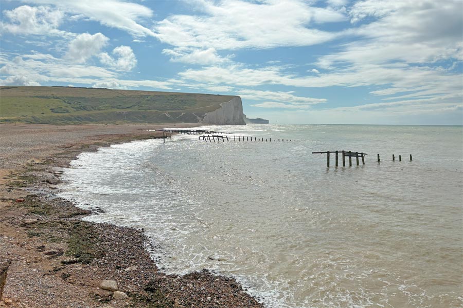
I returned by train to Eastbourne then took a number 12A bus to Seaford where I set out along the coast path along the seafront. This is also part of the Vanguard Way as far as the Exceat Bridge. At the end of the beach the path ascends to Seaford Head and passes a golf course and then the Seaford Nature reserve. Here it meets the Cuckford River at Cuckmere Haven and follows the fiver inland for a mile or so to cross it at Exceat Bridge.
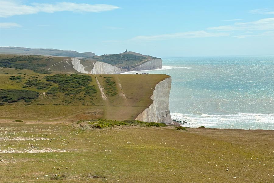
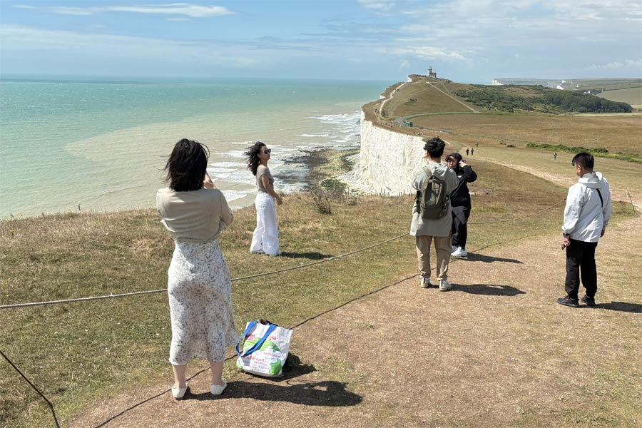
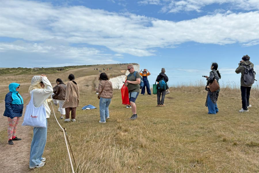
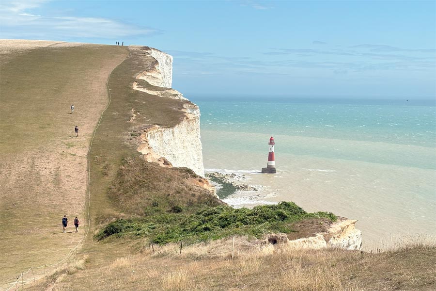
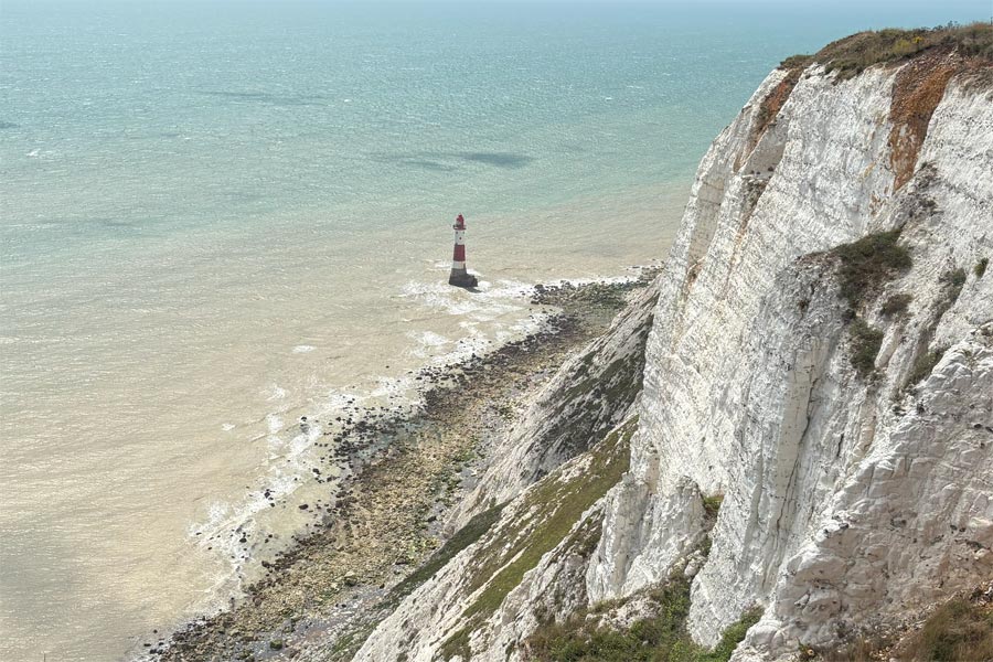
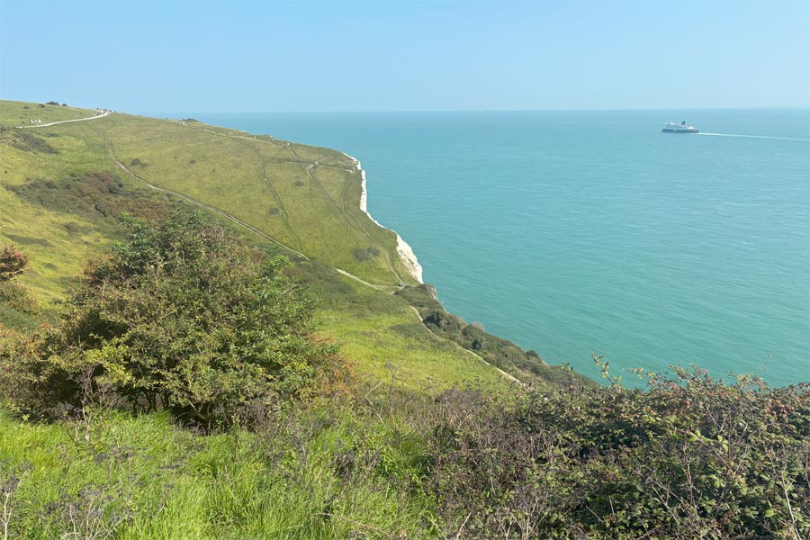
There I stopped at the Cafe in the Seven Sisters Visitors Centre where I had a coffee and a massive Eccles cake before setting out to walk along the Seven Sisters and past Beachy Head. The next 6 miles of the path is also part of the South Downs Way until just after Beachy Head. There was a strong wind blowing from the south west, and the clouds were racing over the high cliffs.
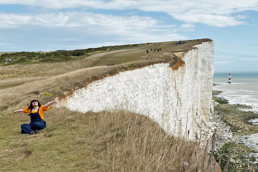
At the Birling Gap, a depression in the line of cliffs, there was a car and coach park and there were many visitors walking along the cliffs beyond, mainly Japanese it seemed, and they were getting blown all over the place, especially the ones that were walking in the opposite direction to me to get back to their coaches, with their heads down and their coat hoods gripped firmly against the wind that they were walking almost head-on into. Further on there were groups people who had stepped over the safety rope to pose and take photos nearer to the cliff edge.
 |
 |
It was a glorious sunny day with the roar of the wind and with the shadows of the clouds racing across the sea and then over the huge rolling grassy hills.
 |
 |
| Looking back | Eastbourne ahead |
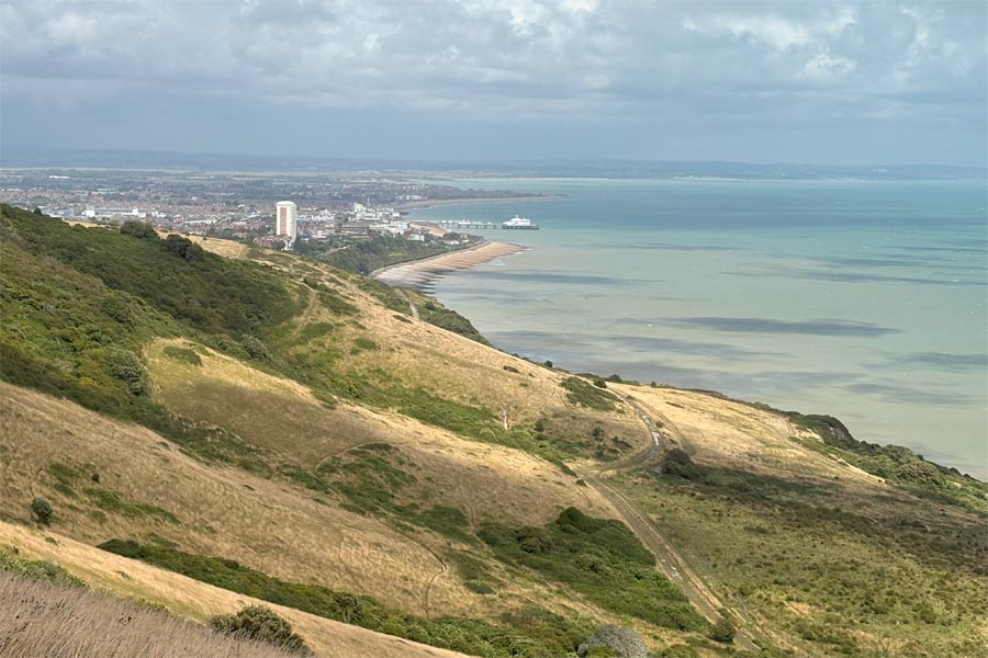
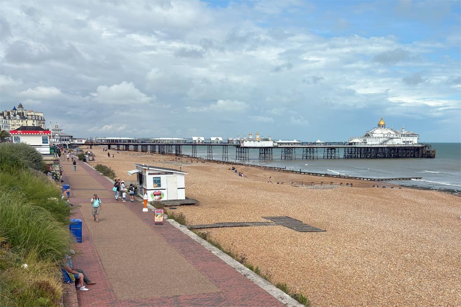
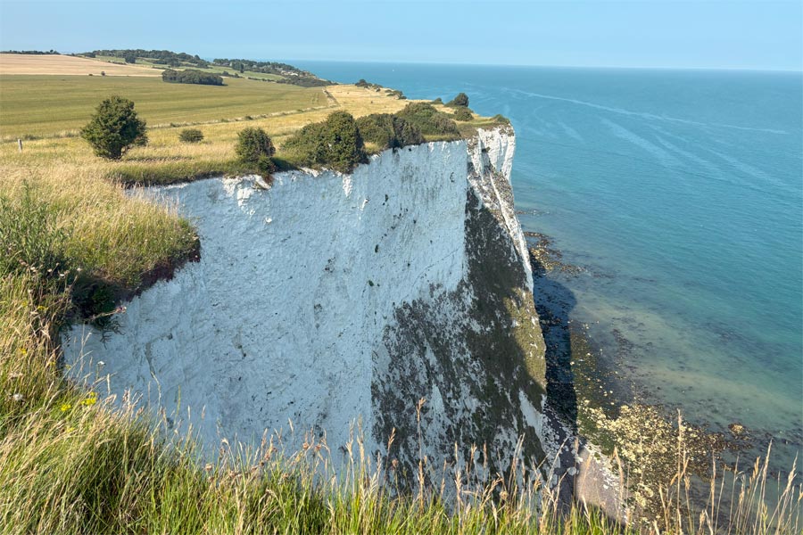
Just after Beachy Head, looking back, there was a last view of the lighthouse and the towering white cliff. Shortly afterwards there was a steep zig-zag path and some steep steps leading down towards the sea and then a very pleasant sheltered walk through a grassy, shrubby area to the outskirts of Eastbourne, followed by a 1.5 mile stroll along the sea front to arrive at the pier, where I then walked into the town to the station (via the London and county for a pint) followed by a return train journey back to Normans Bay.
 |
| Eastbourne |
End of day 2: About 14 miles walked today.
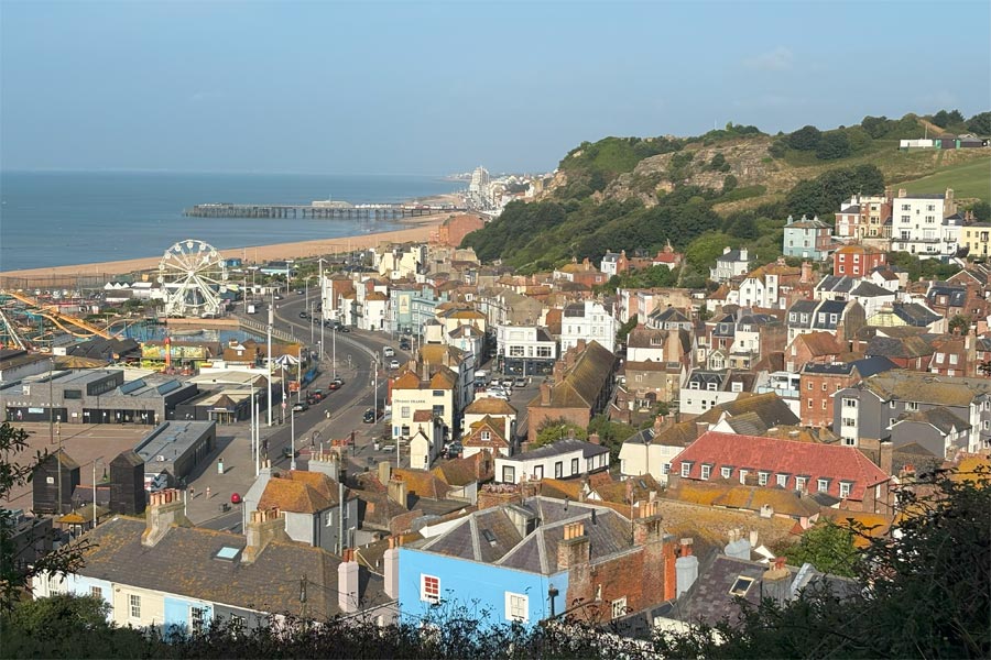
Day 3: Eastbourne to Hastings
Back to Eastbourne next day on the train, I was walking by 7:45, along the front, past blocks of modern flats, around the square Sovereign Harbour and its blocks of flats, then more blocks of flats, this time with pointed tiled roofs, lined the cliffs. Walking on the shingle beach was necessary to get to Pevensey Bay, which requires a more relaxed stride to avoid sinking into the shingle when pushing forward. At Pevensey Bay I stopped for a snack. I had another eccles cake but it was not a large as the one the day before. As I left the cafe I notice that the north-easterly wind was bringing a huge black thundercloud which was already dropping dark curtains of rain as it approached the coast ahead. As I was now near my campsite I decided to shelter in my campervan rather than putting on waterproofs and keep going. I had to increase my pace and arrived just as the first drops of rain started pattering on the roof. I relaxed in the camper for and hour until the thunder, lightning and noisy deluge of rain had passed by. Black and white photography time.
 |
 |
| Pevensey Bay | Rain on the way |
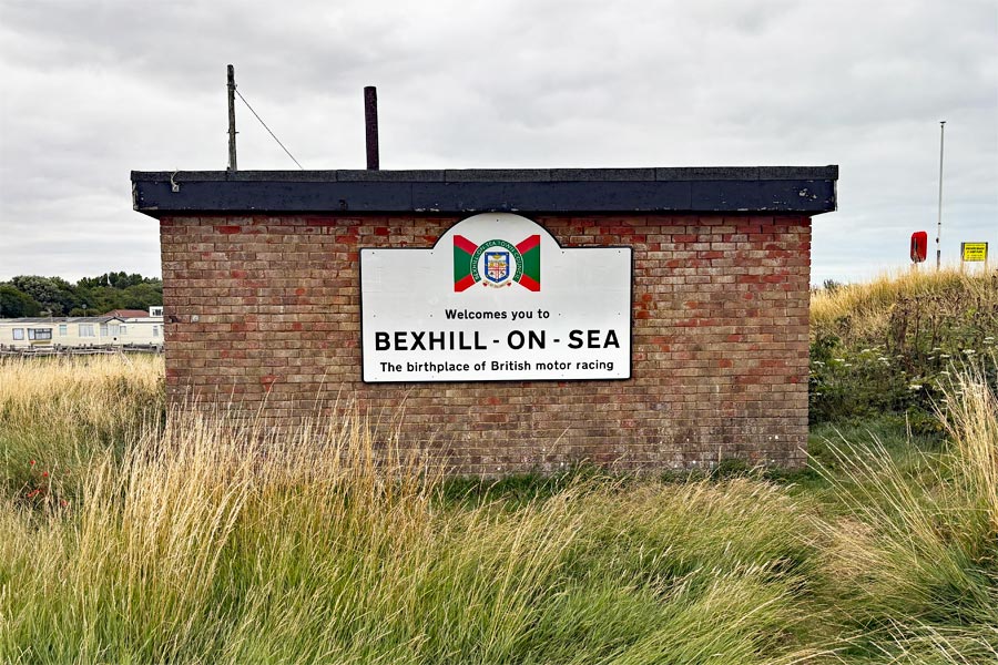
After the storm I continued on towards Bexhill-on-Sea, first passing a "The Home of British Motor Racing" sign. A little more walking on shingle then became necessary and then about 1.5 miles of road walking was done to reach Cooden on the outskirts of Bexhill and where the promenade started. There was about 2 miles of promenading to get to the town centre.
 |
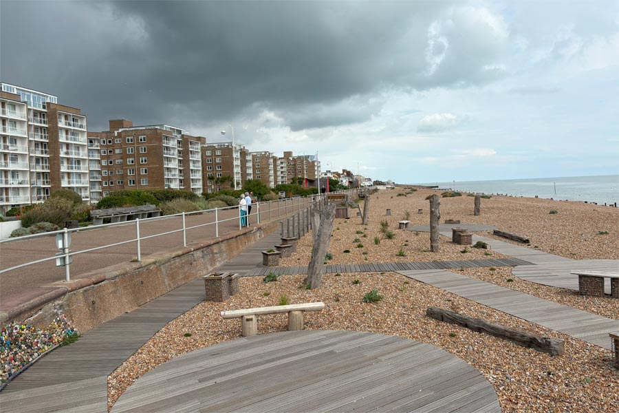 |
| Bexhill-on-Sea | Bexhill-on-Sea |
During this time the heavens opened once again and I was forced, along with twenty or more other people, to squeeze into one of the stylishly angular contemporary but totally impractical shelters (open-fronted, partly open-backed and with a large triangular hole in the angular roof) to try to keep dry. Style before practicality!
I use my black and white camera to catch the moment and also show the deserted promenade shortly afterwards.
 |
 |
After the downpour I continued on along the front, past the normally photogenic De La Warr Pavilion, out of Bexhill and almost immediately into Hastings. I arrived at about 5:45 pm, had a pint in The John Logie Baird and took a train back to Normans Bay.
The De La Warr Pavilion (photo from a previous visit)
 |
 |
| The path to Hastings | Hastings front |
End of day 3: About 18 miles walked today
Day 4: Hastings to Rye Harbour
 |
 |
| View from East Hill | Tough walking ahead |
An even earlier start that morning. I caught the 06:51 train to Hastings and followed the England Coast Path signs which directed me past the tall, narrow fishermen's nets huts near the beach to a narrow ally near the entrance to the East Hill Lift, which is the UK's steepest funicular railway (closed until 10am that day). Several flights of stone steps took me to the top of the cliff and the start of the Hastings Country Park. After a pleasant stroll across the open area of the country park in the sun, the route descended through the trees and bushes to become a steep, narrow, winding, overgrown, slippery path still wet from recent rain. I took out both of my walking poles and used them to make sure that I did not slip, especially on the deep steps. The sun was hot and it was very humid with no wind. At the bottom the path ascended again, even higher, then dropped and ascended twice more before descending more gently down and along the cliffs to Fairlight Cove. This was the first time on this walk that I would have called the going 'quite strenuous' but my knees coped well. After about 5 miles from the start of the first descent the path I arrived at Cliff End and the start of a concrete path along the top of the sea wall. There was a cool breeze blowing. I stopped here to cool down, rest, and eat my lunch. At Pett Level I stopped again for a coffee at an outdoor cafe behind the sea wall but there was no shade and no breeze there, so I soon moved on to catch the cooling breeze along the top of the sea wall. Shortly after the concrete path became rough and strewn with shingle and was not so easy to walk along.
 |
 |
| Pett Level | River Rother. Camber in the distance. |
End of day 4: About 14 miles walked today.
Day 5: Camber to Lydd-on-Sea
For my last day I drove my campervan to Lydd in Kent, which was about mid way on my day's walk and on suitable bus routes. From Lydd I took a bus back to Camber Sands, which was on the other side of the river from Rye Harbour and was where the England Coast Path re-started.
 |
 |
| Camber Sands | Danger zone ahead |
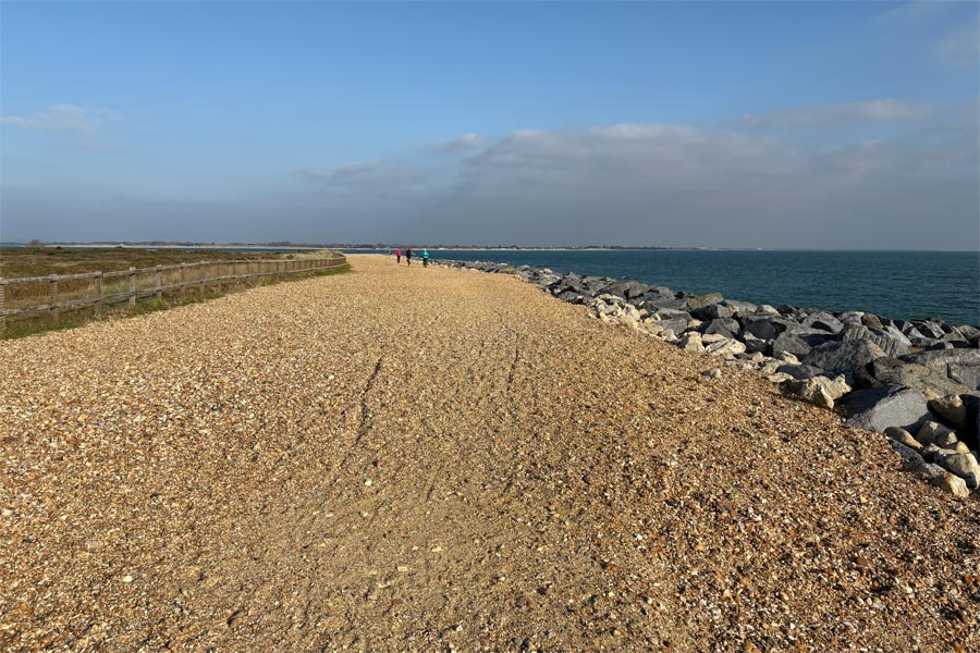
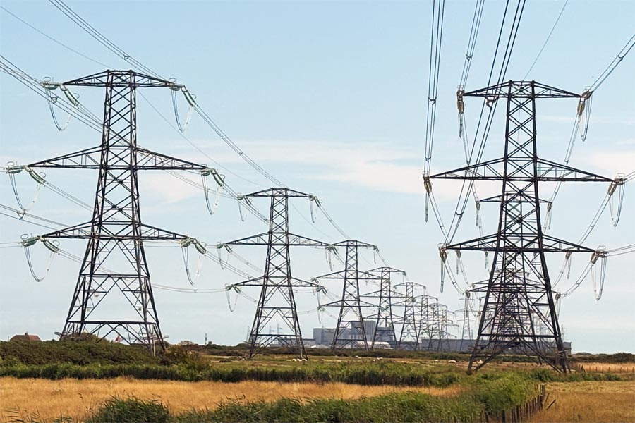
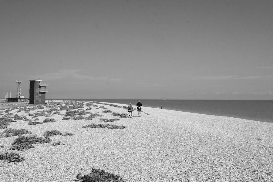
I walked on the beach from Camber Sands for a while and then along the concrete path on the sea wall. After about 2 miles I reached an MOD Danger Area where the path then diverted away from the coast for 7.5 miles and began with a separate tarmac footpath/cyclepath that ran parallel to the road to Lydd. After about 2 miles the path crossed into Kent. At Lydd, after a short walk around the edge of the town, the path continued along the edge of other side of the Danger Area back towards the coast on a concrete road, signposted for walkers and military vehicles only. Soon the sky became dominated by electricity pylons.
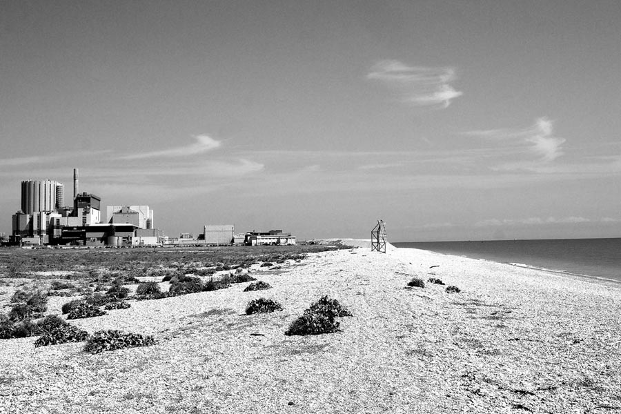
 |
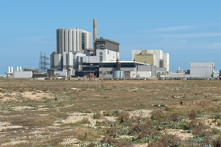 |
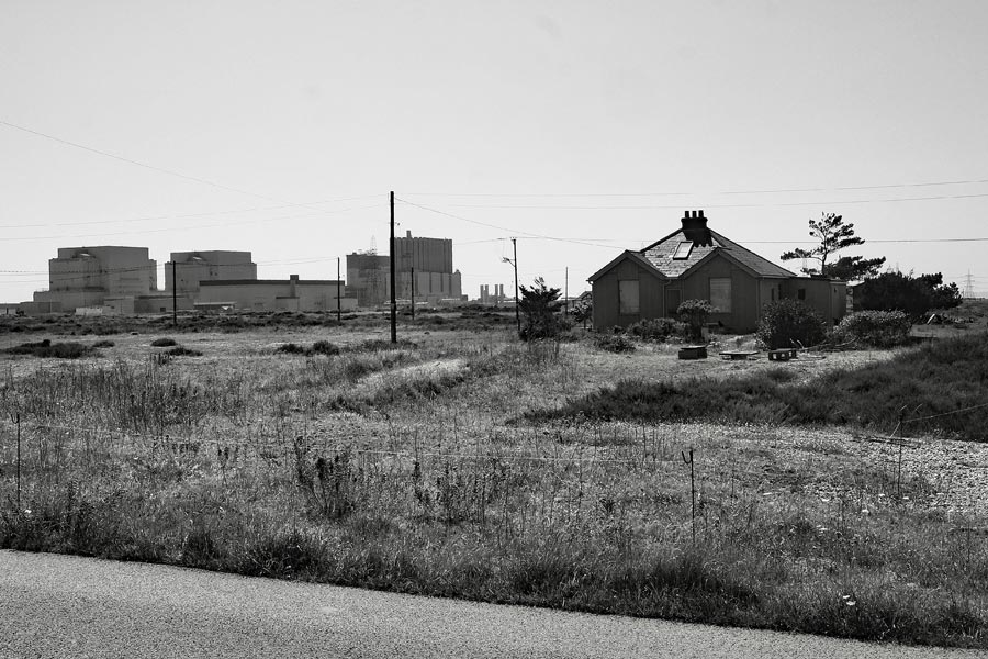
When I was back at the coast, I walked along the beach, past two huge incongruous nuclear power stations, and past the scattered buildings, huts, rusty machinery and patches of low growing plants sprinkled around the acres of shingle, taking photographs. The semi-desolate landscape and sheer open space of Dungeness is great for colour photography and it's also great for black and white photography.
 |
 |
 |
 |
I walked along the beach road to Lydd-on-Sea where I thought that I could catch a bus back to where my campervan was parked at Lydd. But I had to first catch a bus into New Romney and a second bus from there back to Lydd. I could have walked into New Romney but it was another 4 miles and it was a very hot day. Once again I had chosen to walk in what turned out to be a heatwave.
End of day 5: About 14 miles walked today. A very hot day with very little shade.
That's the end of my walk along the coast of East Sussex and a few miles into Kent. About 74 miles walked in five days.
It was an easy walk, apart from The Seven Sisters and Beachy head which was a little more strenuous, but glorious, and the Hastings Country Park and Covehurst Bay area I found challenging. Obviously there was plenty of sea front walking through the towns but also plenty of open coast walking too.
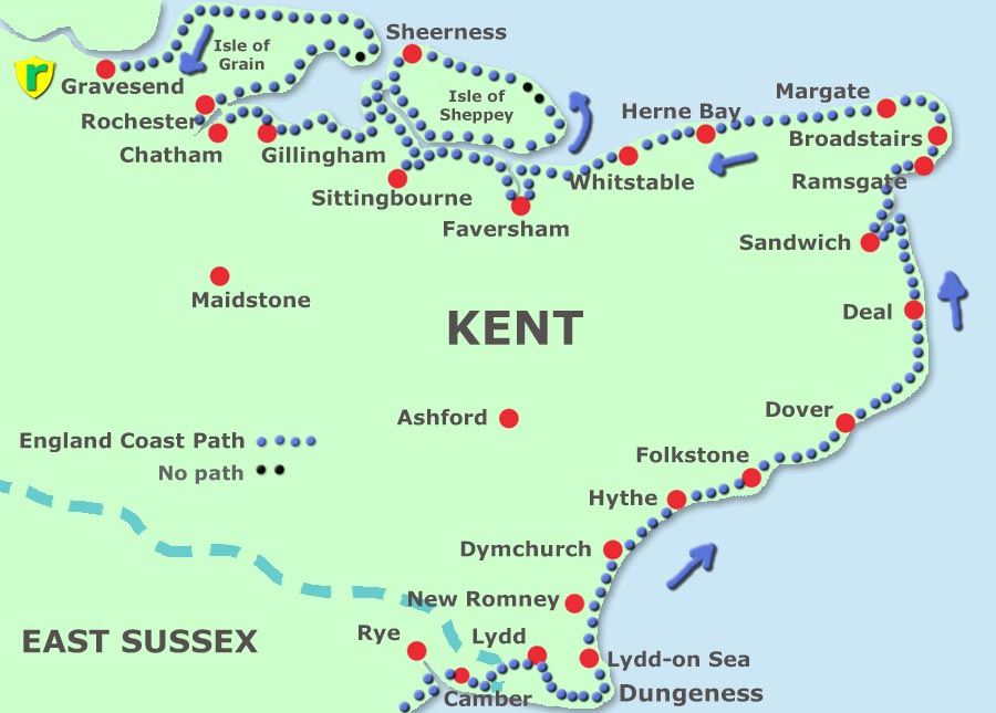
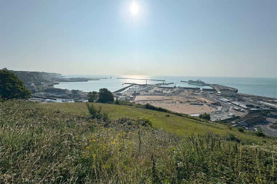
Lydd-on-Sea, Dymchurch, Hythe, Folkstone, Capel Le Ferne, Dover, Deal, Sandwich, Ramsgate, Broadstairs, Margate, Westgate-on-Sea, Herne Bay, Whitstable, Faversham, Sittingbourne, Isle of Sheppey and Sheerness, Gillingham, Isle of Grain, Gravesend.
The Kent border lies between Camber in East Sussex and Lydd, so I had already walked about 10 miles of Kent at the end of my previous walk which ended at Lydd-on-Sea.
By now I had decided that my iPhone was sufficient to take photos. It was nowhere near as versatile as any of my Fuji cameras, but it was very light and always in my pocket, ready for use. The thing that I really missed was not having a viewfinder. A rear screen that has to be held up and squinted at in bright light is no substitute for a large clear high definition viewfinder held right up to the eye.
For this walk all photographs were taken on an iPhone16, unless otherwise stated.
Day 1: Lydd-on-Sea to Capel le Ferne (just beyond Folkestone)
I parked my campervan in Hythe as this was where I thought that I might be spending my first night. I took an early morning bus back to Lydd-on-Sea and started walking east. Another fine week had been forecasted and it was already getting warm. There was little wind. I walked on the firm sand near the water's edge rather than the pavement alongside of the road. After a few miles there was a slipway and from then on there was suitable walking on grass, rough track and finally a proper walkway.
 |
 |
| Base camp | Approaching St Mary's Bay |
After Dymchurch there is a military firing range on the coast, so the path diverts inland alongside the road all the way to Hythe where further on it cuts inland a little more to follow the Royal Military Canal Path to Hythe town centre, where I stopped for a pint at the Red Lion before following the path onwards to the sea front. As I walked out of town and into the outskirts of Folkestone a stiff but warm breeze blew in. At Folkestone the waterfront was very busy and so was the beach. There were queues at most of the food stalls and a band was playing loudly on the quayside.
 |
 |
| Folkstone harbour | Folkstone beach |
I didn't linger for long and was soon climbing the steep and narrow path to the cliff-top and shortly afterwards, I arrived at Capel le Ferne. I walked along the cliff to beyond the village and noticed a quiet spot that might be a good place to park the campervan. I decided that I had done enough walking for my first day. It had been a long but easy walk apart from the initial climb to the top of the cliffs so I had walked further that I had expected. I took a number 104 bus back to Hythe and drove the campervan back to that spot.
End of day 1: About 20 miles walked today.
Day 2: Capel le Ferne to Walmer, Deal.
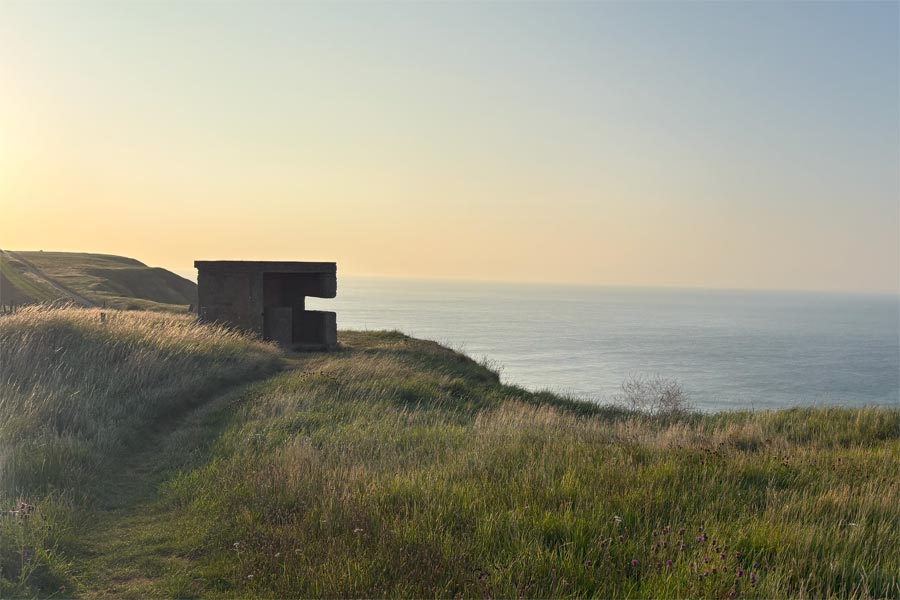
I had a breakfast in the campervan, which was on a cliff overlooking the sea, then I started walking along the cliff top path. In places the path was so close to the edge that heavy steel railings had been provided for safety. There was a cold wind blowing so I added and extra layer until I warmed up. The cliff was dotted with derelict concrete gun-emplacements and lookout posts, and there was also a large concrete listening 'ear'. All reminders of Word War II. France was visible in the misty distance.
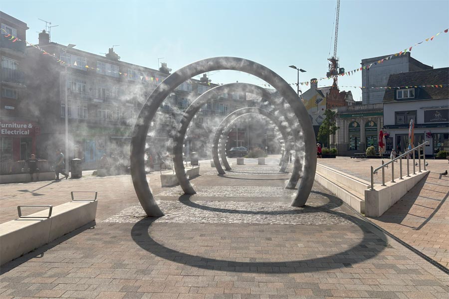
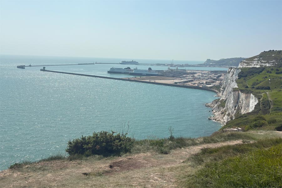
At Dover the path drops down steeply before passing underneath the A20 and then climbs an arm of raised countryside that pokes into the town, on the way passing the massive fortifications at Western Heights and the Drop Redoubt which overlooks the town on one side and the harbour on the other. Here are some spectacular views (and a lot of stone steps), finally descending to reach the edge of the Dover shopping centre. As it was now a very hot day I nipped into town for a pint at The Eight Bells and on the way walked slowly through a 'cooling mist tunnel' in the shopping centre. In the pub I decided that Deal was to be my stopping place for the night, and looking at my map I spotted a campsite at Walmer near Deal that had a railway very station close by. I phoned then and they had a vacancy. The bus station was nearby so I returned by bus to Capel Le Ferne and drove my campervan to the campsite, then returned by bus to Dover where I walked through the 'cooling mist tunnel' once again, very pleasant, before rejoining the path as it headed towards the harbour.
 |
 |
| World War II lookout | Approaching Dover |
 |
 |
| View from Western Heights | View inland of the town |
 |
 |
| Cooling mist tunnel | View from the white cliffs |
At the harbour, the path passed the base of Dover Castle and through part of the old town, then began to ascend, passing close beneath the huge curving flyover that dominates the harbourside, and up a long steep track to the top of the white cliffs, where there are interesting views of the ferry port on the way up and views of the whole of Dover harbour from the top. There followed a very pleasant, but hot, walk along the chalk paths on the cliff top, steep in places, especially when descending to St Margaret's bay (car park jam packed and more cars arriving) and returning to the cliff top via several flights of steep stone steps*. More excellent cliff top walking followed, during which time, my phone welcomed me to France. At Kingsdown the cliffs end and the path dropped down to pass behind the beach. This is where I veered inland through the village then followed local paths across farmland to get to my campsite at Walmer. My phone then welcomed me back to the UK and hoped that I'd had a good trip.
* I realised later that the path did not pass through St Margaret's bay, so I could have continued on the higher ground.
 |
 |
End of day 2: About 14 miles walked today.
Day 3: Deal to Ramsgate
 |
 |
| Deal | Ramsgate on the horizon |
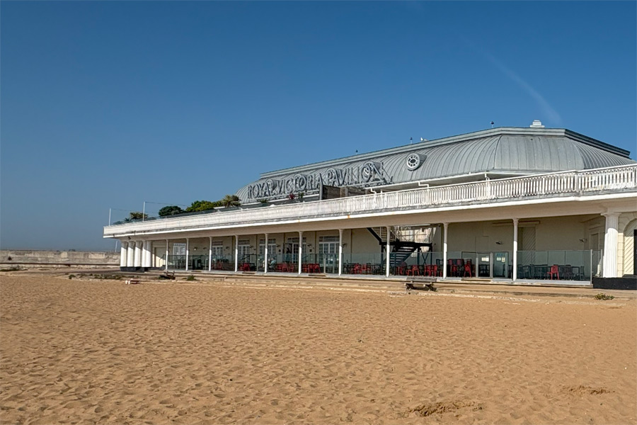
My Walmer Campsite was about 2 miles west of Deal Pier. I walked down to the sea front, past Deal Castle and the pier and out into the flat countryside and a long dusty track. It was becoming a hot day but with a light breeze. Later, as I turned inland towards Sandwich, the breeze died and the heat increased. By the time I got to the bridge over the River Stour I was flagging a little and was dismayed to find that I then had to walk several miles along the pavement of a long, straight, dusty road with fast moving traffic a few feet away and with no shade. After about 2.5 miles I missed an opening in the hedge that lead the path away from the road and back to the riverside, but luckily, about 1 mile on, I came to a SubWay where I was able to sit in the cool interior for half an hour with a chicken and ham sub and large glass of iced water. Refreshed, I found my way to the path again which lead to Cliffs End and where there was a little shade over the path for a while. After another 2.5 miles the path came to the outskirts of Ramsgate rising onto the cliffs. After 2 miles along pavements, the path dropped down from the cliffs to Ramsgate Marina. I walked along the waterfront and spotted the The Royal Victoria Pavilion where I went for a pint and to get out of the sun.
 |
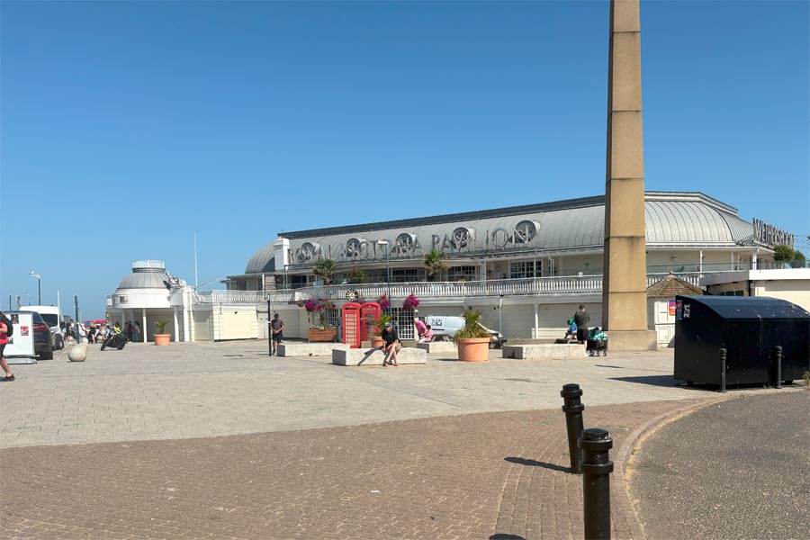 |
| Ramsgate Marina | Royal Victoria Pavilion |
I sipped my pint as I booked my train ticket back to Walmer. I then walked the mile to the station, had a 23 minute train journey and walked the half a mile back to the campsite. As there was a railway station at all of the other coastal towns that I intended to walk to, I had decided to leave the campervan at Walmer and use the train to go to and from the start and finish points. This, I prefer to using buses.
End of day 3: About 16 miles walked today.
Day 4: Ramsgate to Birchington
 |
 |
| Breakfast venue | Royal Victoria Pavilion |
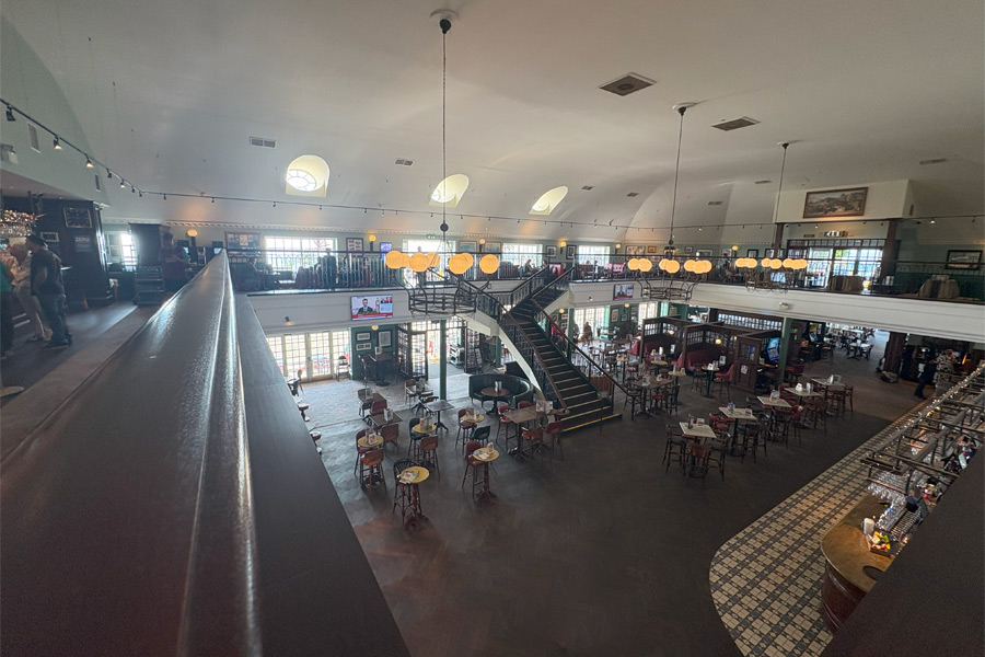
Next day I returned to Ramsgate by train and was back in the Royal Victoria Pavilion by 8:30am for a breakfast. I don't usually display photographs of the inside of pubs on this website but I was very impressed by this building.
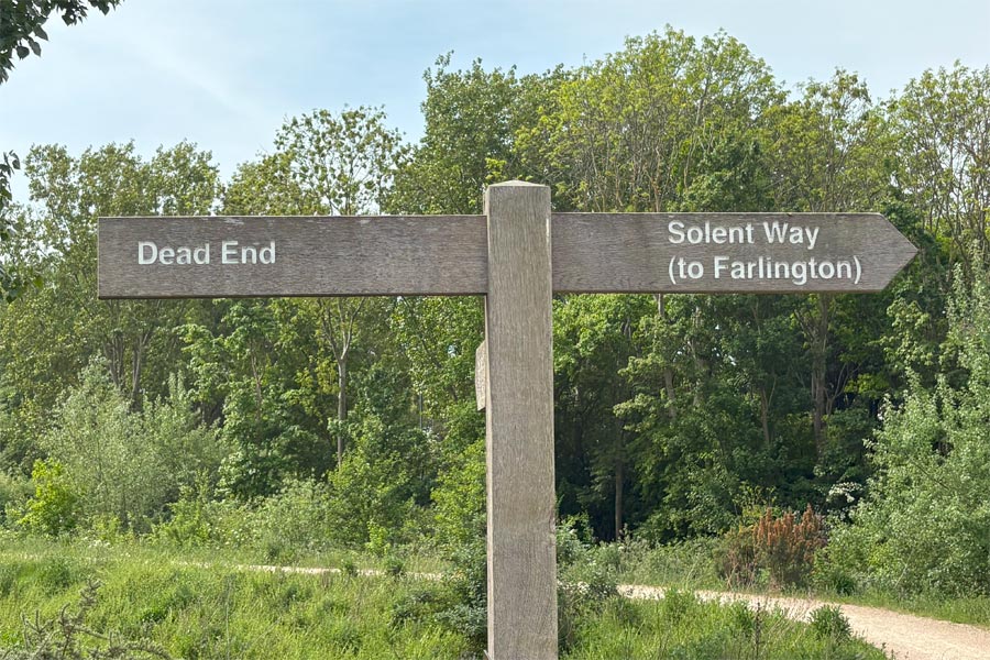
Shortly after breakfast I enjoyed a walk along the base of the white cliffs but after about a mile, the walkway came to an abrupt end. Having misread the map I realised that perhaps I should have taken a left hand fork up to the top of the cliff some way back. I turned back. But I only had to retrace my steps for about a third of a mile before finding a set of steps that would put me back on the path. There was a 'England Coast Path' sign-post there but I had walked straight past it. It wasn't long before Ramsgate merged into Broadstairs, with no countryside in between, and after about 4 miles of pleasant cliff-top walking I was there.
 |
 |
| dead end | back track |
 |
 |
| Approaching Broadstairs | Broadstairs |
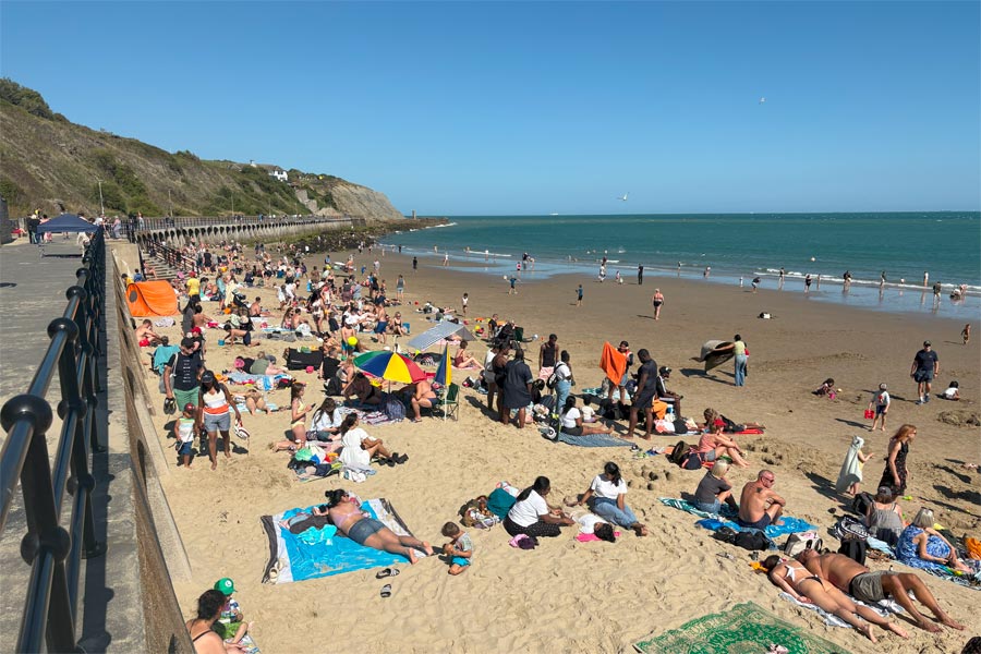
I walked slowly through busy Broadstairs but didn't stop as I had been there before. Out of town there were a few snatches of countryside at North Foreland before reaching the outskirts of Margate. At this point I had been walking approximately north but shortly after that, the path turned westwards towards Margate. I reached Margate hot and sweaty and nipped into The Mechanical Elephant for a pint and a top up* of my water bottle. It was a really hot day and there had been a hot weather warning on the BBC news.
*Top up
My water bottle gets filled up at every opportunity, especially in hot weather. There has been no problem obtaining water on any of my Kent coast walking as there are few stretches with no habitation. I prefer to get my bottle filled in a pub because sometimes it gets filled with chilled water from the squirty dispenser on the bar.
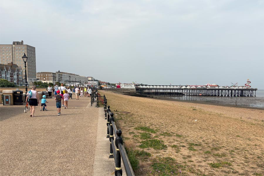
I was hot and busy in the pub so I didn't stay long. I sat out of the sun in shelter on the front and ate my snack watching the antics of the passers-by. Margate had a packed beach, busy pavements and queues for chip shops and other food sellers I then walked for about 4 miles along the top of an amazingly massive and wide sea wall, which was mostly deserted, except for a few places where it had been taken over by holiday-makers that I assume had been forced onto it when the incoming tide had come in and flooded the beach below. After about 4 miles I stopped at Birchington and took a relaxing and cool train ride back to Walmer. I went to the nearby fish and chip shop in Walmer that evening but the portion was too large and I couldn't eat it all.
 |
 |
| Margate | Westgate-on-Sea |
End of day 4: About 14 miles walked today. Hot.
Day 5: Birchington to Whitstable
Back at Birchington early the next day, there was a cool breeze and a misty sun. The tide was out and there was absolutely no one about. After about 5 miles of walking along the sea wall I stopped to look at the remains of a Roman Fort and St Mary's Church at Reculver where I had a coffee and a snack at the little cafe nearby. I sat outside to rest and eat. It was getting rather hot (again) by this time.
 |
 |
| Leaving Birchington | Ruins at Reculver |
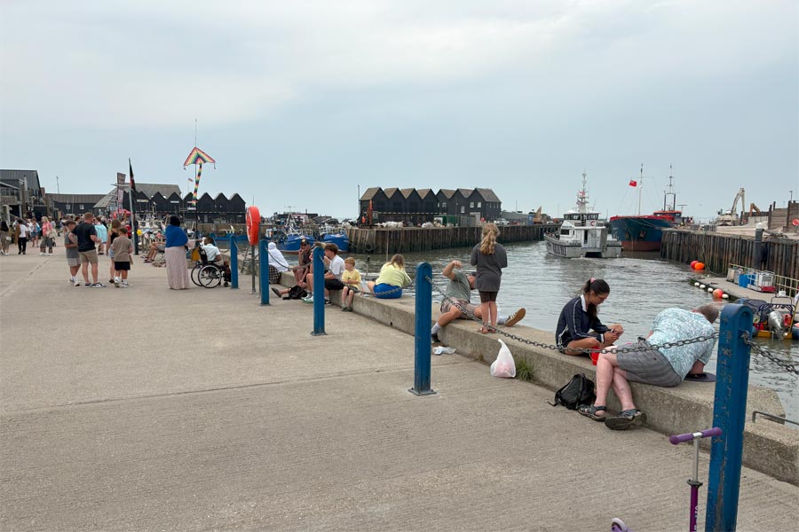
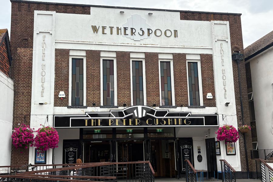
I walked on along the path which was on the sea wall, past mud flats on the right and countryside on the left, then through Herne Bay, which was very busy. There was a little more countryside walking before arriving at Whitstable. The sea wall there was lined with beach huts but the town could hardly be seen until much nearer as the outskirts were on higher ground behind the huts. I had a little wander around town and then went for a pint in The Peter Cushing. I sat in the beer garden to cool down before taking the train back to Walmer.
 |
 |
| Hearne Bay | Whitstable harbour |
End of day 5: About 13 miles walked today.
Day 6: Whitstable to Faversham
 |
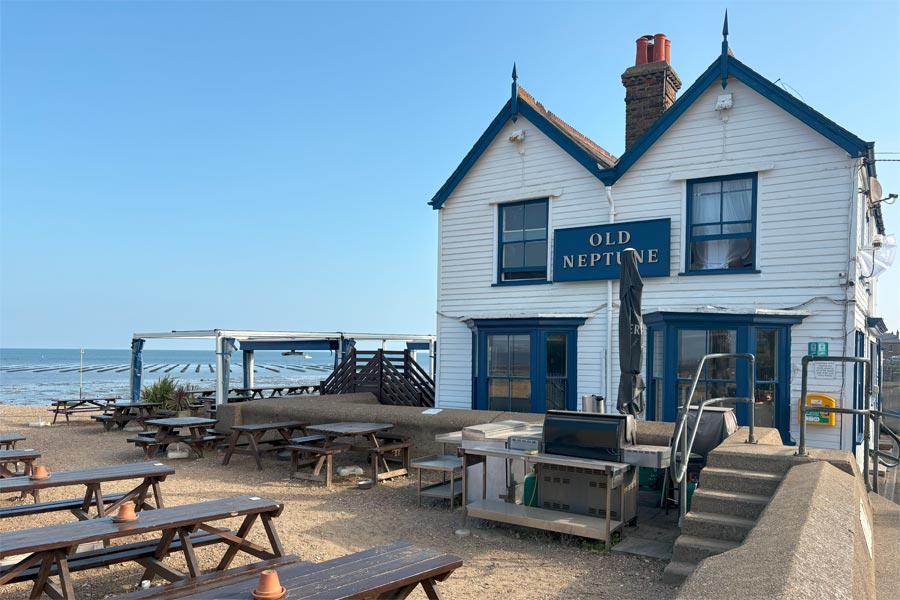 |
| The Peter Cushing | The Old Neptune |
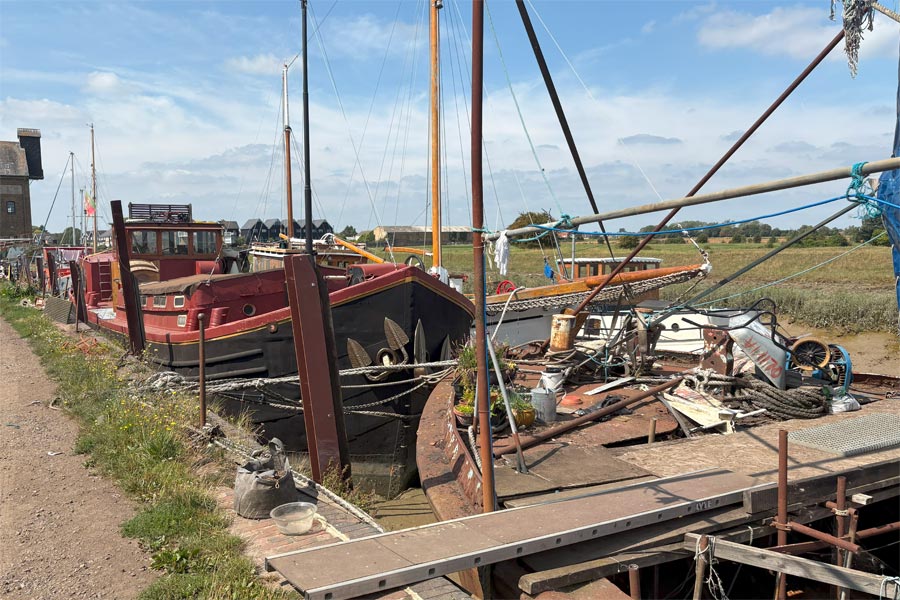
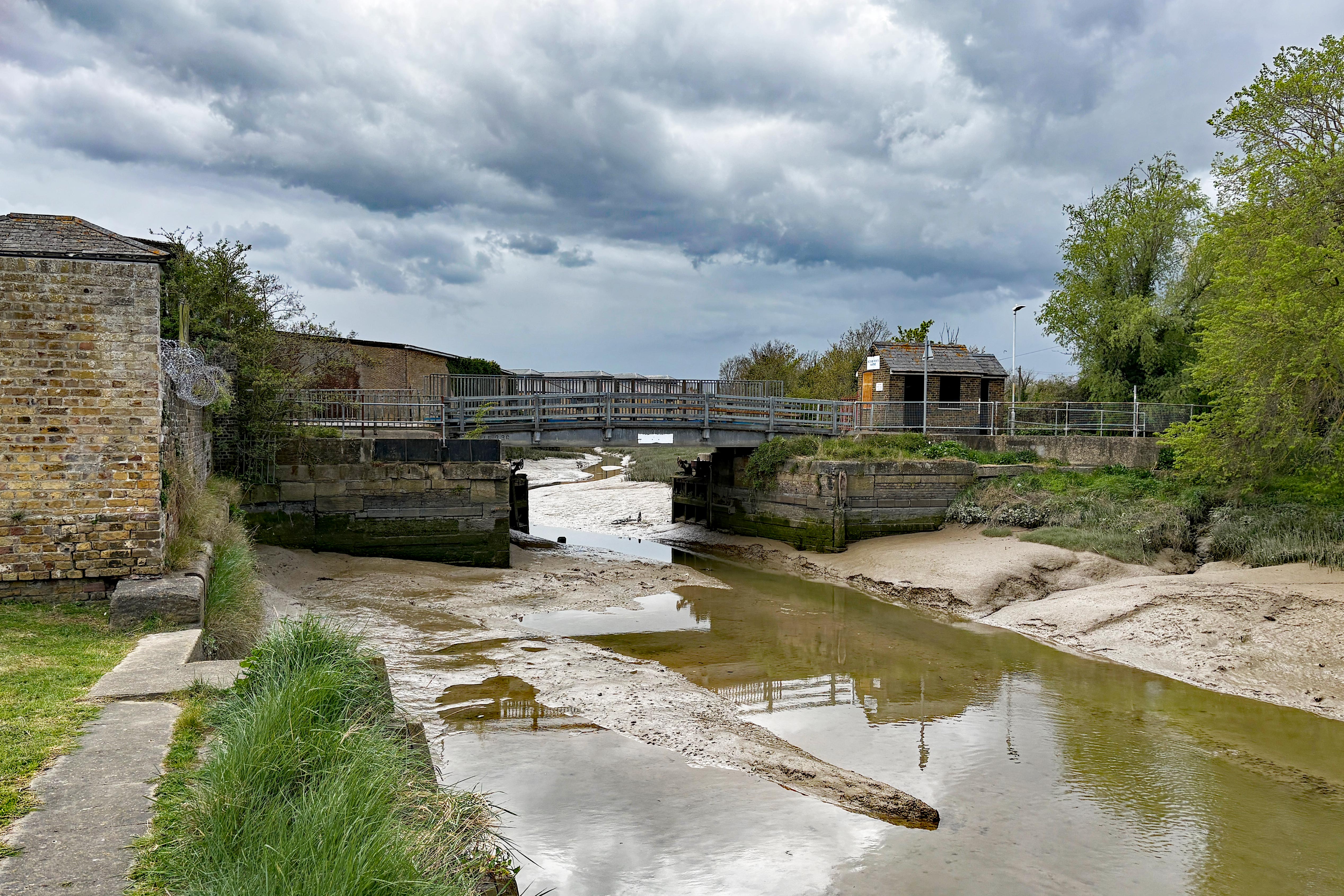
Back at Whitstable for my last day of walking. I went straight from the railway station to The Peter Cushing for an 8am breakfast of scrambled eggs on toast and coffee. Leaving Whitstable, I passed the Old Neptune, a famous pub on the beach overlooking the oyster beds, which were visible on that day due to the low tide. After about 2 miles and past Seasalter I was walking in the open countryside with mud flats on one side and marshes on the other. It was hot but there was a nice breeze blowing. After another 4 miles I reached the mouth of the Faversham Creek and turning inland towards Faversham. Now I had a muddy creek on one side and a huge solar farm on the other. After another 2.5 miles along the bank of the peaceful meandering creek I arrived at the wharf at Faversham where there were a series of boats in various stages of repair or disintegration, moored up and on dry land. From Seasalter to here I only saw two other people. I followed the scruffy path, avoiding rusty pieces of equipment and junk that were left lying around, then walked along some smart paving outside of some tidy waterside residences until I got to the first bridge that crossed the creek.
This was the end of my walk. This is where I will start again next time. I strolled through the town, had lunch and a pint in The Leading Light where I checked the train times and booked a ticket back to Walmer. I had a little time to spare so I wandered around the pleasant town a little more and bought a Henry James novel in the Oxfam Bookshop for 99p before walking to the railway station for a quiet, restful and cool 62 minute journey back to Walmer via Canterbury. I thought that I might read my book on the way but I did what I always do, relax and look out of the window.
End of day 6: About 11 miles walked today.
 |
 |
That makes 88 miles of Kent coastal paths in six days. During another heatwave.
That's it for 2025.
April 2026. Continuing on the Kent coastal path.
This walk follows the England Coast Path and the Saxon Shore Way.
Day 7: Faversham to Sittingbourne
 |
 |
| Bridge over Faversham Creek | Bridge over Oare Creek |
I drove my campervan to Newington, where I knew that I would be able to park near the railway station, then I took a train to Faversham to start my 2026 ramble. I returned to the bridge over the Faversham Creek that I had reached in 2025. Soon I was back where I wanted to be - enjoying the peace of the countryside with Oare Marshes on one side and the River Swale on the other. There was a little rain so I needed my waterproofs now and then. I was late starting this walk so by the time I got to Sittingbourne it was early evening. I noticed a suitable spot to park the camper for the night as I walked into town so I took a train back to Newington and drove the camper to Sittingbourne for the night.
End of day 7: About 15 miles walked today.
Day 8: Sittingbourne to Minster
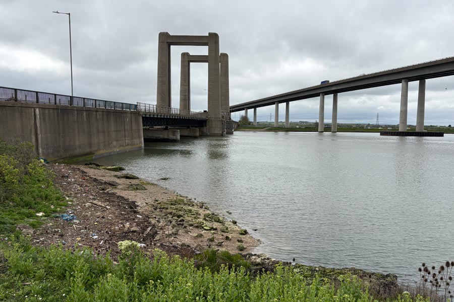
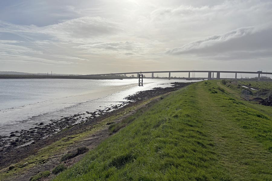
After a reasonably good nights sleep (several large HGVs arrived later at my parking spot and one had a refrigerated trailer with a generator that ran all night), I made my way out of Sittingbourne along Milton Creek, the Swale and Clay Reach, arriving at the Sheppey Crossing at about 9am.
 |
 |
| Sittingbourne Milton Creek 7am. | The Sheppey Crossing |
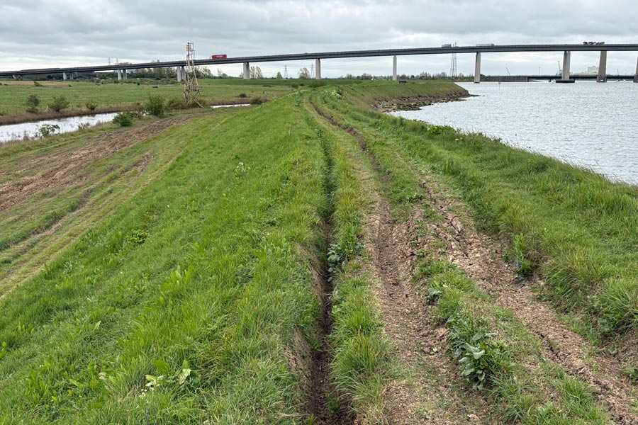
I booked two nights at a campsite near Minster on the north of the Island of Sheppey as a base while I walked around it. I took a number 334 bus back to Sittingbourne and returned in the campervan to the Kingsferry Bridge, which is next to the Sheppey Crossing. I parked it close to the bridge. This allowed me to walk part of the south shore of Island and back again. I followed a long detour and picked my way through a deserted construction site to get to the shore and later returned to the camper and took it to the camp site. From the campsite I took a number 360 bus to Leysdown and walked to Shell Ness and part of the south shore at the other end of the Island and back again. Then I took the bus back to the campsite. There was no safe path between Leysdown and Minster. The number 360 bus was recommended by the England Coast Path official guide.
 |
 |
| South shore looking across towards Sittingbourne. | Shell Ness |
End of day 8: About 11 miles walked today.
Day 9: Minster to Kingsferry Bridge
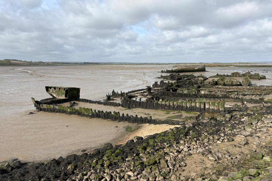
I made an early start and had a pleasant 5 mile walk along the Thames estuary, past Minster to Sheerness, where I had a traditional breakfast at The Belle and Lion. Then a short walk through the town centre to where a short distance later the path passed along the landward side of a huge compound on the coast containing I don't know how many thousand new cars. The path was very enclosed and threaded between what seemed to have previously been a sea wall on the left and newer high steel fence on the right. At first I thought the long lines of bright new Peugeot and Audi cars, partly visible through the screened fence was interesting but after about half a mile of high wall and high fence and no views I was anticipating its end. After 1 mile I was fed up, especially when the steel fence became a steel tunnel for a time with a compound on both sides. After 1.5 miles the compounds finally ended allowing an open view across the West Swale channel to the River Medway beyond.
 |
 |
| Sheerness north shore | The compound |
 |
 |
| The tunnel | The end |
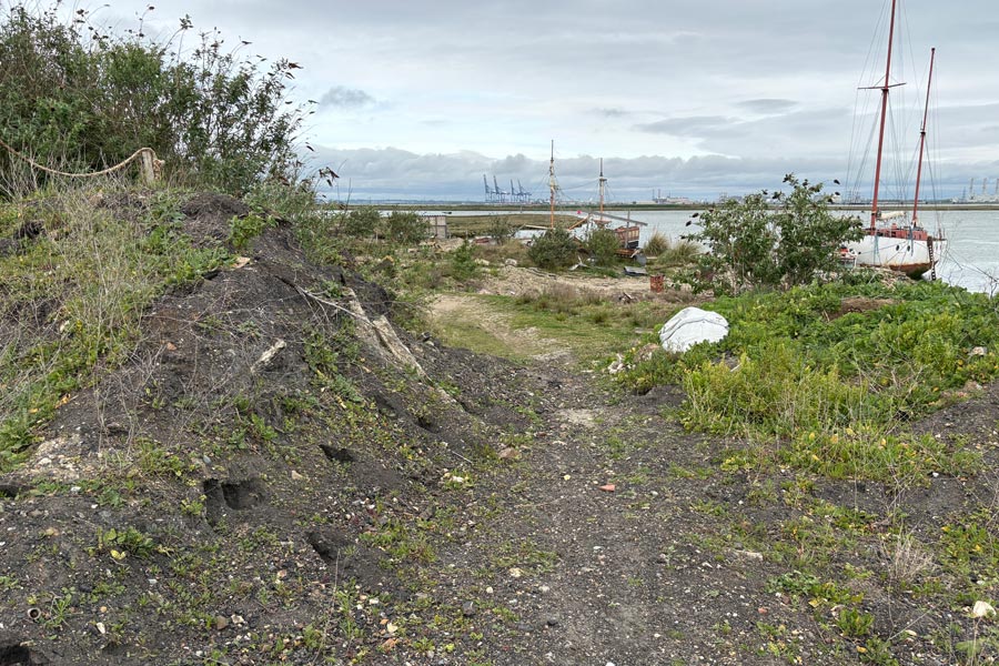
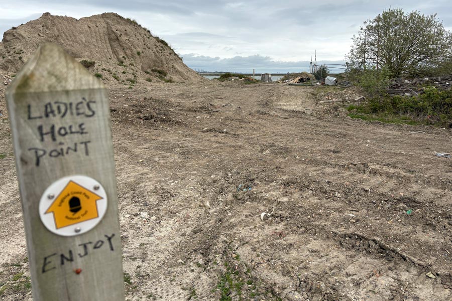
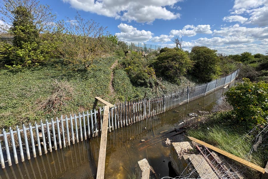
There was then a short walk along the sea wall around to The Hard and past The Old House at Home public house at Queenborough (it was only 10:15 - too early for a pint). Then some path walking round The Creek before the trail turned onto a rough track below Rushenden Hill which was strew with rubbish along its edges. And judging by the many black and evil smelling oily patches, some the whole width of the track, it was where road tankers had been discharging waste liquids. Walking out towards Ladies Hole Point was even worse with churned-up tracks and waste strewn everywhere.
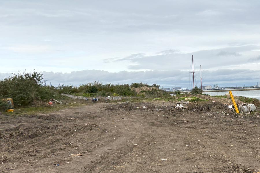 |
 |
 |
 |
The path beyond Ladies Hole was on the top of a high earth embankment but was so badly rutted by construction vehicles it was hard to walk along. The lower ground on the landward side of the embankment was flatter, and I tried walking there but it was even more churned up and rutted. Some ruts were 60cm deep (2 foot). Part of the way along the embankment there were huge blocks, which seemed to be an attempt to keep vehicles off the embankment top but beyond it was also rutted by something that was capable of making really deep ruts. Walking here was difficult due to the hardness of the lumpy ground and I was glad to reach the Sheppey Crossing where the damage had ended.
 |
 |
From the Kingsferry Bridge I started walking along the B3221 towards Sheerness until I found a bus stop. I went back to Sheerness to have a proper look round and do some shopping. I had a pint in The Belle and Lion then took a number 360 bus back to the campsite. Weather-wise it had been a dry but cloudy day.
When I first drove onto the island I began to notice the amount of rubbish thrown onto the road verges and the rubbish piles in lay-bys and gateways, and later as I walked round the island, I could not help but notice the amount of discarded rubbish down country tracks, in ditches and in streams and at the edges of fields. I wondered if it was mainland fly-tippers that were coming to the Island to do their dirty deeds or if the islanders were so unaware of the beauty of their island that it was they who were responsible?
End of day 9: About 12 miles walked today.
Day 10: Kingsferry Bridge to Gillingham
I drove the campervan from the campsite to the Kingsferry Bridge and parked near the Swale railway Station which was close by. There were several railway stations on or near my proposed route for that day so it would be easy for me to get back there later.
It was a pleasant walk along the edge of the Swale channel with the sun coming up behind me but I was walking into a brisk and cold wind so I kept my fleece on and swapped my cap for a beeny hat to cover my ears. There was no England Coast Path from Kingsferry Bride to Gillingham yet so I was following the Saxon Shore Way.
 |
 |
| Looking back to the Sheppey Crossing | Ferry Marshes looking across the Sheppey channel. |
 |
 |
| Derelict boats, Iwade | Container terminal on the Island of Grain |
After less than 2 miles the path turned inland to cross the Chetney Marshes and continue back along the other shore of the peninsula After another 2 miles of pleasant walking I got confused by some new England Coast Path signs that unexpectedly diverted me away from the Saxon Shore Way near Bedlams Bottom. Later it seemed to join with the Saxon Shore Way again, but this was where I came across a notice concerning a diversion that I should have taken some time back due to the construction of a new Solar Farm. In the end I backtracked for a mile and then walked along the road to Lower Halstow. As I neared the village I diverted off route to the Three Tuns for lunch. It was a little after midday. I had a very nice bacon and brie ciabatta with cranberry chili jam, and a pint.
Back on the path I continued along the Saxon Shore Way which mostly followed the coast for about 8 miles followed by about 2 miles of walking through the streets of Gillingham. The route passed the railway station, which was where I stopped walking and returned by train to my campervan at Kingsferry Bridge to spend the night. It was very quiet there, just the gentle swoosh of traffic passing over the nearby Sheppey Crossing.
End of day 10: About 16 miles walked today.
Day 11: Gillingham to The Isle of Grain
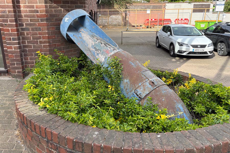
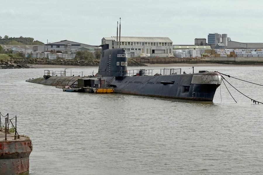
I drove the camper to the parking spot in Gillingham that I had noticed the day before and was parked up by 07:30. I walked to the railway station where I resumed my journey. Here I slipped up as I continued to follow the Saxon Shore Way which was, for a short while, not the same as the England Coast Path so I missed out on some waterfront walking. Little of the walking through Chatham and Rochester was near the riverside until I got beyond Rochester Bridge but I did see a few interesting objects to photograph.
 |
 |
| Rochester | U-475, Strood |
At Lower Upnor, where I stopped at lunchtime for a snack and a pint at The Ship. The tide was coming in so I chose to take the high-tide route to Hoo St Werberg, which was routed more inland.
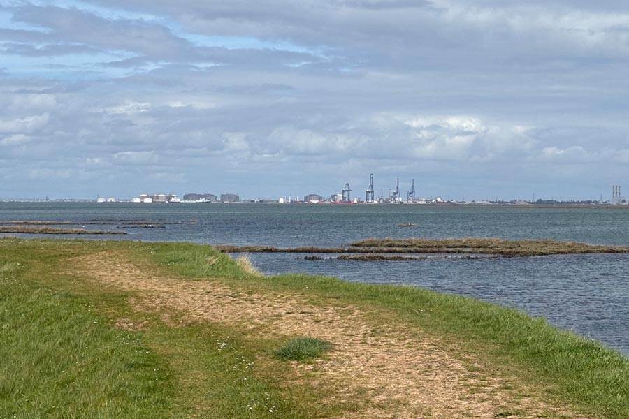
After Hoo St Werberg the Saxon Shore Way turned back towards the other side of the peninsula and the England Coast path continued onwards towards the Village of Grain at the end of the it. Further ahead England Coast Path did not yet exist and an Arriva number 191 bus ride was needed to get to Grain, so instead, I took a number 191 bus back to Gillingham, returned to my camper and drove it back to Grain. I found a quiet spot to park in the village, freshened up, and had a wander along the waterfront, where I could see Sheerness across the mouth of the river Medway, where the massive new-car compound was (under the wind turbines in the photo below). Later I had a very nice meal and a pint at The Hogarth Inn and an early night.
 |
End of day 11: About 10 miles walked today.
Day 12: Grain to Gravesend
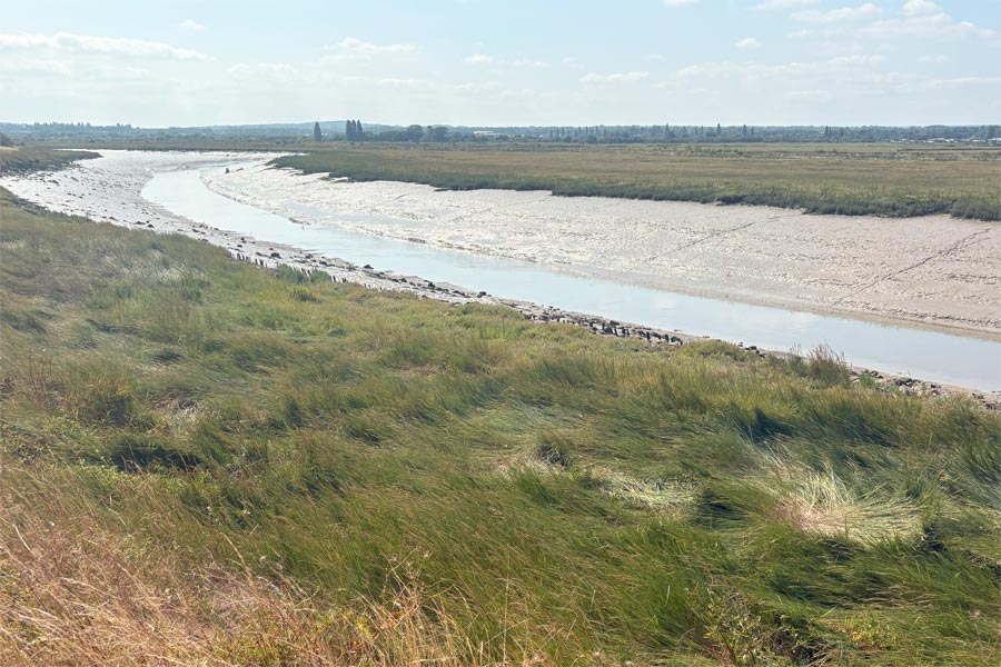
I started out early as I knew that it was going to be a long walk that day. It was a nice day but I was walking almost head-on into a very cold wind. I wore my waterproof jacket over my fleece to keep warm for the first few miles. After 3 miles and a walk along the Yanlet Creek I reached the mouth of the mighty River Thames, which for me was an event, as I had basically started this contrived ramble at the mouth of the mighty River Severn on the other side of England. After 4 miles I reached All Hallows-on-Sea, the last habitation until Gravesend. The walking was excellent, although a little chilly. The path was mostly on top of the sea defences although just after Egypt Bay it was necessary to descend to the lower ground below the bank for a time to keep avoid a wildlife conservation area. Here I sheltered from the wind and had my lunch and then stretched out in the long soft grass for a short nap in the sun. So far I had seen no other walkers.
 |
 |
| Looking back towards Grain | Looking across towards London Gateway Port |
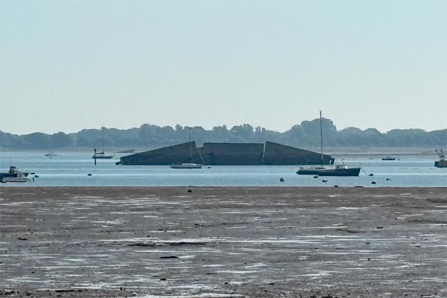
I rounded the first bend in the Thames at Lower Hope and began to head in a more southerly direction. Shortly afterwards the very pleasant walk deteriorated into something less pleasant. At Cliffe Fort and Highnam Creek the path became narrow and scruffy, passing through an aggregate works where a scruffy the path lead through rusty metal structures and other obstructions. One gap was too narrow for me and my rucksack. Then the path followed alongside of a filthy creek full of rubbish, beyond which were the remnants of a collapsed path that was difficult to walk on.
 |
 |
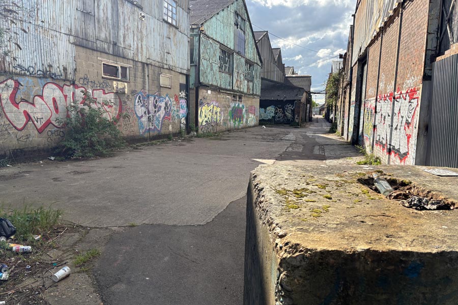
The path improved a little and shortly after that a complicated meeting of paths at Shoreham Marshes Nature Reserve had me and a few other walkers slightly baffled. This was the first time that I had seen another walker that day. After another 3 miles I came to the outskirts of Gravesend. The trail continued through long, narrow, grubby, fenced-in and walled alleyways littered with refuse and then through the almost deserted, dusty, litter strewn roads of an industrial area for over a mile.
 |
 |
 |
 |
I felt much happier when I came to the busy streets of the town centre. I used an Arriva number 190 bus to return to Rochester and then a number 191 back to Grain.
End of day 12: About 22 miles walked today.
It was also the end of my coast path walk around Kent. About 175 miles walked.
That's a total of 398 miles of south east coast walked in 27 seven days.
Including my earlier south west of England coastal walk makes a total of 1,133 miles.
The Suffolk coast path is next.
Perhaps I was a little too harsh in my description of the walk into Gravesend but it did feel unpleasant walking through those narrow alleyways and streets after the miles of open countryside that I had just been enjoying. After having walked the whole south coast of England, this was the first time that I felt that I was not enjoying myself, and it made me realise that walking through large built-up areas like Gillingham, Sittingbourne, Chatham, Rochester and Gravesend was not the sort of walking that I wanted to do.
I prefer walking through open countryside and along the coast, although I did enjoy walking along the promenades and waterfronts of the coastal towns and cities that I had passed through along the south coast. Walking the rivers, marshes and mud flats that I had encountered while walking west towards London was also enjoyable but as I got nearer to London I began to think about changing my plans.
It used to be possible to cross the Thames at Gravesend on the ferry to Tilbury, but it has now ceased operating. The England Coast Path extends to from Gravesend to Woolwich where there is a foot tunnel under the Thames to North Woolwich. On that side of the Thames the path does not start again until Tilbury in Essex and there is no coastal walking route between North Woolwich and Tilbury. As my southern England coastal walk has not always followed the England Coast Path, I have ended my Kent coastal path walk at Gravesend. I will be starting my Suffolk coastal path walk at Tilbury.
All photos © rambleman.uk

Website © 2026 rambleman.uk