
On this page:
Gravesend to Burnham On Crouch. May 2026.
This section is now being updated beyond Burnham On Crouch. June 2026.
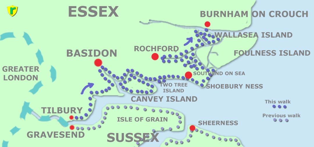
Tilbury, Stanford-Le-Hope, Basildon, Benfleet, Canvey Island, Two Tree Island, Leigh-on-Sea, Southend-on-Sea, Shoebury Ness, Great Wakering, Rochford, Paglesham, Wallasea Island, ferry to Burnham-on-Crouch, Bradwell Waterside, Ramsey Island, Maylandsea, Maldon, Tollesbury, Salcott, Mersea Island. A gap, where no path exists. Then Shotley Gate, Wherstead, Orwell Bridge, Levington, Felixstowe.
I decided to book accommodation for this trip. The weather was uncertain but a hot shower and a comfortable bed each night would be nice.
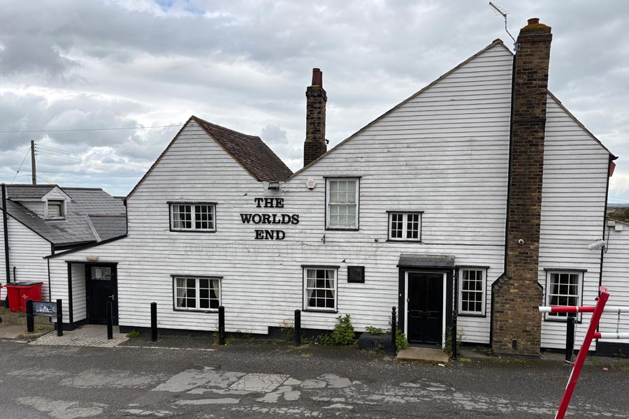
I left Dorset on a sunny Monday morning by train to Waterloo, took the tube to West Ham then a train to Tilbury, where it looked like rain was possible. I walked into town to find out what might be available to me, thinking that I might stop for a snack or a drink but found nothing to my liking. I was too early to book into my accommodation so I took a stroll to see the famous The World's End pub, which I had read about on the train. I though that it might make a nice photo to start the account of my walk. I didn't realise that Tilbury town was not near Tilbury docks where the pub was, so after walking out of town for a mile or so on the deserted pavements of a large industrial area I found the pub, which was closed, which I expected on a Monday, but it looked rather run down and I wondered if it was permanently closed. I took a photo anyway and strolled back to the town to find my accommodation. It was located at the eastern edge of the town where I found that there was nowhere nearby to eat. There was a mini-market type shop nearby so bought some supplies to eat at my accommodation and for the next day. I looked up the The World's End on Tripadvisor and the last entry was two months old.
Day 1: From Tilbury to Vange, Basildon.
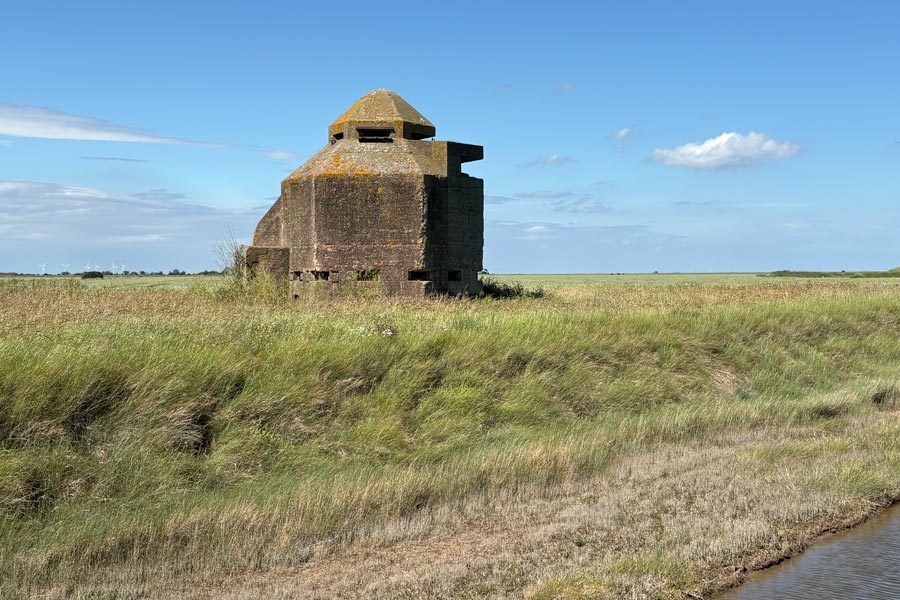
Walking back to the coast on Tuesday morning I passed the shabby and deserted looking World's End again. From there I began walking along the England Coast Path which was signposted along the top of the sea wall and past Tilbury Fort. Shortly afterwards the path dropped down to run along the bottom of the sea wall on the shoreline side. This meant that it could be submerged during high tides and there was a large notice to warn of this fact.
 |
 |
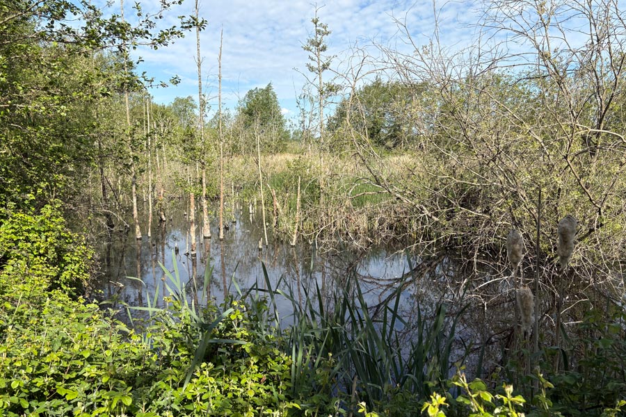
| The World's End | East Tilbury marshes |
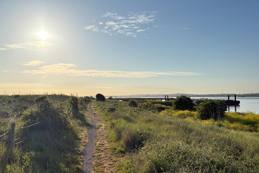
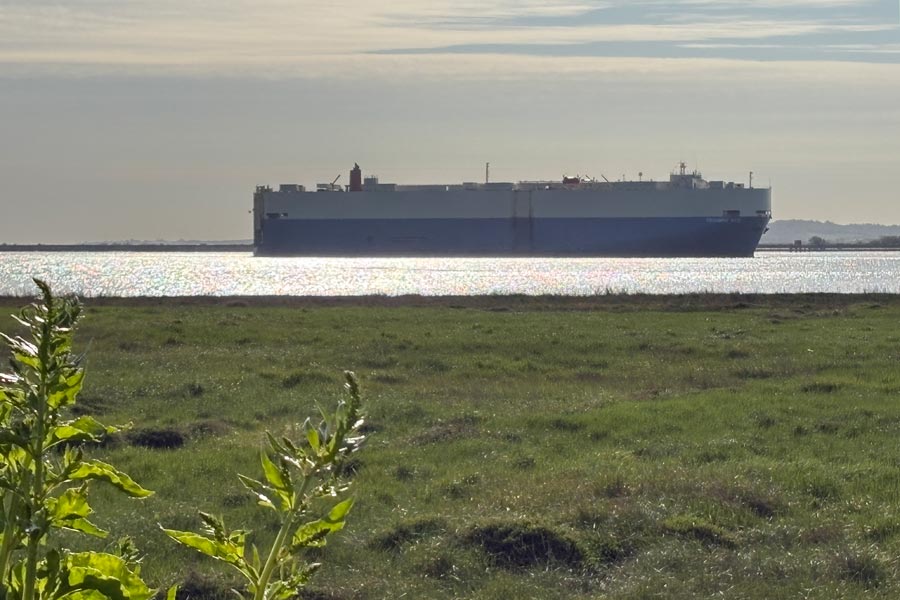
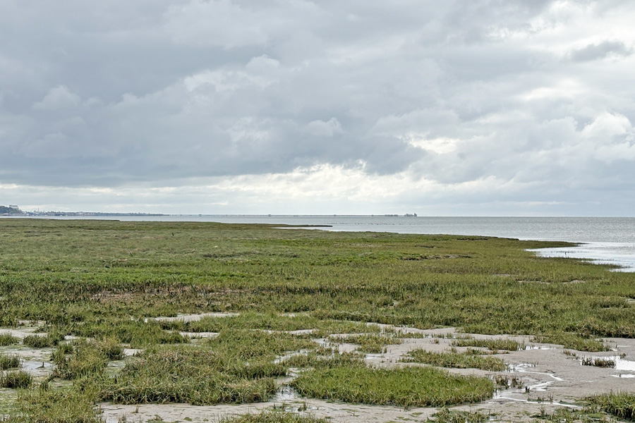
Being out on the marshes was what I was looking forward to. The noise of the traffic had died away and ahead was all I needed, a path, open countryside and a blue sky. There was a cool breeze and a warm sun, Perfect. There was a huge cargo ship gliding slowly and silently up the Thames and all I could hear was the sound of the breeze and the birds, including a cuckoo.
After about 4 miles, at Coalhouse Fort Park, I stopped and had some breakfast, sat in the warm sun at one of the picnic tables there. After that the path turned inland edging around Mucking Marshes and towards Corringham which was about 7 miles away the path snaking around the edges of the marshes. After a few miles I heard a another cuckoo, or perhaps it was the same one.
 |
 |
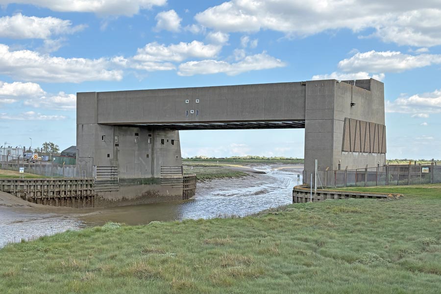
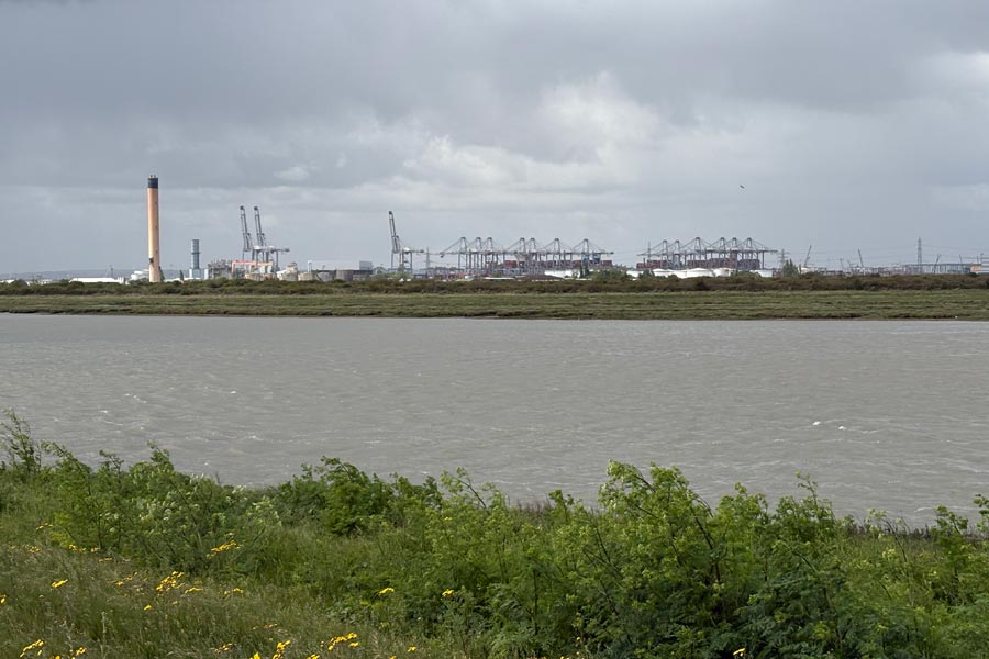
The path bypasses Corringham but as it was lunchtime I diverted from the route and walked half a mile into the village to have lunch and a pint in the Bull Inn. I returned to the path which continued inland and followed alongside of a fast road around the outside of the industrial estate behind the London Gateway Port for nearly 2 miles before leaving the road to pass along the top of the sea defences of Holehaven Creek. Further along, in the middle of nowhere at Fobbing Horse there was a substantial construction called, according to my map, a Movable Flood Barrier which protects the low lying land from high water. I first saw it on the horizon without the creek below it and that really puzzled me as to what it was.
The path then snaked around the ends of several smaller tributary creeks that feed into Holehaven Creek. Here the path was slow going; it had been trodden by cows; was deeply rutted; and the mud was now rock-hard and partly hidden in the long grass were deep holes. About 4.5 mile further on I passed through the Vange Marsh Nature Reserve where I used the foot tunnel that the route takes to pass beneath the A13 and the railway line. I was then at the edge of the Vange area of Basildon, where my accommodation was. Similar to the night before I found nowhere in Vange within walking distance to get a meal so I bought a pasty at a small mini-market and a bottle of beer at the large booze shop next to it and returned to my room, where I ate my simple meal, listened to a talking book on my phone for an hour and had another early night.
End of day 1: About 18 miles of the path walked today.
Day 2: Vange to Canvey Island.
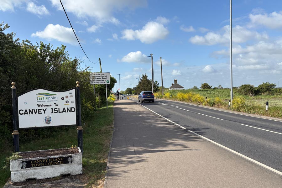
Early next day I returned to the where the path exited the foot tunnel and passed through derelict land trapped between the roads and the railway line. It then followed the railway line for about 1.5 miles. It was an overcast day and there was a cold wind blowing. The next two miles was along the edges of the marshes of East Haven creek, where I heard another cuckoo. I took out my pocket monocular and spotted it at the top of a tree. Later the path emerged onto the road near Benfleet railway station. Shortly afterwards I turned right onto the road bridge to Canvey Island.
 |
 |
| East Haven Creek | Welcome |
I chose to walk the island in an anticlockwise direction because my accommodation was in the centre of island in the town and I had calculated that my day's walk would be about 17 miles if I walked about three-quarters of the island's coast path before diverting to my hotel. This would also make my next day's walk about 16 miles. The first few miles were very pleasant, through the countryside along the edge of a creek, even with the cranes of the the London Gateway Port and the oil storage tanks of an oil refinery always on the opposite banks of the wide Holehaven creek. Wide because the tide was now high, which made the expanse of grey water more photographic than the acres of mudflats that it would have been. But the blue sky was now beginning to be replaced by darkening clouds. At the west end of the island was another Movable Flood Barrier, (unless they had moved the one that I saw the day before). Not funny, I know, but the description Movable seemed wrong to me.
 |
 |
| Holehaven Creek | Gathering storm |
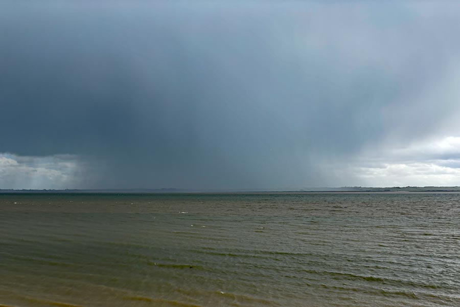
When I reached the end of the creek and was back at the Thames, the path, which continued to be along the sea defences, had an oil storage depot on the landward side that was connected to a series of jetties on the shore side by caged gantries carrying pipes, which the path, now hemmed in by wire fences, had to periodically drop down to negotiate beneath. I had noticed that approaching from the south west were dark clouds, already dropping curtains of rain beneath them but I left it to the last minute to put my waterproofs on as I was already quite hot. When the rain hit it was torrential and I was soon being battered with hailstones as well, but I was well protected by then. I was up on the sea wall with no cover and no way to get off so I had to keep going. It was still raining as I then passed a new housing development of long rows of hundreds of identical park homes built behind and below the sea wall. By the time I got to Thorney Bay the storm had passed on ahead of me so I stripped off my rain-gear and came to a nice cafe overlooking the bay.
After two very substantial bacon and brie ciabatta rolls plus crisps and a salad I rested with my large coffee for a while. Then I continued on along the sea wall towards the eastern end of the island. The air was fresh after the storm but looking out over the estuary there was another very visible deluge occurring over the mainland. The weather improved as I walked round the end of the island, through Canvey Heights Country Park, and about halfway along the top (north) of the island I turned towards the town centre and my hotel, the Oysterfleet. In town there was a reasonable choice of eating places but I chose to eat in the bar of the hotel.
End of day 2: About 16 miles of the path walked today.
Day 3: Canvey Island to Shoebury Ness.
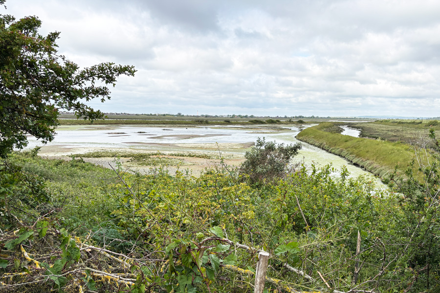
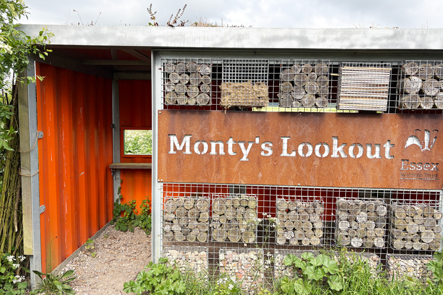
The tide was out as I walked out of the town the next day along the side of Benfleet Creek and towards the bridge. After crossing the bridge the path passed through the Benfleet Moorings site and into open countryside. After about 3.5 miles of pleasant walking the bridge onto Two Tree Island appeared. I crossed the bridge and spotted a small picnic area so I sat at a table to have a light snack and a drink before continuing to walk towards the western end of the island. At the end of the island I came to Monty's Lookout, a hide overlooking the Salt Lagoon at the end of the island. I took out my pocket monocular and spotted some oystercatchers.
 |
 |
| The Salt Lagoon | Monty's Lookout |
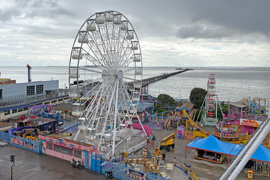
The Island was covered with bushes and small trees and was crisscrossed with paths for walkers of which there were quite a few, mostly with dogs. I walked along the south shore noticing the outline of the mile-long Southend on Sea pier, just visible on the horizon. Back on the mainland I walked along the edge of Hadleigh Marsh and past Hadleigh Railway Station. The path continued to follow the railway on a narrow road with the high fence of the line on one side and a row of cockle sheds on the other side. Very fragrant. Quite nice actually. I nearly stopped to get some at one of the counters but I was intending to have a late breakfast in Southend On Sea. The path progressed along the road through Leigh-On-Sea and past a rapidly receding sandy beach before becoming a narrow path between the railway and the sea for a time before the beach reappeared at Southend On Sea.
 |
 |
| Southend Pier on the horizon | Leigh-On-Sea |
I walked along the promenade for a while and then made my way up the hill into the town. I had been hoping to get a late breakfast at The Last Post but Wetherspoon breakfasts are not served after midday, and it was 12:15 by then, so I had a gammon and chips and a pint. I rested for a time, sipping my pint, watching and listening* to the customers and enjoying the ambiance and decor of the building before moving on.
* I don't usually listen to other peoples conversations but the loud voices of the locals as they entered the bar and greeted each other, and then the banter that was passed between the tables, all in great local accents, was impossible to ignore. It fascinated me.
The last Post
When I left The Last Post I found that it was raining, and as I slipped my waterproof jacket on, it stopped. Much refreshed by my lunch break I strolled down the High Street, looking at the different shops hoping that one of them would jog my memory into remembering something that I had earlier realised that I had forgotten to pack. Nothing came to mind. I made my way down to the sea front near the pier then continued to walk eastwards along Marine Parade towards Shoebury Ness where I had booked an Artsy Minimalist Suite for the night. It was the only accommodation that I could find that was available near the Coast Path.
 |
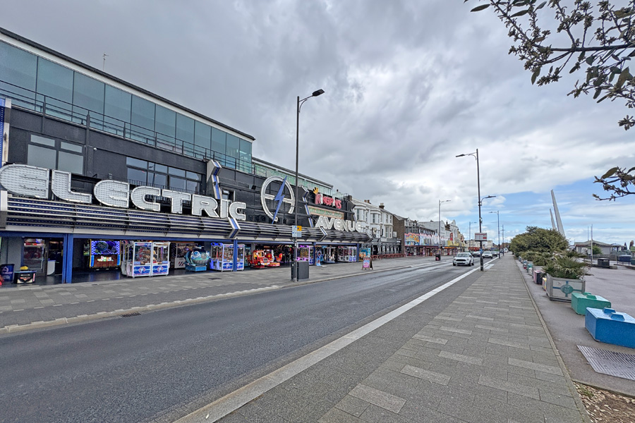 |
| Southend On Sea | Entertainments |
I walked along the promenade past the entertainment establisments, stopping in a shelter to put my rain gear on when a rain storm nearly caught me out, and strolled on a little more slowly until I was able to remove it again so as not to overheat. I was at my accommodation by 4pm so I dropped off my rucksack and strolled back down to the beach to pass the time and search for somewhere to eat later.
The end of the beach at Shoebury Ness is marked as a military danger area which stretches up the coast, including parts of the land, Potton Island and Foulness Island and out to sea for up to 5 miles. I walked along the beach as far as I could then around the headland (the ness) and along the coast path for about 2 miles, then returned to my accommodation.
End of day 3: About 17 miles of the coast path walked today.
Day 4: Shoebury Ness to Rochford
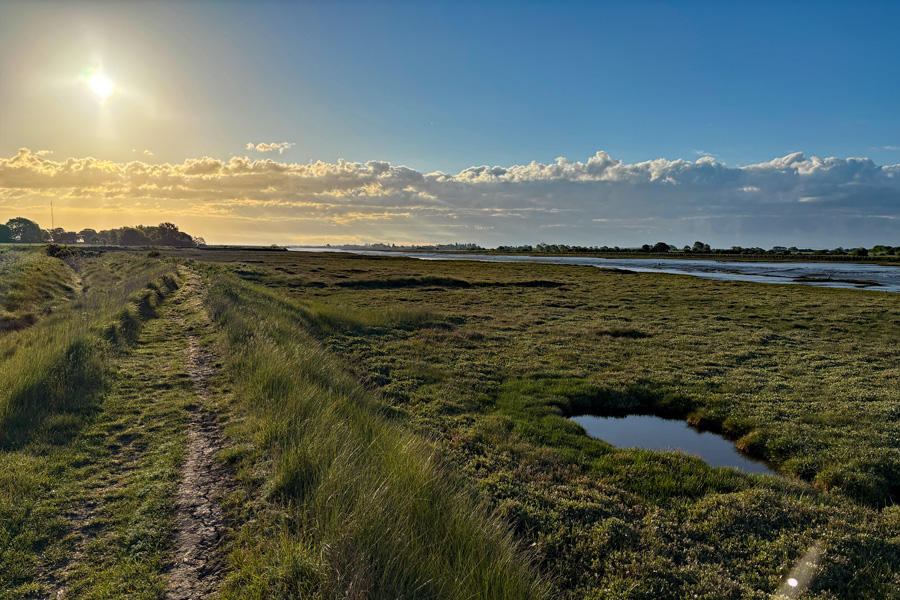
I was up early and had a cup of coffee with my host Ellie, who was a charming and helpful host, before leaving. My room was excellent, not quite 'minimalist' as described as there were lots of decorative items everywhere, but very clean and comfortable. I was walking by 6:30 and was able to start where I had finished my evening stroll the night before, shaving 2 miles off the walk ahead. The path was now away from the coast and I walked to Great Wakering where I bought supplies, including a pasty and a big bar of dark chocolate at the mini-market there. Shortly after that the path returned to the coast again at Havengore Creek and began the start of a 13 mile ramble around the edges of four more creeks and the River Roach. There was a bit of confusion just after walking through the boatyard at Mill Head where I found myself entering a 'Danger Area' and after trying some alternatives, decided that it was the correct path after all and continued through it.
From then on it was excellent open countryside walking. It must have rained shortly before I got to Barlinghall Creek because for a mile or two the long grass was very wet and soaked my trouser legs. Further on the grass was dry and my trousers quickly dried again. I took several photos of the weak sun shining on the muddy creeks but none were outstanding. The only signs of life were where the path very briefly touched the outskirts of the village of Barling when it rounded the end of Little Wakering Creek. All of this walking was along the track at the top of the sea defences around the creeks and along the River Roach. The walk along the river was due west and into the cool wind that was blowing.
 |
 |
| Potton Creek | Baring Ness |
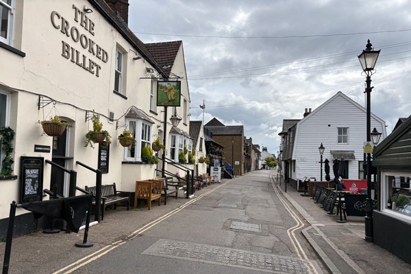
The countryside ended and the path followed a very narrow pavement on Sutton Road, due to the mass of uncut hedges growing over it. The road was very busy and the traffic was fast, noisy and dusty. I was buffeted, inches away from the large vehicles that roared past. At a road junction the path then turned north through an industrial area but I carried straight on and walked into the town as I had time to spare before I could book into my accommodation. I had a look around the town, which didn't take long. I couldn't find an open cafe so I bought a large coffee and a big chocolate-chip cookie in Greggs and sat on a bench in the little square enjoying the sun and watching the cars lining up to wait for a parking space. There was an awkward one in the corner that obviously only the brave drivers used because the other drivers saw it but preferred to sit and wait for one to be vacated that didn't require any skill.
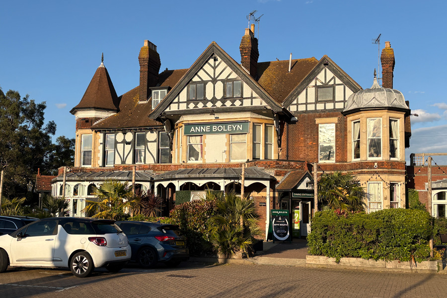
Back at the B&B I had a hot shower and rested, then later crossed the road to the Ann Boleyn where I had Gammon, chips and peas. Then I relaxed with my pint and watched the antics of the young adults turning up, greeting each other and starting their Saturday night out. I'm sure that we were never that loud.
End of day 4: About 15 miles of the path walked today.
The B&B was well placed for the pub. It was also well placed for London Southend Airport, being at the end of the runway. I knew this when I booked it but the price was right and when I am walking I sleep well anywhere. I was asleep by 10pm but was awoken a little after midnight when my room became filled with bright light together with the sound of a plane landing. I was instantly awake and managed to take a photo of the plane seemingly heading straight at me. I was asleep again five minutes later.
 |
 |
| The Anne Boleyn | 00:16 last inbound flight? |
Day 5: Rochford to Burnham On Crouch.
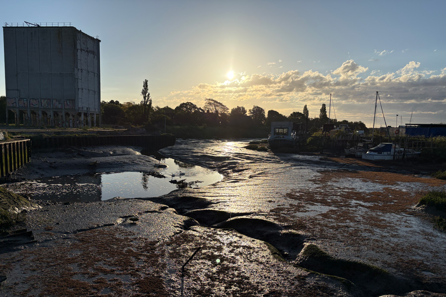
I walked out of town through an industrial estate and then arrived at the other side of the River Roach. The tide was out so I took a picture of the mud shining in the sun. As I walked the tide began to flood in. I was walking with my back to the wind with the the warm morning sun on my face.
 |
 |
| Mud. Lots of it. | River Roach. |
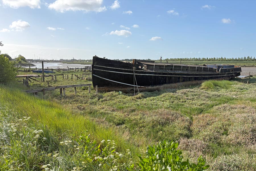
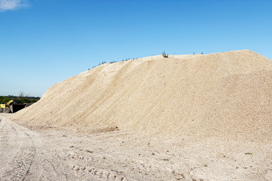
After about 3 miles, the track became more of a road and a very bright one, and looking closely at it I could see that it consisted of finely crushed tiny seashells, and a little further on I came across a huge mound of them. After more pleasant riverside walking I came across an information board showing that I was at the final resting place of HMS Beagle, the ship that carried Darwin on the voyage of discovery that caused him to write his famous theory of evolution. Just after that I left the banks of the River Roach and made my way up Paglesham creek and onto Wallasea Island.
 |
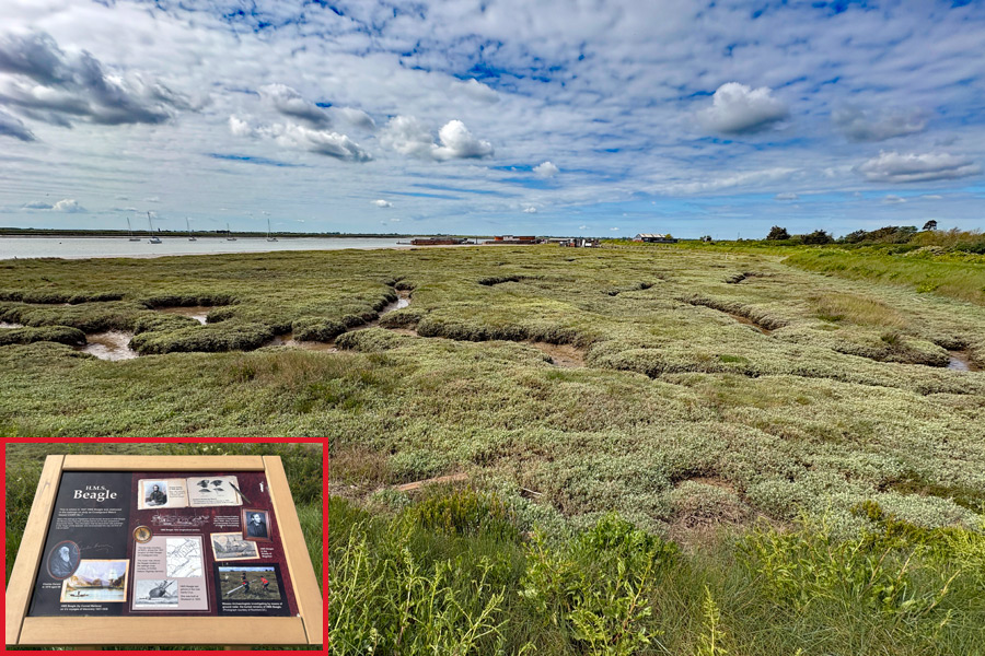 |
| A crushed shell mountain | HMS Beagle 'graveyard' |
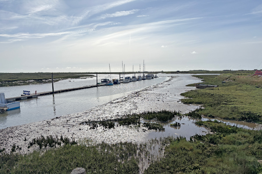
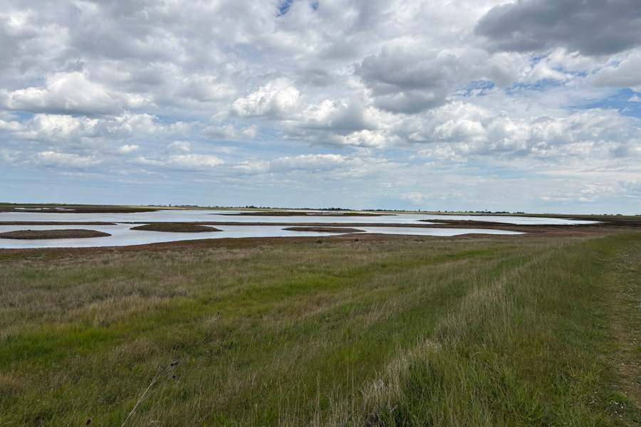
I decided to walk round the island in a clockwise direction so that I could first visit the cafe and then speak to the ferryman before starting my proposed 8 mile walk around the RSPB reserve there. I was nearly three-quarters of the way round when I found that my chosen route was closed due to nesting birds and when I went to try the alternative track along the top of the sea defences I found it to be impossible to locate in the very long grass. I tried to push through but it was impossible to make any normal progress as I could not see where I was putting my feet on the rough ground. So I was forced to make a speedy retreat back the way I came as the centre of the island was restricted and signposted as being for birds only. I needed to get back before the ferry stopped at 6pm. I rang the ferry and left a message to say that I was still walking and would be back before then, which I was, at 5:35, but when I arrived the ferry pier was deserted. As my night's accommodation was in Burnham On Crouch, on the other side of the river, and because it was a 26 mile road trip to go round, I rang the ferryman, who had finished for the day, but thankfully, returned to take me across. He had not received my earlier message.
It had turned out to be a rather windy afternoon's walk during which I saw almost no one else but I did see a lot of birds. I didn't quite finish the circular tour of the island but later when I checked my actual mileage on my Ordnance Survey app I found that I had walked 13 miles around the 9 mile island! So I had walked 25 miles that day.
 |
 |
| The centre of Wallasea Island | Burnham On Crouch |
I had booked a single room with en-suite at the Royal Burnham Yacht Club for that night. I was a nice room with all that I needed. After a hot shower and a rest I went out for a meal and a drink. The ferry man had recommended The Anchor* as the place to go for good food.
*The Anchor was was not very busy, and as the two customers in front of me at the bar had both asked for a pint on Guinness I decided to have the same. I then asked for the menu and was told by the barmaid "Sorry love, no food tonight, there's a band playing," nodding towards the large empty space in the room that I had not noticed when I came in, where they were setting up drums and loudspeakers. I already had a pint being poured for me so I asked what snacks they had and she recited a list of flavoured crisps. I must have hesitated for a moment, so the guy sat on the bar stool next to me said, "go for the Longhorn Beef mate, they're the best." So I did.
I sat on my stool sipping my Guinness and munching my crisps. They did have a beef flavour, similar to most of the beef flavour crisps I have ever had, but when the first few notes were played by the nearby lead guitar I decide to retreat to the other bar. It was too much for me after five days of quiet countryside. The other bar was a small snug and it was completely empty.
As I left it stated to rain lightly. I didn't find a restaurant nearby but I had noticed a fish and chip shop earlier, but when I returned I decided that I didn't want fish and chips after all. I was getting damp so I went back to my room and dug out what food was left in my rucksack. I had bread rolls and cheese, then made a cup of coffee and had ginger biscuits and th remains of a bar of dark chocolate.
End of day 5: About 25 miles of the path walked today.
Next morning I bought some travel supplies at the mini-market and returned home by train. A few weeks later when good weather was forecasted I returned to continue my Essex ramble.
Day 6: From Burnham On Crouch to Bradwell Marshes
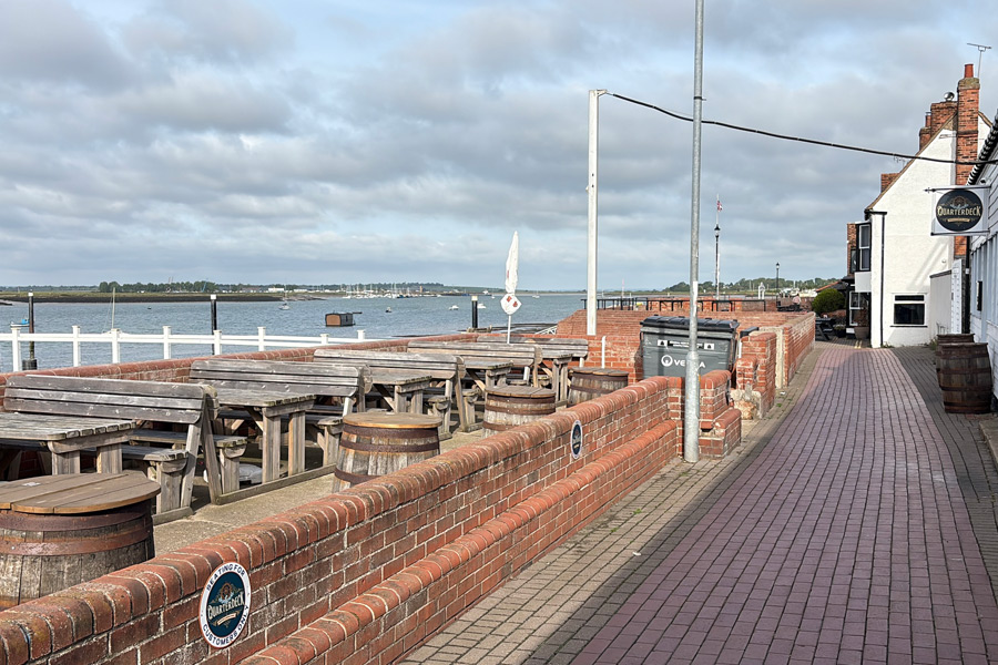
I arrived at about 1pm and started my walk after a pint at the The Star Inn which overlooks the River Crouch. I walked out of the beer garden, turned left, and continued along the riverside walkway until I was out of town and walking along the top of the grass-covered flood defence bank of the River Crouch.
 |
 |
| River Crouch | WW2 Observation Tower |
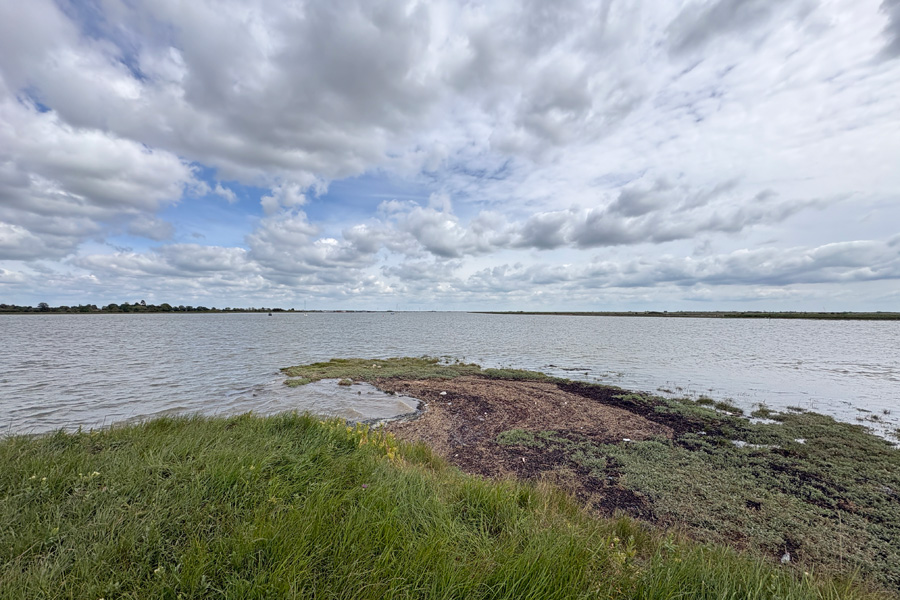
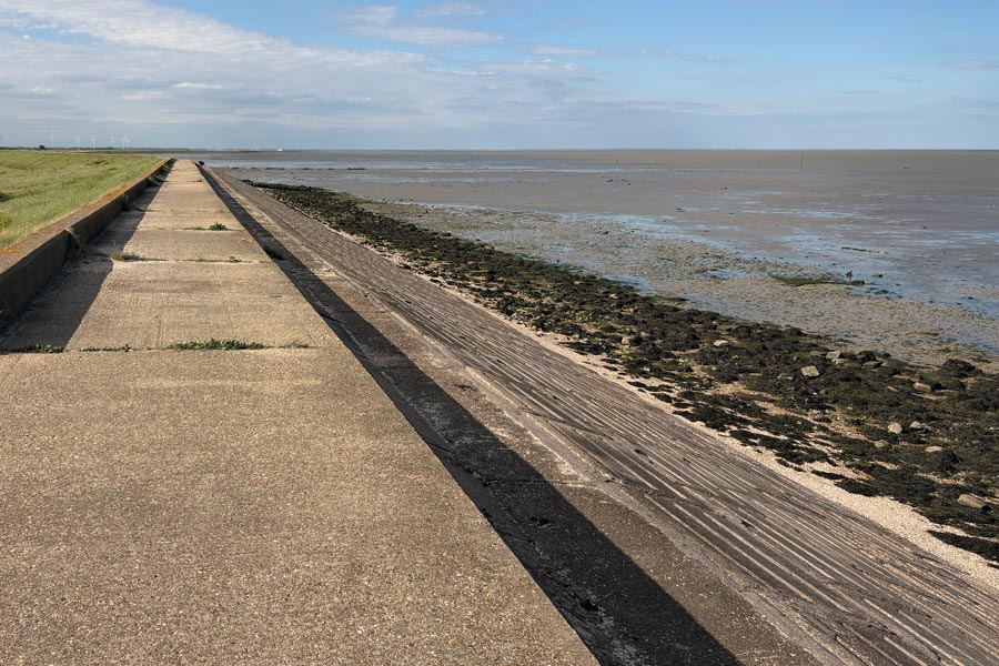
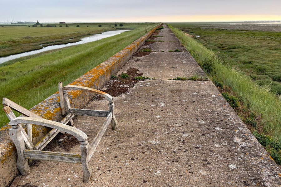
The walking was great. It was warm and sunny with a cooling wind. After walking eastwards for about 5 miles the path rounded Holiwell Point and began to head north. More water or mud flats to the right, more acres of low-lying fields to the left. There was very little change to this scenery except that for part of the way the rough path became a concrete path along the top of a concrete block sea defence. Part of the way along this section I came across a collection of flotsam and jetsam tied to both sides of a large metal gate across the path.
 |
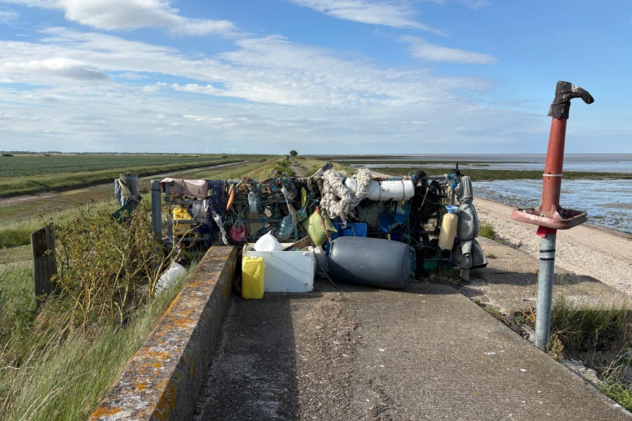 |
| Defences | Flotsam and jetsam |
I had booked some accommodation for this ramble but as there was none available in several places, (or I was too tight to pay for what was available), I took some camping gear with me. There had been no suitable accommodation available for that first day so after about 12 miles of walking I decided that it was time to bed down for the night. It was almost 9pm. This would also mean that the booked accommodation for my next night was about 16 miles away. I was treated to a lovely sunset and the sight of the Moon and Venus in conjunction (once I had waited for enough aircraft con-trails to almost fade away), Venus being just above the tip of the Moon's crescent. Until I had stopped walking and settled down to rest I had not noticed the constant stream of aircraft passing overhead. I didn't realise that this part of the Essex Marshes was under a busy flight path. As the sky darkened, although never completely dark at this time of the year, I was able see a few of the brighter constellations such as the Plough, slowly wheeling around Polaris, the Pole Star.
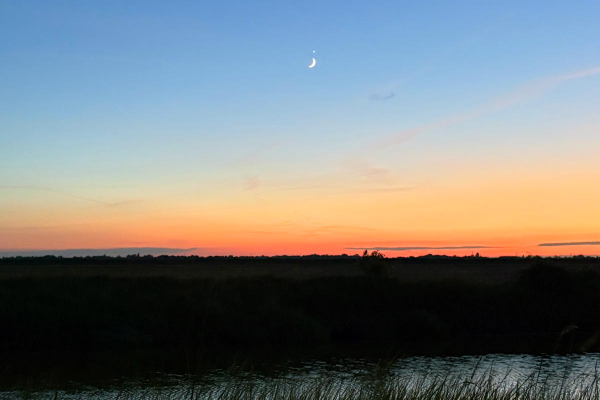
The crescent Moon and Venus.
End of day 6: About 12 miles of the path walked that afternoon and evening.
Day 7: From Bradwell Marshes to Maylandsea.
The sound of aircraft never bothered me and I slept very well but as the sky was dark-ish for less than six hours, it was not enough, so I was up early and soon like this on my way by 5 am. I came across another stretch of concrete walkway. Although I don't like to see a lot of concrete it does make walking easier as there is no need to keep checking the ground for trip hazards, allowing me to enjoy my surroundings. Not that there was much to see at that moment; just acres of grass, marsh, mud and water. I was also walking along St. Peter's Way and was looking forward to seeing the Chapel of St Peter, where I was intending to stop for my breakfast. The day began to warm up and by the time that I had arrived arrived I was hot and hungry.
 |
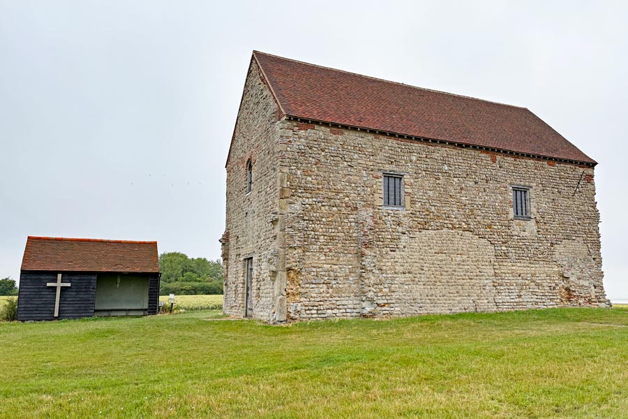 |
| Sea defence | St Peter's Church |
I sat on the bench in the little hut next to the chapel, to cool down and eat my breakfast. A cheese roll and some oaty biscuits, washed down with most of the remainder of my water, which I will get refilled when I get to Bradwell Waterside. In the chapel it was cool and quiet. I sat on a side bench for a while and considered the feeling that I get when I am in a quiet holy place. I can only describe it a sort of 'refresh' of the mind and a hint that there could be more to life than just existing.
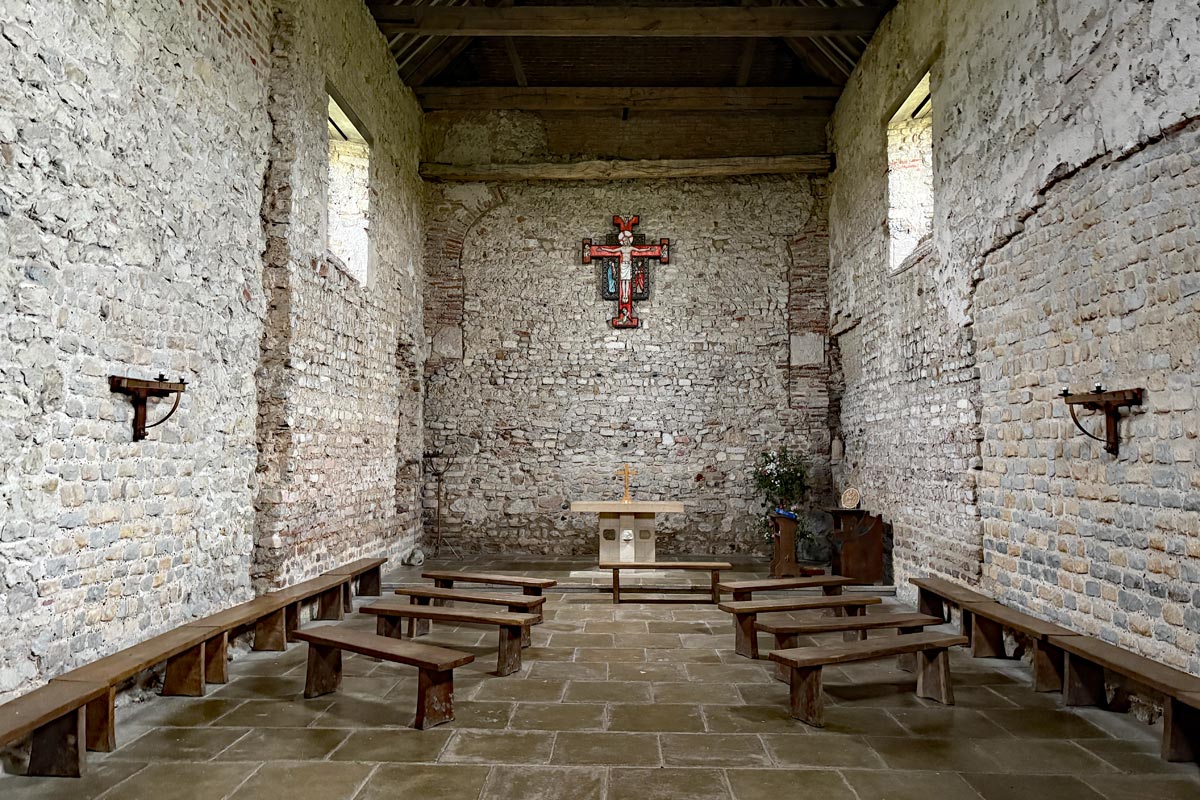
The Chapel of St Peter on the Wall c660
I walked on feeling even more peaceful than when I arrived. Rounding the northern tip of the land at Sales Point brought into view the riverbank that I will be walking along on the other side of the water, less than 2 miles away over the water but about 40 miles away walking the coast path around The River Blackwater. There was a line of objects sunken into the mud along the shore. These were second world war era concrete filled barges that were sunk to protect the wetlands, mudflats and salt marshes. Also the pair of large white featureless blocks of the decommissioned Bradwell Nuclear Power Station, which had been coming into view for the last 5 miles or so were now beginning to dominate the landscape on this side of the river.
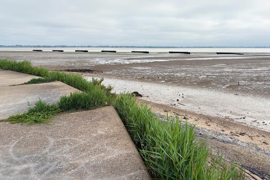 |
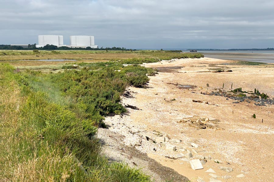 |
| View across the Virley Channel | Bradwell Nuclear Power Station |
More photos have been uploaded but the text has yet to be written.
 |
 |
| Aproaching Bradwell Marina | Mayland |
 |
 |
| Marldon | Marldon |
 |
 |
| awaiting caption | awaiting caption |
 |
 |
| awaiting caption | awaiting caption |
 |
 |
| awaiting caption | awaiting caption |
 |
 |
| awaiting caption | awaiting caption |
To be continued
All photos © rambleman.uk

Website © 2026 rambleman.uk