Day 1: Lyme Regis to Beer
Day 2: Beer to Sidmouth
Day 3: Sidmouth to Exmouth
Day 4: Exmouth to Teignmouth
Day 5: Teignmouth to Babbacombe
Day 6: Babbacombe to Brixham
Day 7: Brixham to Dartmouth
Day 8: Dartmouth to Salcombe
Day 9: Salcombe to the River Erme
Day 10: the River Erme to Plymouth
Next: The Tamar Valley
Day 1 - Lyme Regis to Beer
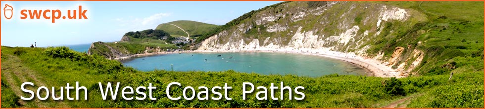
Lyme Regis. Early morning.
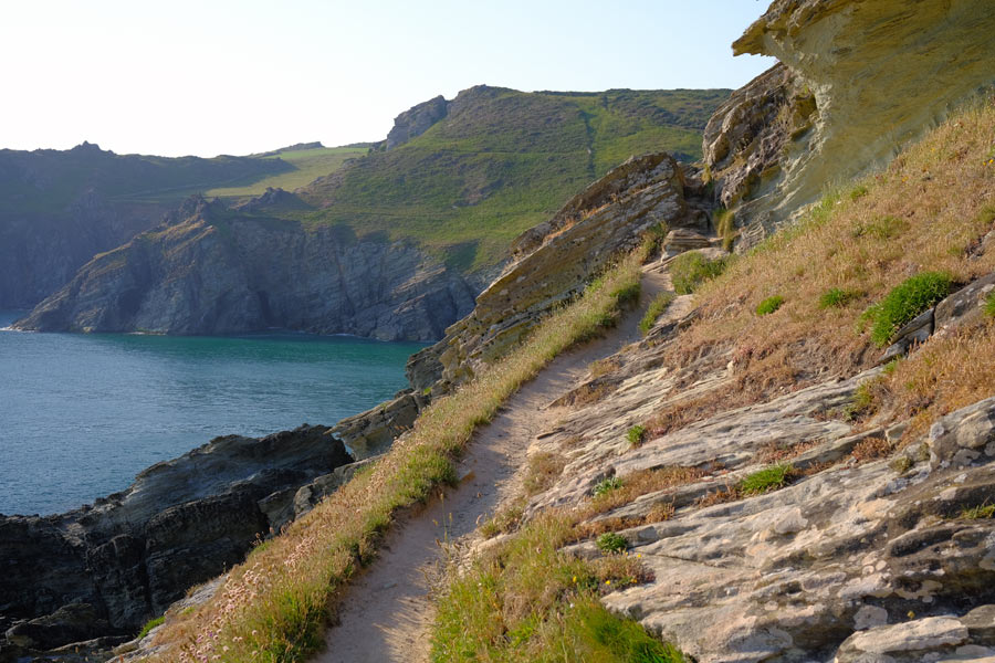
Lyme Regis is in Dorset but after half a mile the path enters Devon. The path leavesthe car park next to the Cob and rises up to the undercliff. This is a long strip of land that has slumped and lies between the real cliffs above and the sea cliffs below. There is no access up or down from the path.
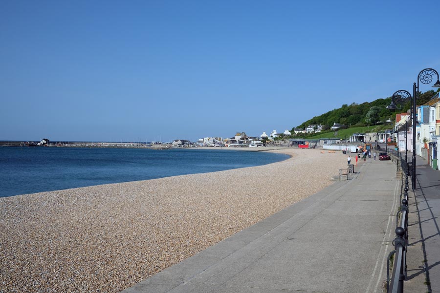
The undercliff
After about half-mile into Devon the path enters the undercliff woodland and continues through the trees for several miles. The sound of the sea is mixed with the sounds of the woodland and there are glimpses of the sea now and then. I seem to have chosen another hot day to start my trek but in the woodland it was much cooler.
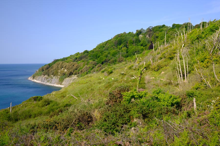
The golf club
The path twists and turns up and down until the undercliff is no more and rises up onto the cliff before crossing the golf course and dropping down (past the club house, visitors welcome) to sea level at Seaton. I made a visit but only for water.
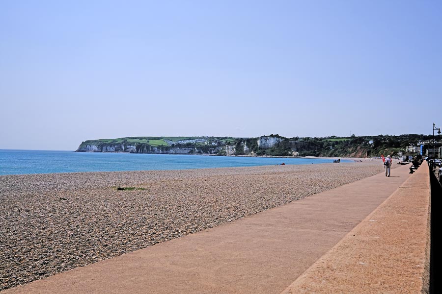
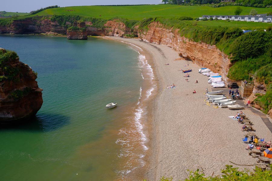
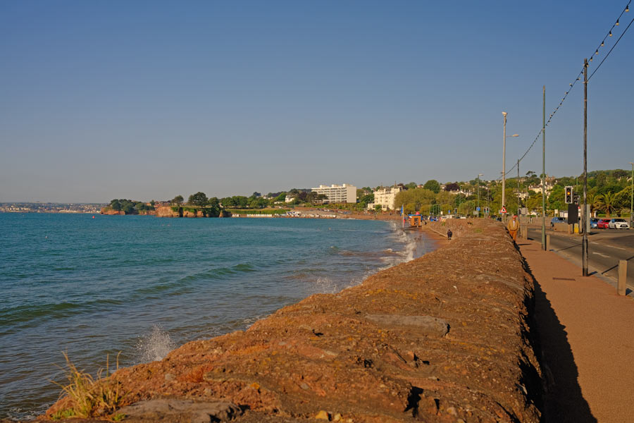
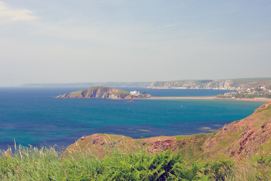
Seaton
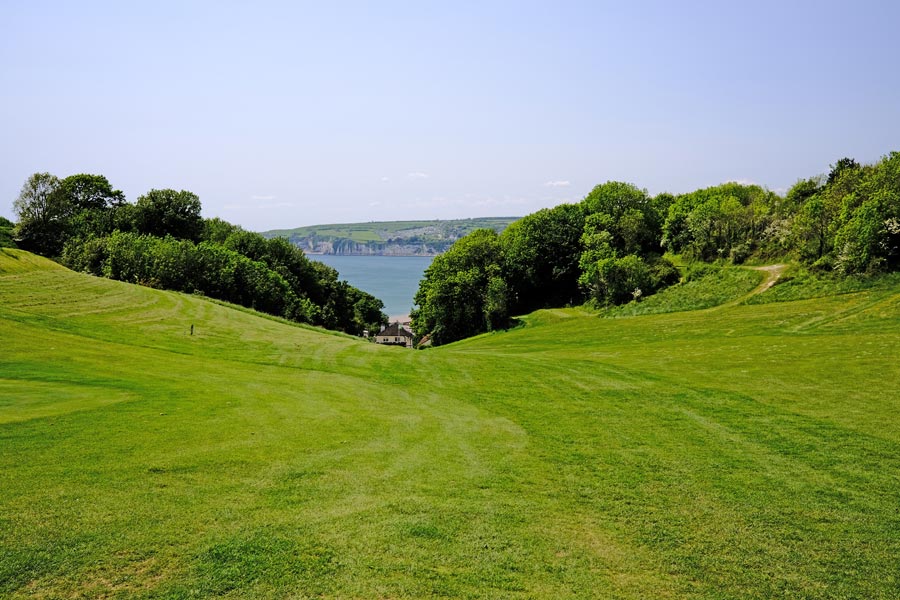
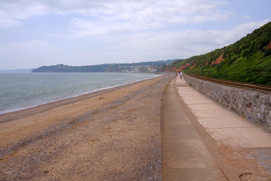
At Seaton I had a pint in the Eyre Court Hotel. Nice cool bar and shady beer garden. Then, because the tide was out, I was able continue out of town and along the pebble beach and avoid the inland diversion caused by a collapsed road and footpath, then I climbed up onto the cliffs, visible in the centre of the above photo, before descending into Beer.
Beer
I arrived in beer mid afternoon after walking about 8.5 miles. The going was not very strenuous but I was worn out. Unlike my trek through Dorset I was now carrying a tent, inflatable mattress, sleeping bag and other camping gear as I intending to stay at campsites whenever possible to save on the cost of accommodation. My rucksack now weighed about 12 kilos. I decided to stop for the night at the camp site on Beer Head. I walked beyond the town to the campsite, pitched the tent, had a refreshing shower and returned to the town for a pint and a snack at the Anchor Inn. I hoped that I would soon get used to carrying the extra weight.
End of day 1. About 9 miles walked today.
back to the top
Day 2 - Beer to Sidmouth.
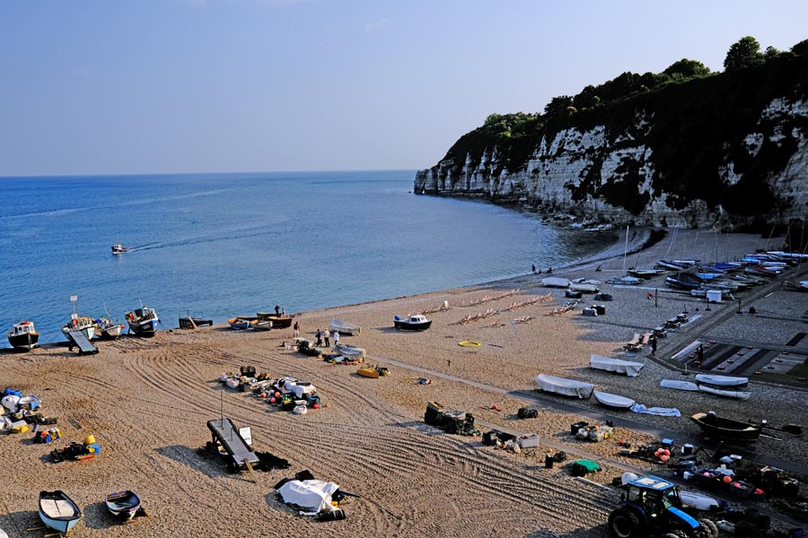
Branscombe Mouth
I decided to walk to Branscombe before having breakfast. I had bought a large pasty before I left Beer and I stopped at Branscombe Mouth and ate it at one of the picnic tables on the beach. Then I ascended through the woodland and onto the cliff top, where the going was easy for a time, but it didn't last.
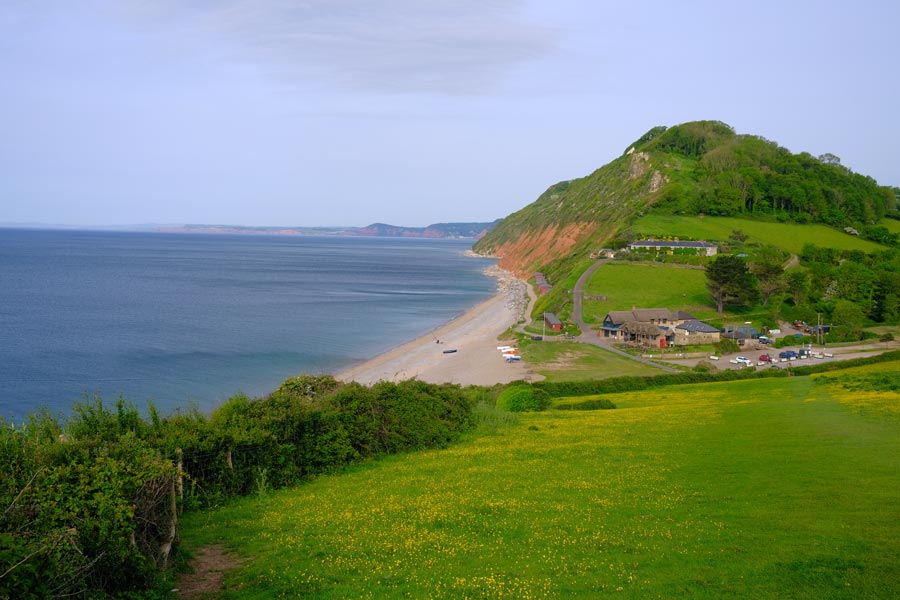
Salcombe Regis
Then came two very steep descents and ascents at Weston Mouth and Salcombe Regis. There was light cloud and a breeze but I found it hard going.

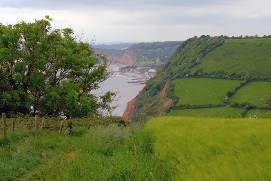
Sidmouth
Then came one last steep descent into Sidmouth. I was worn out by then so I found accommodation for the night. My knees and hips were complaining and my shoulders were sore from the pack straps but mainly I had run out of energy again. A shower, fish and chips and a pint cheered me up. I even managed a stroll around the town afterwards.
End of day 2. About 9 miles walked today.
back to the top
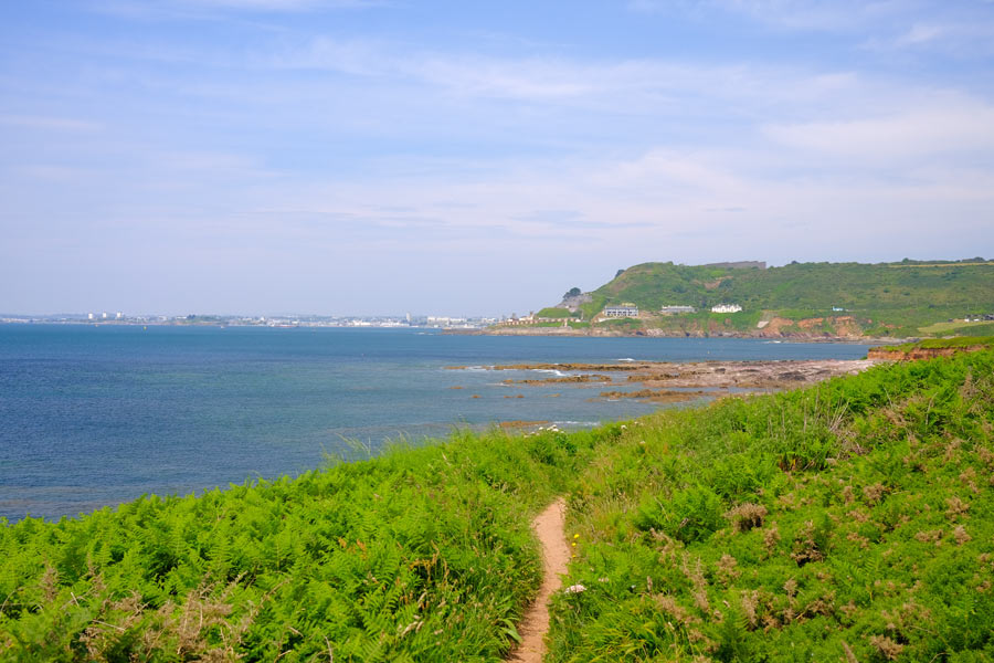
Day 3 - Sidmouth to Exmouth

High Peak
After a 'full English' at Sidmouth there was some strenuous walking followed by some moderate walking according to the Reverse Guide. I could see that the land was flatter in the distance. It was becoming another hot day with little cloud and but there was a cool breeze. The path was very narrow in places with high hedges on both sides. Being sheltered from the cool wind by the hedges it was very hot and moist and the views were restricted.
Ladram Bay
At the Ladram Bay holiday caravan and campsite I topped up with water.
Budleigh Salterton
The path to Budleigh Salterton was much easier. I walked into the town and had a snack and a pint at The Feathers
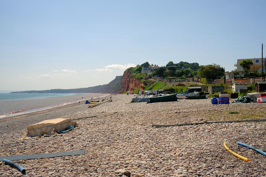
Exmouth beach. Town end.
The going to Exmouth was pleasant but it was very hot. When I got there, beach was busy with people swimming, paddle boarding, playing volley ball and barbecuing. I was glad to have arrived. But I hadn't. I had forgotten just how long the beach was. So I trudged on in the heat for another mile and a half to reach the town and found some accommodation. I had an early night.
End of day 3. About 13 miles walked today.
back to the top
Day 4 - Exmouth to Teignmouth
Looking back to Exmouth
The first ferry across the River Exe from Exmouth to Starcross was at 10:40 so I had time to wander around the town. I found a popular cafe in the docks and had a bacon sandwich and a drink, then I just sat on a bench nearby for an hour watching the people and the boats and waited for the ferry.
Dawlish to Teignmouth walkway.
It was an easy walk along footpaths from Starcross to Dawlish Warren, where I had a lunchtime snack and a pint in the Silly Goose before joining the walkway that runs between the beach and the railway line towards Dawlish.
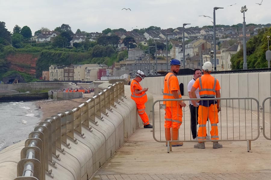
Waiting for 2 o'clock.
I had been told by the barman at the Silly Goose that at 2 0'clock the were going to officially open the final part of the new walkway that ran along the new sea defences and the railway line at Dawlish. So I took my time but still arrive half an hour before the opening. I could have taken the detour up through the town but I decided to wait. There were a few people standing near the barrier and a few more people arrived while I was waiting. Most of them seemed to have been aware of what was happening until they were told by the men at the barrier.
In the distance I could see the official opening taking place (see photo) and just before 2 o'clock the barriers were removed and we were allowed to move forward. By the time that we got to the other end, the opening had been performed and a large crowd of people was surging forward towards us. I continued to walk on and I seemed to have been the first walker heading south along the new officially opened section. After leaving the railway walkway at Dawlish the route became a little more strenuous before rejoining the railway walkway again for the last 1.5 miles into Teignmouth. It was very hot but a cool wind was blowing.
End of day 4. About 8 miles walked today.
As I walked I had decided that I was carrying more weight in my rucksack than I could comfortably carry. Either I wasn't as fit as I thought, or my age was catching up on me. So I took the next train home to Dorset and lightened my pack. Because the weather was supposed to stay fine I discarded the tent along with my heavy bad-weather clothes and my spare clothes. I rested for a few days and booked a few B and Bs for the first part of the onward journey. I had managed to reduced my pack from 12Kg to about 8Kg, which included a light sleeping bag and a bivvy bag.
back to the top
Day 5 - Teignmouth to Babbacombe
The Teignmouth to Shaldon Ferry
Returning to Teignmouth by train I took the ferry across the River Teign to Shaldon. It was, once again, hot. The walk to Babbacombe was strenuous but there was plenty of shade from the trees and hedges along the route. I stopped at the Thatched Tavern at Maidencombe for a pint and a top-up of my water bottle.
The end of Oddicombe Beach
At Babbacombe there was a long descent to Oddicombe Beach followed immediately by a steep ascent to where my B and B was. After a shower I had time to walk part of tomorrows route into Torbay before returning to Babbacombe for a pint and a meal at the Babbacombe Inn, which was on the cliff top near my B and B.
End of day 5. About 8 miles walked to get to Babbacombe plus a couple more towards Torquay marina.
back to the top
Day 6 - Babbacombe to Brixham
Early morning. Torbay.
Next day I made an early start and was able to take a short cut through the town as I had already walked part of the route beforehand. I rejoined the path at the marina on the Torquay seafront.
Paignton
At Paignton I walked into the town to buy some large safety pins. I always take two pairs of walking socks and I had washed one pair the night before at the B and B. But they were still wet the next morning so I hung them on my rucksack to dry and nearly lost one as I walked. Unfortunately I had to wait until 10am for the shop to open. I bought two large kilt pins and hung the damp socks on my rucksack.
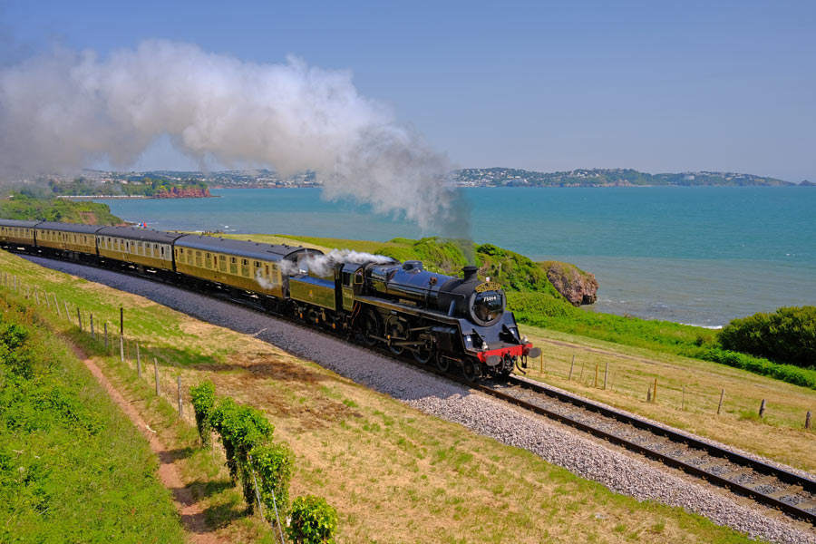
Paignton to Kingswear Heritage Line
As I walked into Goodrington Sands with my socks swinging in the breeze a Kingswear to Paignton Heritage Railway steam train passed by on its way to Paignton. Later, when I was walking right alongside the line it passed by again on its way back to Kingsbridge. I was glad that I had been delayed at Paignton as I was at a perfect spot to take my photo.
Arriving at Brixham
Due to my early start and it being a moderately easy walk I arrive in Brixham mid afternoon. It was a very hot day but there was a cool wind blowing so after a brief rest I continued on along the coast to Berry Head and then came back to my B and B via St Mary's Bay. That evening I walked back into town and had a meal and a pint or two at the Old Market House on the quay.
End of day 6. About 14 miles walked today.
back to the top
Day 7 - Brixham to Dartmouth

Scabbacombe Head
As I had walked part of this section through Brixham the day before I rejoined the path at St Mary's Bay. It was hard going at Man Sands and Scabbacombe and it was another hot day but there was a cold wind blowing on the exposed cliff tops and even more wind was blowing up the valleys between them.
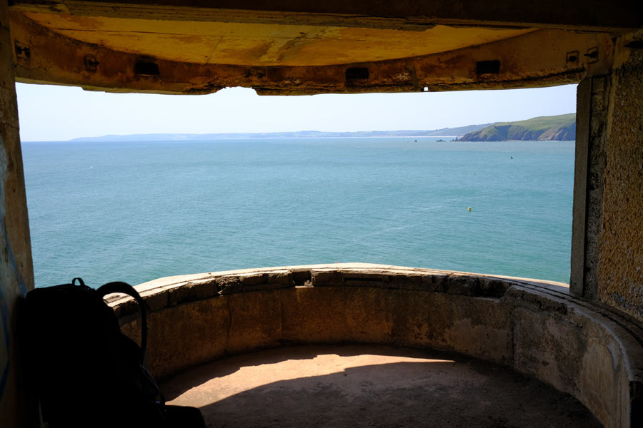
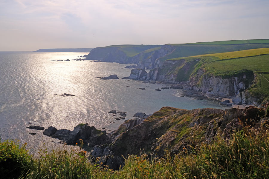
Forward Point
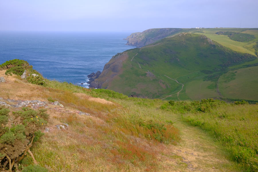
Just before the path rounded the point and continued along the river Dart I visited the ruins of the World War II defences at Forward Point. Start point is visible in the distance on the extreme left of the photo. It had been a hot day so far but the cold winds had helped to cool me a little.
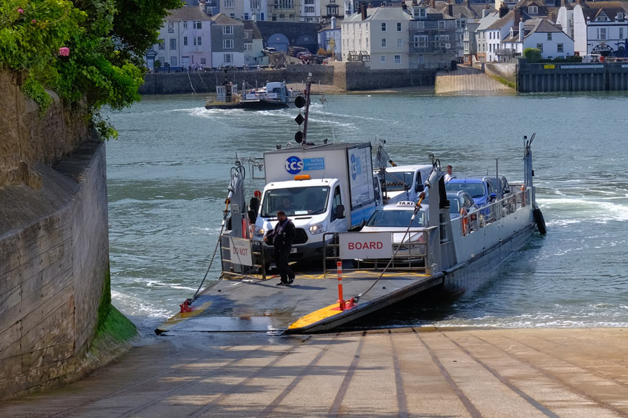
The ferry arriving at Kingsbridge
After Forward point the path passed through the cooler and shady Warren Woods, then it descended on a narrow road, giving glimpses of Dartmouth between the many expensive housed that were crammed along the steep bank of the river. I crossed to Dartmouth on the ferry and went straight to The Crab, which has an outdoor seating area on the quay, and sat under an umbrella with a pint of lager and a snack until I had cooled down. I had booked into the Seven Stars where, after a shower and a wander around the town, I later returned to and had a pint and a nice meal.
End of day 7. About 10 miles walked today.
back to the top
Day 8 - Dartmouth to Salcombe
Blackpool Sands
I left early as breakfast wasn't included in my booking. I hoped hope that it would be cooler than the last few days, and it was. It was cloudy with a cold easterly wind. The first stretch was strenuous so I soon warmed up enough to walk in a polo shirt, but as the going got easier I began to speed up to keep warm. I could have put my fleece back on instead but I wanted to see if I could improve on my mileage. My daily mileage had been quite low so far, partly because I was stopping frequently to take more interest in my surroundings than I did on my previous SWCP walk twenty years ago but mostly because I was walking more slowly than I did then. I stopped at the Blackpool Sands beach cafe for coffee and breakfast.
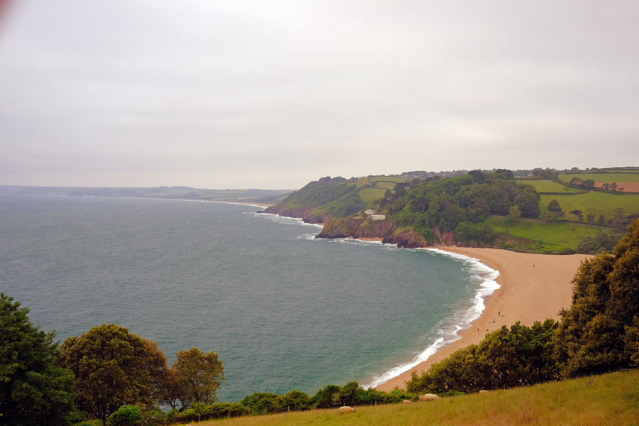
Slapton Sands with Torcross at the far end.
By midday I had passed Slapton Ley Nature Reserve and arrive at Torcross village. After topping up with water I kept going. The cloud had lifted and it was getting hot again so I stopped at The Cricket Inn in Beesands for a pint and a snack.
Narrow and rocky.
The going was getting strenuous and parts of the path were narrow and very rocky. Just before Prawle point a chap who engaged me in conversation told me that Salcome was not far, that there was spectacular scenery, and that the difficult bit was behind me. I shouldn't have listened to him. I was already tired and thinking of camping for the night but then I decided to keep going. After Prawle Point lookout station the scenery was certainly spectacular but the path continued to be difficult and slow until the final descent to East Portlemouth. But by then it was late and I was sure that the ferry across to Dartmouth would have stopped running. I arrived in the dark just before 10 o'clock and was pleased to see the little ferry heading across the river towards me. The ferryman told me that he had been booked to take two passengers back to Dartmouth at 10 o'clock so I joined them. I could not find accommodation in Salcombe so I spent the night in my bivvy bag in a discrete but not very comfortable location.
End of day 8. 23 miles walked today. My best so far.
back to the top
Day 9 - Salcombe to the River Erme.
Sunrise as I left Salcombe
I made a 4am start and decided to get to the River Erme, where there is no ferry but where it was safe to wade across across the river one hour either side of low tide. This would avoid an 8 mile detour off the coast path and along narrow roads. Low tide was to be around 3:30 pm so I had to be there by 4:30 pm at the latest.
Between Bolt Head and Bolt Tail.
The scenery between Bolt Head and Bolt Tail was spectacular but the going was strenuous. There was also a very strong wind blowing from the east which constantly tried to push me towards the edge of the cliffs. It was actually difficult to walk in a straight line during the frequent strong gusts. I was feeling the wind-chill so I put my fleece on and zipped it up to the neck.
Hope Cove.
After 8 miles I arrived at Hope Cove, where I realised that I was not going to get to the river Erme in time to wade across that afternoon as I still had 9 miles to go. The lack of a good nights sleep and the constant battle with the wind had worn me down. I bought some supplies in Hope Cove and walked on. There was a ferry crossing at Bantham Sands next but this did not operate between 12noon and 2pm and I would not get there before 12 so there was no need to hurry. I found a wind-free spot just off the path and had a wonderful snooze in the sun.
Heading for Bantham. Burgh Island in the distance.
The walking was easier from then on apart from the strong gusts of wind that continued to push me around on the elevated parts. I reached the ferry at 1:30pm so I had time for a pint and a snack in the Sloop Inn before crossing.
After Bantham
The walking was classed as "moderate" by the guide but there were a few steep climbs and descents. I arrived at the beach marked as the best spot to wade the river Erme but it was well past low tide. I settled down on the beach to enjoy the evening, intending to sleep nearby later and wake at 4am for the 4:30am low tide.
A little while later I met some students who had a car and was able to get a lift with them to the other side of the river. I gave them some cash for petrol as I was happy not to have to wade the river. I remembered the time that I waded across in the opposite direction about 20 years ago. That had been a 4am low tide. But I missed my way as I crossed, up to my knees in water, and didn't get to this beach but ended up a little farther down river where I had to scramble up a steep bank, through dense undergrowth and over a fence in the dim light to find the path again.
End of day 9. A little over 17 miles walked today.
back to the top
Day 10 - River Erme to Plymouth
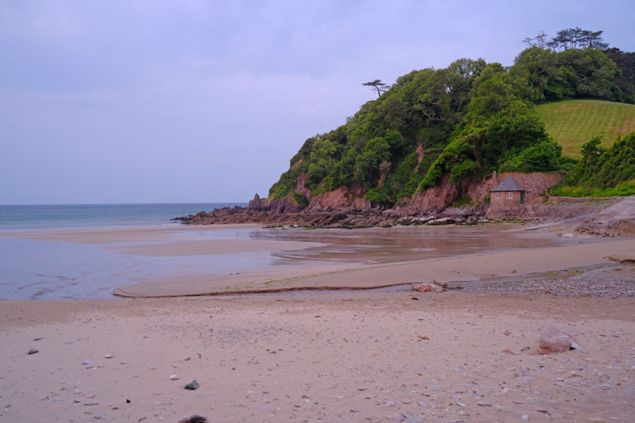
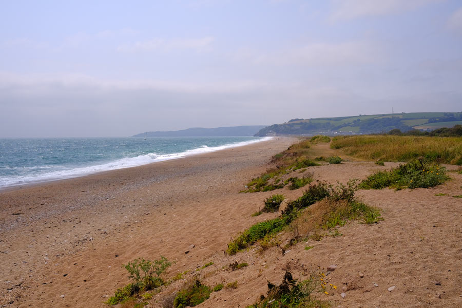
Early morning Meadowsfoot Beach
I slept on a grassy area at the back of Meadowsfoot Beach. I sat on the beach at about 5am and ate half a packet of ginger biscuits for breakfast while watching the sky lighten. It was cool and cloudy. I decided to head for Plymouth which was 18 miles away and classed as "strenuous becoming easy" to Wembury, where there was a ferry crossing to Warren Point, then it was "easy" to Mount Batten, where there was a second ferry crossing into Plymouth. This was as far as I wanted to go as it was as the end of the South Devon coast section.
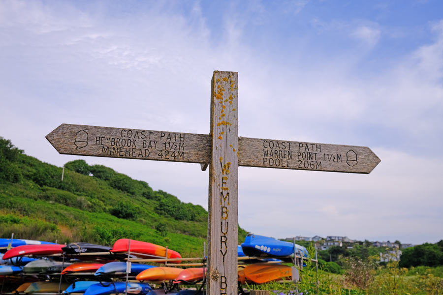
Signpost at Wembury Beach
At Wembury beach I stopped to refill my water bottle and had a large coffee and a very large bacon bap at the beach cafe. I checked the train times for Plymouth and bought a ticket valid for travel on that day using the GWR app and then carried on walking. It was then that my right knee gave out and would no longer carry my full weight, so I had to make constant use of my walking pole. It was fine on level ground but going uphill and downhill was painful and climbing and descending steps was worse. I took two Ibuprofen tablets and took comfort in the fact that the guide had classed this section as "easy".
Fort Bovisand ahead and Plymouth beyond
This "easy" section turned out not to be so easy for me. After Bovisan Bay I completely forgot about taking any more photos. There were steep, narrow, overgrown steps and paths then a climb up to Brownhill Battery above Fort Bovisand and down again. I continued to follow the SWCP signs which then sent me down into a dense woodland where the path twisted and turned up and down before sending me down flights of slippery wooden steps that descended deeper into the woodland. My knee gave out after descending the first two flights and there were more below, so I had a quick look at the contour lines on my map, which showed me that I would have to ascend again a little further on. So instead, I eased myself back up to the start of the steps to where I had seen a "SWCP Alternative Route" sign pointing up a short slope. I continued upwards and came to a road that headed down towards Mount Batten and the short ferry ride into Plymouth. Further down the hill I was able, with the help of a local lady, to find and join path again.
By then my knee was getting really painful and as I neared the ferry I spotted a bus shelter. According to the timetable there was a bus due in ten minutes that went right past the railway station.
From the bus stop I looked at the long, baking hot road where I thought the ferry point was and checked the ferry times on my iphone. I calculated that I might just get there before it sailed, or then again I might not, depending on how fast I could hobble. So I caught the bus, which then gave me a tour of Plymouth before it reached the station. With the help of a couple more Ibuprofen tablets I had a pleasant train journey home.
Later I found out that I was at the wrong place for the ferry anyway.
End of day 10. A little over 17 miles walked today - 5 of them hobbling along!
That's a Total of 123 miles along the East and South Devon coast and a total of 212 miles from South Haven Point. The Cornwall coast is next but that will be later in the year if my knee will allow me.
Correction: According to my SWCP guide I have walked 219 miles, so my calculations are wrong somewhere.
back to the top
Next
I decided not to walk the SWCP around the Cornish coast. My knee is just not able to do too much walking over severe terrain. I decided instead that I would next walk the 87 mile Tamara Coast to Coast Way that roughly follows the river Tamar and the Devon/Cornwall border along the Tamar Valley from Plymouth to the source of the Tamar and then on to the North Cornwall coast where it meets the Devon Coast. Looking at the route it was obviously going to be an easier walk than the rugged terrain of the Cornish coast path. I will just have to fondly remember when I walked it twenty years ago.
back to the top