The Dorset coast
Extra: Hampshire Border to Sandbanks
Day 1: South Haven Point to Langton Maltravers
Day 2: Langton Maltravers to Kimmeridge
Day 3: Kimmeridge to Lulworth
Day 4: Lulworth to Weymouth
Day 5: Round the Isle of Portland
Day 6: Weymouth to Abotsbury
Day 7: Abotsbury to West Bay
Day 8: West Bay to Lyme Regis
Extra walking - Hampshire Border to Sandbanks
Walkford Brook at Christchurch Bay
The finish (or the start) of the South West Coast Path is South Haven Point, but I wanted to walk the whole coastline of Dorset. So I took a train to Hinton Admiral Station and walked down to the coast and into Hampshire at Chewton Bunny where the Walkford Brook denotes the county border with Dorset. It was overcast but not cold. A fine day for walking.
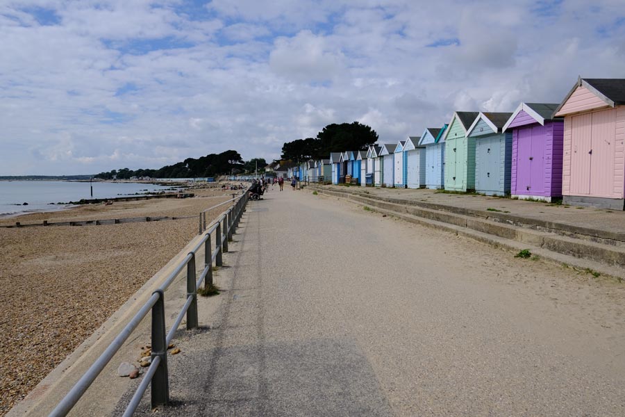
Highcliffe Beach
It was a pleasant, easy walk into Highcliffe where the track becomes a promenade.
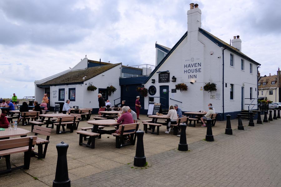
The Haven House Inn
After more beach huts and a pleasant detour through the wooded grounds of Highcliffe Castle and then more beach huts I arrived at the Haven House Inn where I stopped for refreshment.
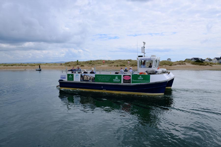
The Ferry to Hengistbury Head
Much refreshed I took the short Ferry ride across the mouth of Christchurch Harbour to Hengistbury Head whre I then walked past more beach huts before walking along the edge of the Hengistbury Head Nature Reserve.
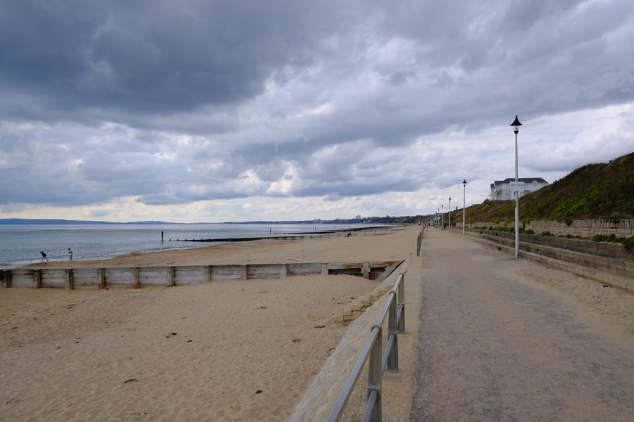
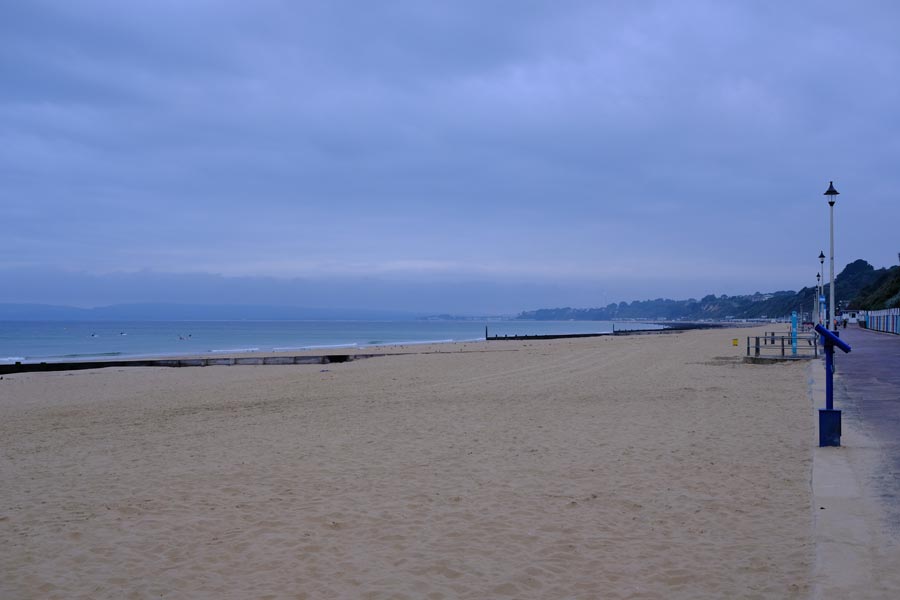
Southbourne Beach
After a walk across the heath the path joined with the promenade along Southbourne Beach.
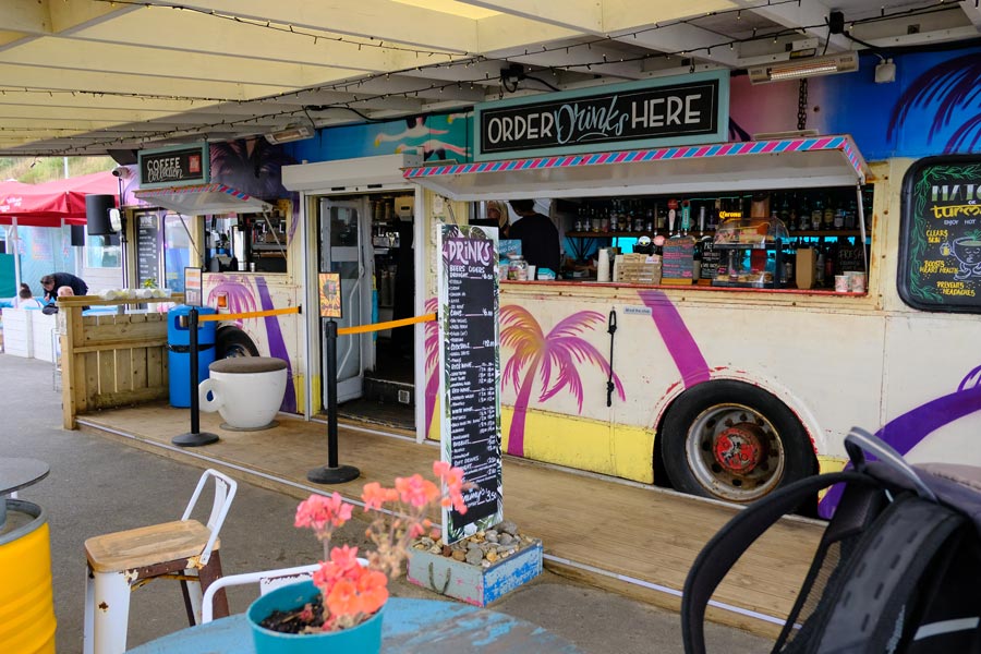
Bar Bus
Some way along I stopped to rest my feet and refresh myself at this colourful establishment.
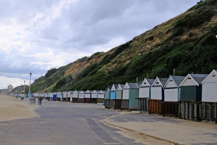
Beach Huts
Coming into Bournemouth I couldn't help but notice that there were a lot of beach huts. I notice that one was numbered 1098.
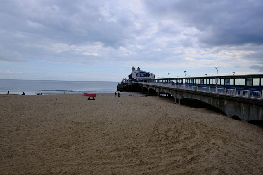
Bournemouth Pier.
By the time I got to Bournemouth Pier the weather was getting threatening.
Heading toward Sandbanks.
After resting at Bournemouth I continued on. The beach huts were once again disappearing into the distance. I guessed that there might be over a thousand. The weather was worsening. It was still dry but rain was visible in the distance.
Sandbanks.
At Sandbanks the promenade ended. The rest of the walk was along the pavements of the road to the ferry. There were a few fine spots of rain falling but they were drying on my clothes quicker that they could land.
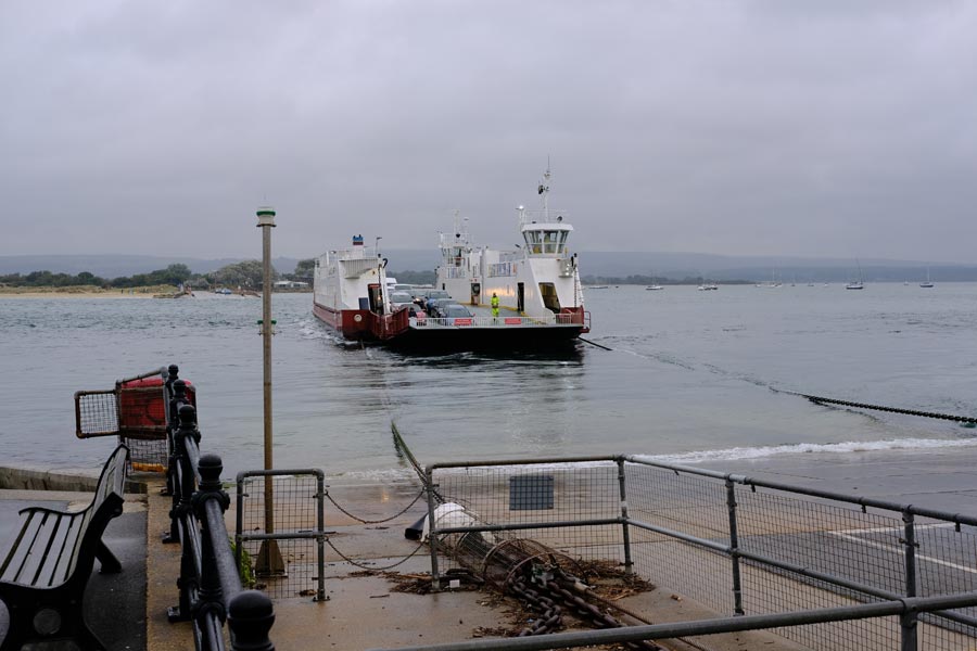
The Sandbanks Chain Ferry to South Haven Point.
This was the end of my extra walk. I boarded a bus and as it drove onto the ferry, the rain started.
About 18 miles walked. Easy walking all the way.
(I later found out that there are about 2000 beach huts along Bournemouth Beach!)
About 18 miles walked. Easy walking all the way.
(I later found out that there are about 2000 beach huts along Bournemouth Beach!)
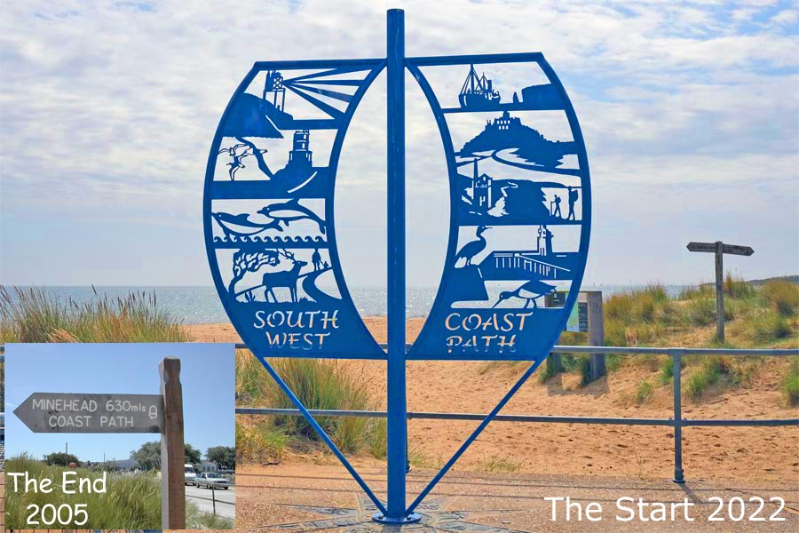
The South West Coasts Path - Dorset. 2022
Day 1 - South Haven Point to Langton Maltravers
Things have changed since I was last here
The end of the journey for most SWCP walkers is here at South Haven Point, as the most popular direction to walk the whole path is from Minehead to here. Having walked the SWCP in the normal direction several years ago I decided to attempt it in the reverse direction. The path begins with an easy beach walk on the damp sand just above the waterline to Redend Point at Studland. At Studland I rested in the beer garden of the Banks Arms which overlooks the sea.
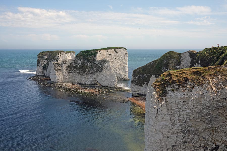
Old Harry Rocks
Much refreshed, I continued out on the headland to Old Harry Rocks. These chalk stacks mark the eastern end of the 95 mile-long Jurassic Coast stretching to Exmouth in Devon.
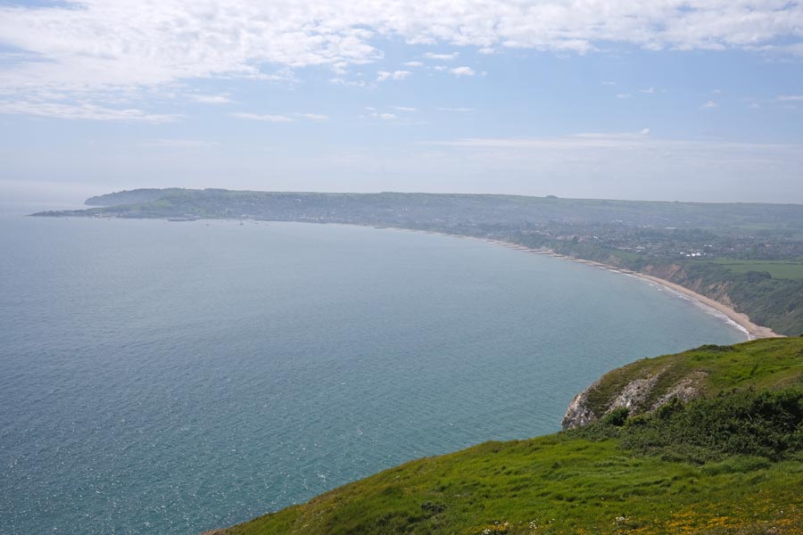
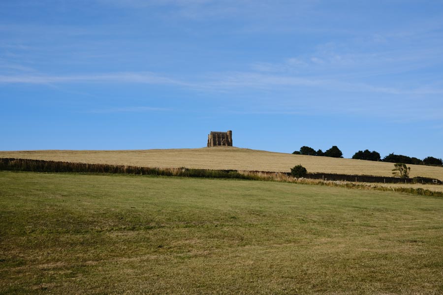
Swanage Bay
The view of Swanage from Ballard Down. I missed the path down and walked half a mile too far before backtracking. In Swanage I had a pint in the White Horse Inn because the other pubs were too hot and busy. Much refreshed I continued along the coast to Dancing Ledge, where the sea washes over the rock ledge and bobs about as if dancing. Here I diverted inland to Langton Maltravers to catch a bus back to my accomodation.
End of day 1. About 11 Miles walked today. It was hot day with a few clouds now and then, including a short downpour just as I headed inland for the bus stop at Langton Maltravers. This turned out to be the only time that I got wet on my walk along the Dorset coast.
End of day 1. About 11 Miles walked today. It was hot day with a few clouds now and then, including a short downpour just as I headed inland for the bus stop at Langton Maltravers. This turned out to be the only time that I got wet on my walk along the Dorset coast.
Day 2 - Langton Maltravers to Kimmeridge.
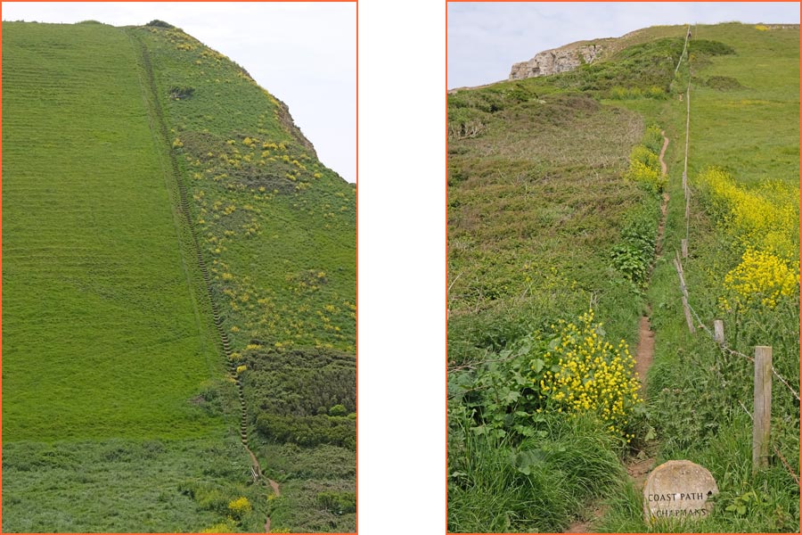
On the way to Chapman's Pool
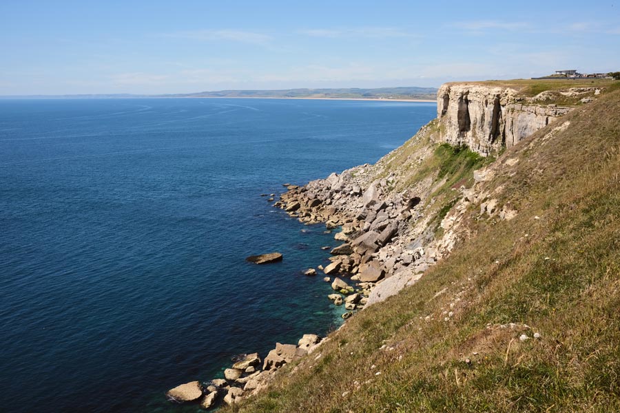
After a short walk from Langton Maltravers back to the coast I came to St Aldhelm's Head where the terrain began to get more challenging. I know that steps are often necessary on very steep slopes but my knees really don't like them!
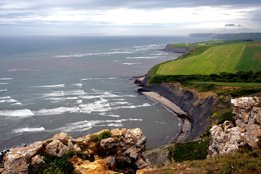
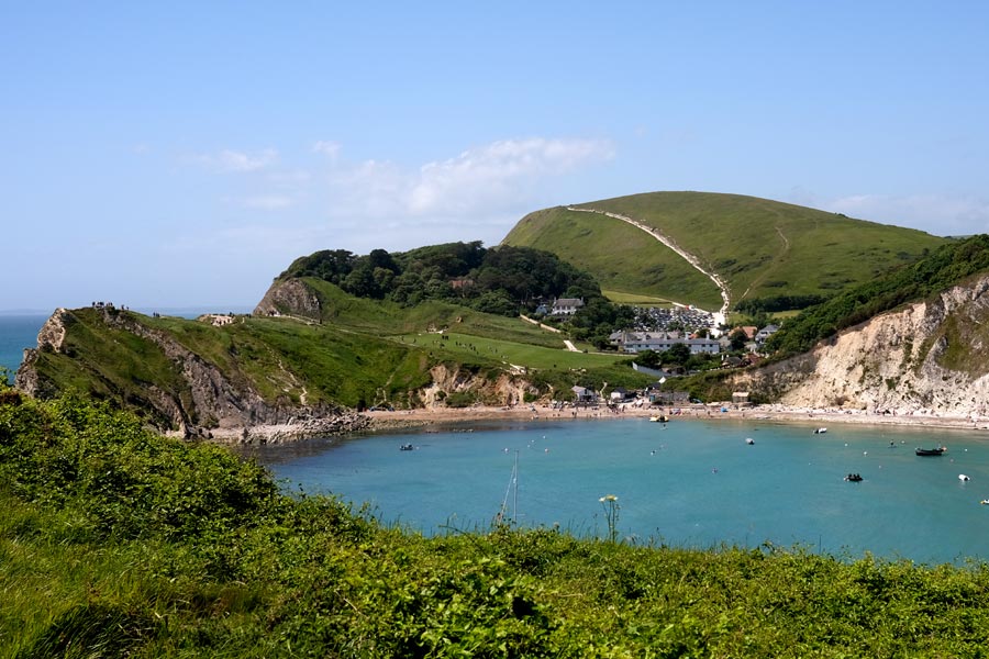
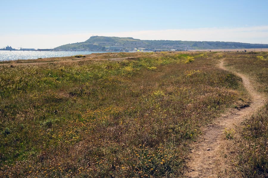
Almost at Kimmeridge
Now approaching Kimmeridge. The Isle of Portland is visible on the distant horizon. Kimmeridge is a small village a short walk inland from the beach. It has minimal services, apart from a very nice restaurant. Note: There is no bus service and no mobile phone coverage here. There is a phone box, which didn't take cash, and wouldn't accept my card, so the nice restaurant lady very kindly called a taxi for me, KBay Taxi, based in the village, which took me back to my accommodation.
End of day 2. About 10 miles walked today. Hot.
End of day 2. About 10 miles walked today. Hot.
Day 3 - Kimmeridge to Lulworth
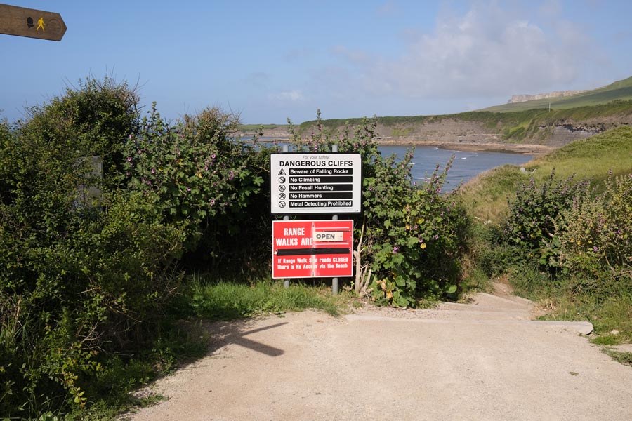
The Lulworth Range Warning Notice.
The road from Kimmeridge village to the beach is a toll road for vehicles. From the beach, the path going west first passes through the Army firing range. "Do not leave the path" and "Do not pick anything up" a second notice warns. From here to Lulworth village the path is only open certain weekends and weekdays per year. For more information Google 'Lulworth Range access times' and choose the .gov.uk site.
Brandy Bay
Hard work but simply beautiful.
I'm not sure where this is.
Nearly at Lulworth though. The group of walkers coming down the hill were heading to Poole. They had less that thirty miles to go.
Lulworth Cove
The village was very busy and it was still a very hot day, so as I was passing the Lulworth Cove Inn I stopped for a pint in the beer garden. As I live in West Dorset I was able to catch a bus to Weymouth and then to Bridport and go home for the night.
End of day 3. Only 8 miles walked today, but it was a severe section, and it was very hot!
End of day 3. Only 8 miles walked today, but it was a severe section, and it was very hot!
Day 4 - Lulworth to Weymouth
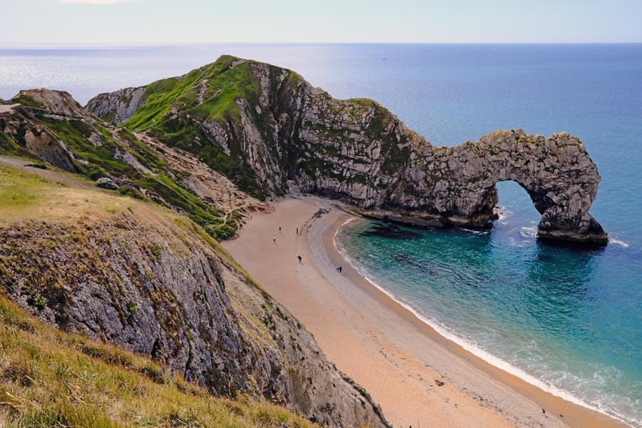
Durdle Dor
After two bus rides to get back to Lulworth I walked to Durdle Dor. There was almost no one around. It was going to be another hot day. I seem to have chosen to walk the coast of Dorset during a heat-wave.
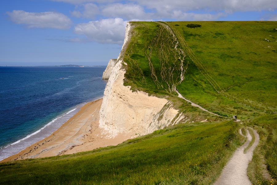
Another hill.
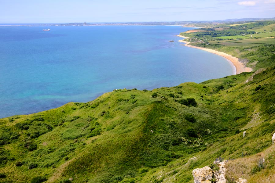
Weymouth is now on the horizon. Notice the well-trodden paths ahead.
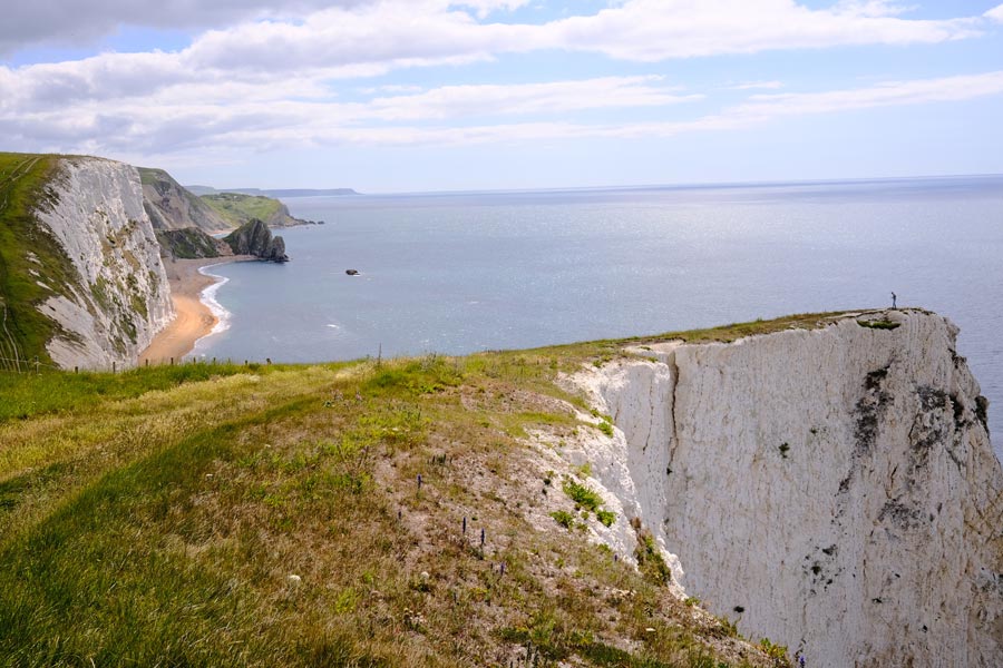
Looking back
I often stop and turn around to see if I have missed anything. Like this view back to Durdle Dor.
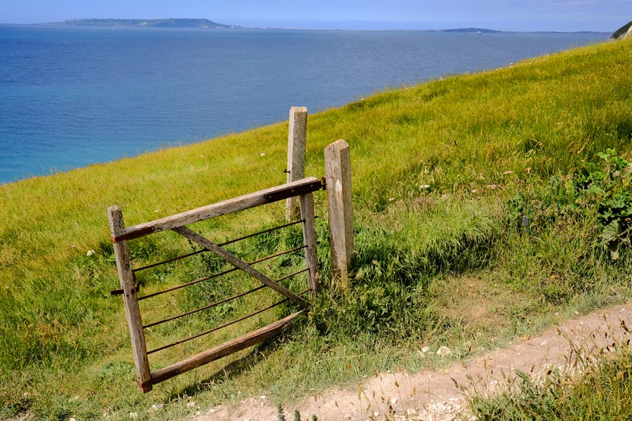
When out walking, always close the gate behind you.
Ringstead Bay
Just before Osmington Mills the cliffs drop away and the going gets easier. Getting hot now though.
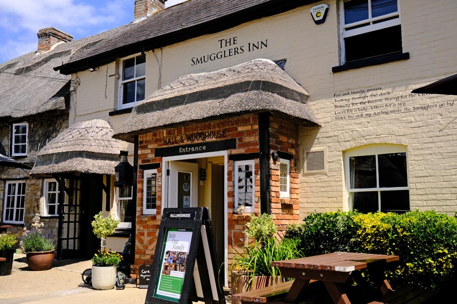
Osmington Mills
The path goes right through the garden of the The Smugglers Inn. There was a shady table waiting for me in the beer garden.
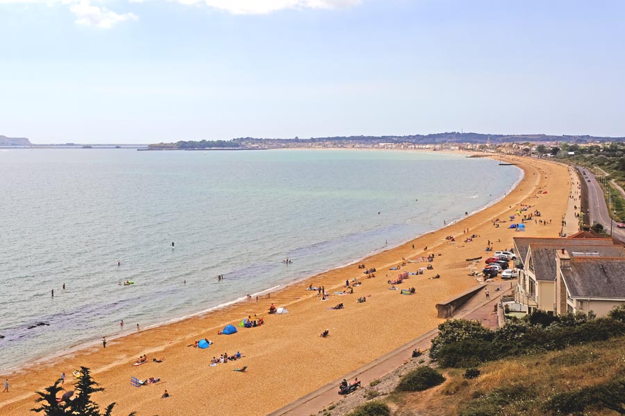
Weymouth Beach
After my cool pint it was an easy 5 mile walk to Weymouth town centre, about half of it being on the promenade along the beach.
End of day 4. About 13 miles walked today. It was a hot day with a few clouds now and then.
End of day 4. About 13 miles walked today. It was a hot day with a few clouds now and then.
Day 5 - From Weymouth round the Isle of Portland (clockwise)
Portland
From Weymouth town centre it is a 2.5 mile walk to the start of the causeway to Portland. There is a pavement alongside the road on the causeway but it is more pleasant to walk along the tracks through the scrub and be away from the noisy road.
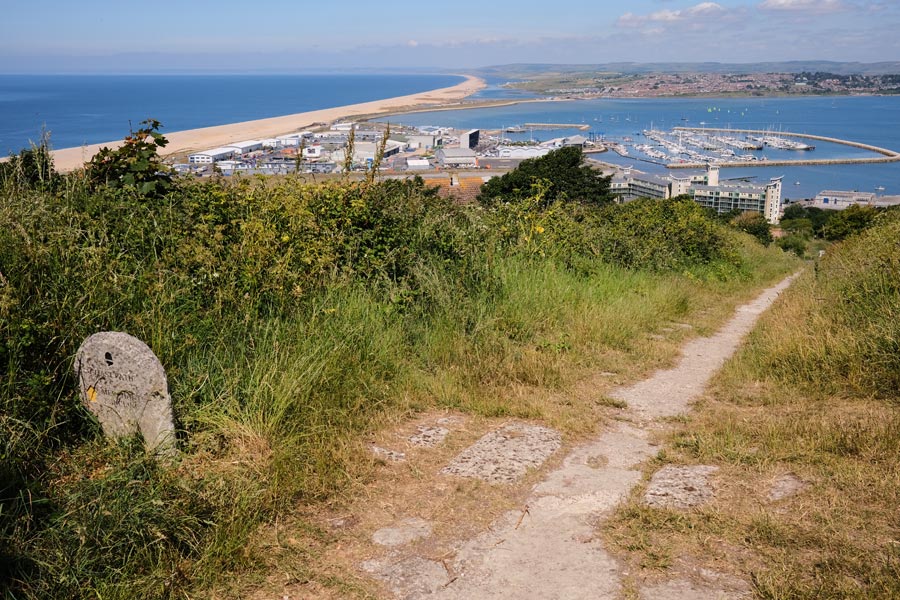
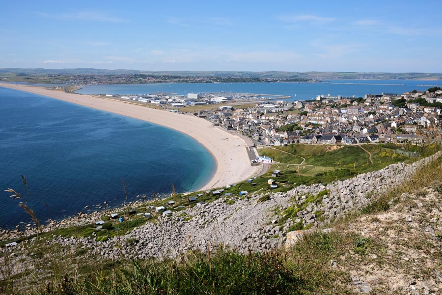
At the top of the Merchant's Incline
View from the top of the Merchant's Incline, an abandoned tramway that used to take the limestone rock from the quarries down to the docks below. This view is looking back at Chesil Beach curving away into the distance, with the causeway in front of it and the start of Weymouth town at the top right of the picture.
The under-cliff
After passing the HM Prison and the Young Offender Institution the path drops down to the under-cliff on the east side of Portland. There was no wind down there so I was getting very hot in the blazing sun. Here I saw a man hurrying ahead of me carrying a what appeared to be a large mattress? Later I saw some climbers practicing on low rocks, with mattresses on the ground below them. Mystery solved.
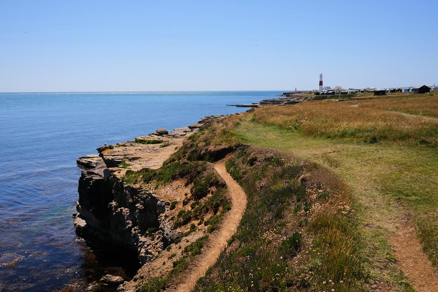
Portland Bill
Approaching the lighthouse at Portland Bill. Still very hot. Here there is a snack bar and in the large car park where there are toilets. I cooled down with a pint under an umbrella at the Pulpit Inn.
West Cliff
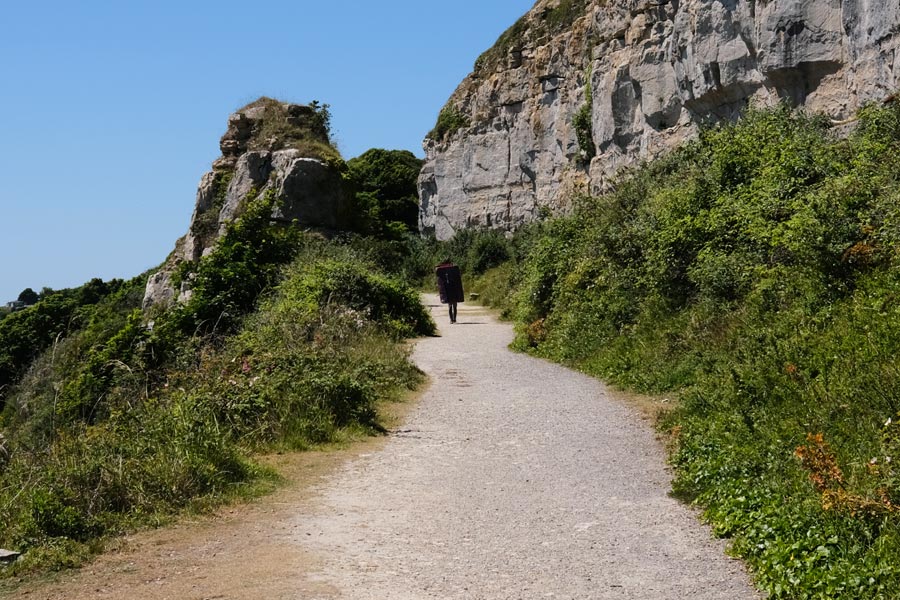
Continuing my clockwise walk around the edge of Portland, the walk along the cliff top on the west side of the island was more relaxing and there was a cool breeze blowing. There were a couple of diversions where the path had partly collapsed, one of which sent the path through Tout Quarry. It is worth a detour anyway to look at the many contemporary rock carvings there.
Chiswell
From here I was about to make the steep descent to the beach and the Cove House Inn, but when I got there it was packed and there was no shade outside so I walked on to the Little Ship Inn where I sat outside in the shade with a pint before walking back along the causeway to the mainland.
End of day 5. 16 miles walked today. A hot day but with a cool breeze on the west facing cliffs and when walking back along the causeway.
End of day 5. 16 miles walked today. A hot day but with a cool breeze on the west facing cliffs and when walking back along the causeway.
Day 6 - Weymouth to Abbotsbury
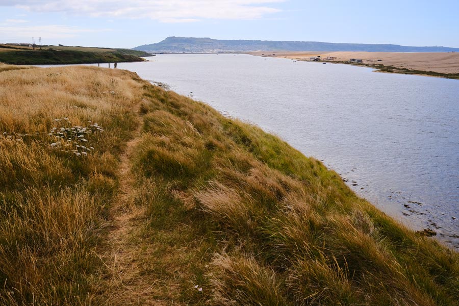
The Fleet
Continuing my walk from the Weymouth end of the Portland causeway, the path passes alongside the landward side of the Fleet. The fleet is a long lagoon almost completely cut off from the sea by Chesil Beach, which at this point is a huge bank of pebbles. This photo was taken looking back along the Fleet, with the back of Chesil Beach on the right, the causeway across the end and Portland beyond.
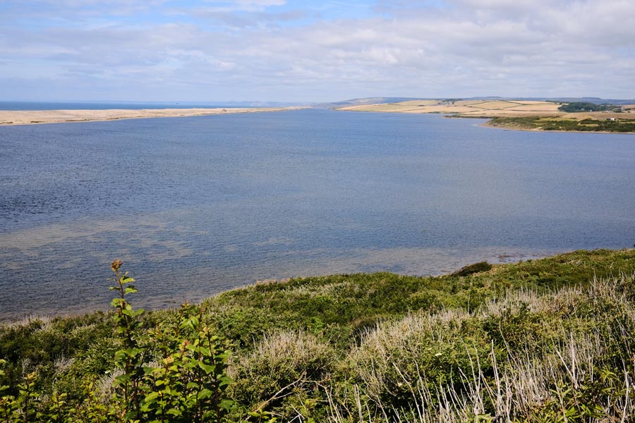
The Fleet
This view is looking forward along the Fleet, with the back of Chesil beach on the left and Lyme Bay behind it on the left horizon. It was very hot, so I stopped off at the Moonfleet Manor Hotel for a pint. I sat under an umbrella on the patio and was served with a bottle of cold beer. They didn't serve pints; it was too posh!
St Catherine's Chapel
After about 7 miles along the shore of the Fleet the path diverts inland towards Abbotsbury and passes St Catherine's Chapel high on the hill. Occasional services are held here throughout the year.
End of day 6. Ending at Abbotsbury. About 12 miles walked today. A hot day with very little cloud.
End of day 6. Ending at Abbotsbury. About 12 miles walked today. A hot day with very little cloud.
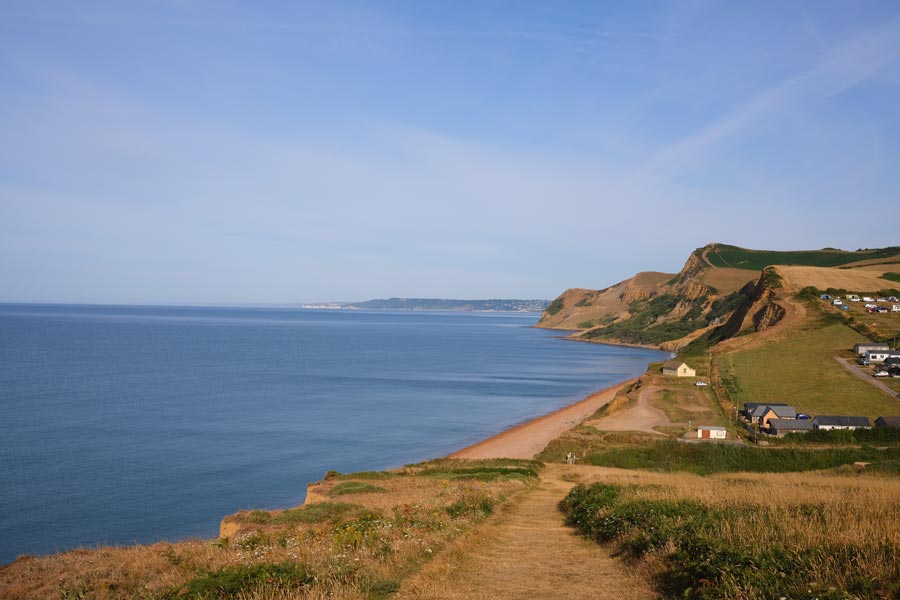
Day 7 - Abbotsbury to West Bay
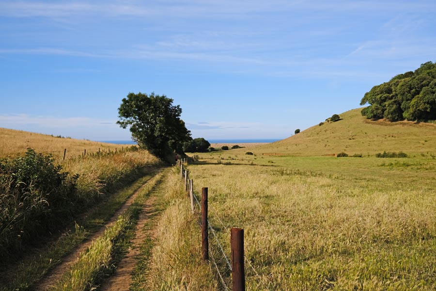
Starting from Abbotsbury the path heads back to the coast and Chesil Beach. The pebbles are now smaller than those at the Portland end.
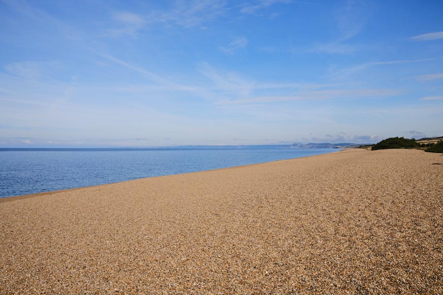
Chesil Beach
Walking on the pebbles is hard going until the path diverts into the adjoining fields and along the back of the beach. This is sign-posted as the 'Summer route'. At other times the fields can be too marshy and then it is necessary to keep to the beach.
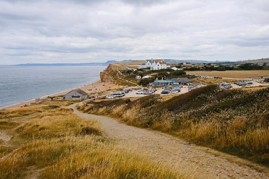
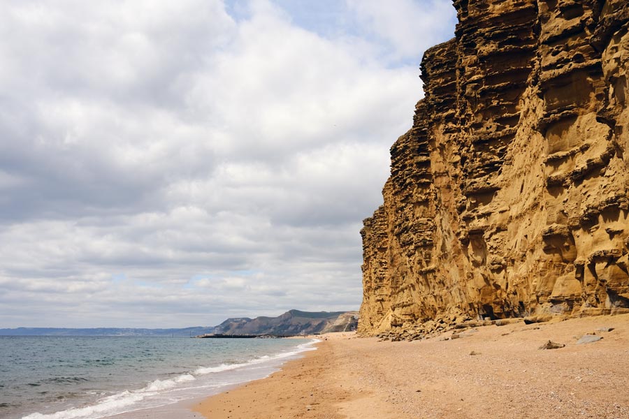
Burton Bradstock
Here I am about to descend the cliffs to Hive Beach at Burton Bradstock. The cafe/restaurant here is open all-year-round. From here to West Bay there is a spectacular line of cliffs that glow in the early morning and evening sun. There are regular cliff falls along this stretch of the coast making the cliffs too dangerous to walk under or to walk along the top near the edge. At a very low tide it is possible to walk along the beach away from the cliffs but sometimes a cliff fall blocks the beach right up to the water's edge and into the sea. It is dangerous to attempt to climb over any part of the fall. It produces a very sticky mud, often with a hard crust, and it is impossible to escape from this mud if you get bogged down.
Burton Freshwater
After leaving the beach at Burton Bradstock, by walking through the large car park and across a cliff-top field, there is the start of a road that goes inland to the village of Burton Bradstock, where there are two pubs. But I continued on along the cliff top path to Burton Freshwater where there is a large static and touring caravan park. Here the path diverts inland a short way to a small bridge that crosses the River Bride.
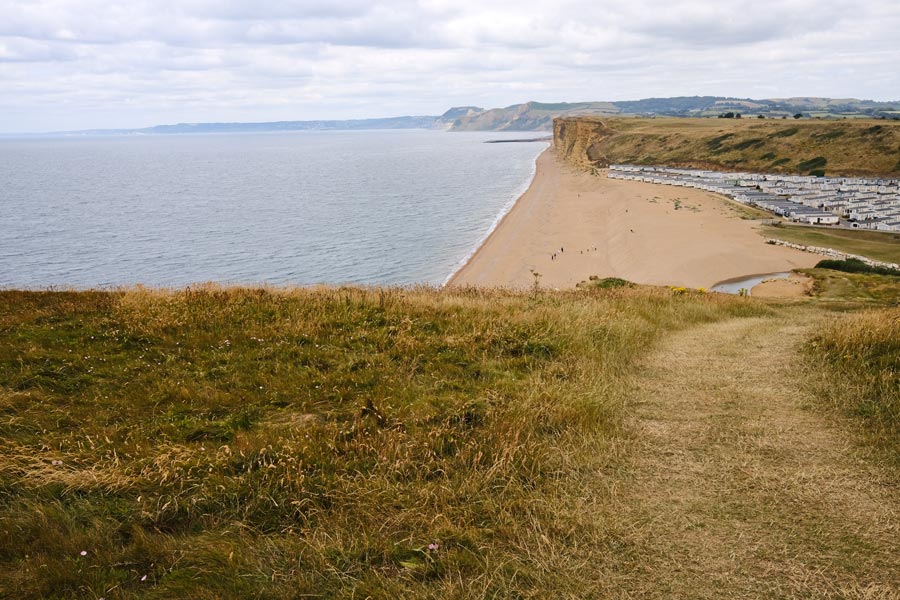
East Cliffs West Bay
The tide was going out but walking along the beach was dangerous as it would mean getting too close to the unstable cliff face. The path continues along the cliff-top but keeps well away from the edge.
West Bay, also known as Bridport Harbour, is a small coastal community with a large static-caravan park. It also has harbour-side kiosks selling food, including fish & chips and ice-cream. I followed the footpath through the caravan park to Bridport which is almost 2 miles inland, where I had a pint in the The Pursuit of Hoppiness before catching a bus home.
End of day 7. About 9 miles walked today. A hot day to start with but later the clouds helped to cool it a little.
Day 8 - West Bay to Lyme Regis
Eype Mouth
Back to West Bay the next day, the path continues up onto the cliffs then down again to Eype Mouth beach.
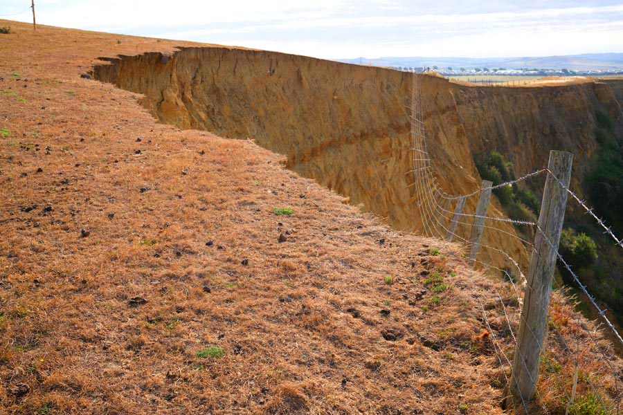
There have been large land slips on the section between West Bay and Lyme Regis. This recent land slip was between Eype and Thorncombe Beacon. Notice the brown grass due to the long dry-spell.
Thorncombe Beacon.
Starting the climb up to Thorncombe Beacon. The beacon, a fire basket on a pole, is just visible in the photo.
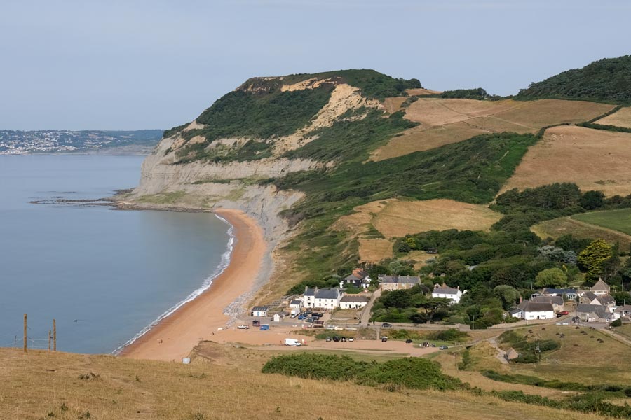
Seatown
Looking down the steep descent to Seatown and the Jolly Sailor next to the beach. Golden Cap is beyond. At Seatown it is a short walk inland on the road to reach the path to Golden cap. The old path along the headland is no longer useable due to land slips.
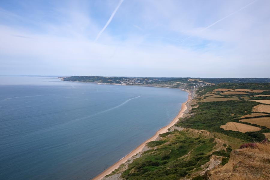
View from Golden Cap
A view of Charmouth ahead and Lyme Regis beyond.
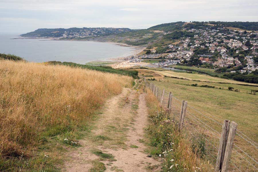
Charmouth
The inland diversion via Stonebarrow Hill between Golden Cap and Charmouth is no longer necessary as a section closer to the coast is now in use. At Charmouth there is still an inland diversion to Lyme Regis, partly along roads. This was in operation when I last walked through in the other direction about 17 years ago.
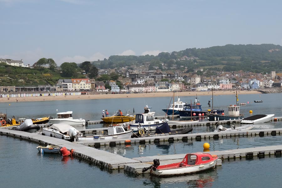
Lyme Regis. Photo taken from The Cobb.
From Charmouth, Lyme Regis is approached from the landward side with no chance of a nice view of the town to photograph. I had time to spare before catching a bus to Bridport and then home, so I had a pint in the Naval Volunteer first.
End of day 8. About 10 miles walked today. This does not include the extra walking from Hampshire.
That's a total of 89 miles and the completion of the SWCP section of Dorset coast.
End of day 8. About 10 miles walked today. This does not include the extra walking from Hampshire.
That's a total of 89 miles and the completion of the SWCP section of Dorset coast.